Scientific Investigations Report 2009–5073
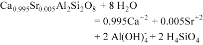
Source of Water to Cave SpringsStable IsotopesStable isotope values in water from the four water samples are listed in table 5. Values of stable isotopes of 2H (deuterium or D), 18O, and 13C are reported in delta (δ) notation, whereas the ratio of strontium (87Sr to 86Sr) is expressed simply as a ratio. The delta notation is used to distinguish variations in the concentration of the stable isotopes among samples and is determined as the difference between the isotopic ratio in a sample and the ratio in a reference standard divided by the ratio in the reference standard (Clark and Fritz, 1997, p. 6). The values are expressed as parts per thousand or permil difference from the reference standard. The reference standard for determining δD and δ18O in water is the Vienna Standard Mean Ocean Water (VSMOW). The reference standard for oxygen and carbon in carbonate minerals is the internal calcite structure from a fossil Belemnitella Americana from the Cretaceous Pee Dee Formation of South Carolina (PDB; Craig, 1957; Clark and Fritz, 1997, p. 9). A negative value of δD, δ18O, and d13C represents water with less D, 18O, and 13C relative to 1H, 16O, and 12C, respectively, than the reference standard. The global meteoric waterline (Craig, 1961) shows the general relation between δD and δ18O in precipitation whereby isotopically lighter values (more negative) are associated with cold regions and winter precipitation and isotopically heavier values (less negative) are associated with warm regions and summer precipitation (fig. 8). A local meteoric waterline was estimated for Great Basin National Park from the isotopic composition of summer and winter precipitation reported by Friedman and others (2002). Composite samples of precipitation were collected at three specially designed gages near Great Basin National Park between April 1991 and June 1997 (Friedman and others, 2002, p. ACL 15‑5). The composite samples for summer precipitation typically spanned May through October and the composite samples for winter precipitation typically spanned November through April. Locations of the three precipitation gages are shown in figure 1 and were designated as Cave Mountain (elevation of 10,650 ft above mean sea level), Connors Pass (elevation of 8,275 ft above mean sea level), and Mount Moriah (elevation of 9,375 ft above mean sea level) by Friedman and others (2002, p. ACL 15‑4). Although δD was determined routinely for precipitation during summer and winter, δ18O was not always analyzed; therefore, the number of precipitation samples used to determine the local meteoric waterline in figure 8 is less than the total number of samples. The local meteoric waterline determined from regression of the data from the three precipitation gages is close to the global meteoric waterline and when the one outlier from Connors Pass is excluded from the regression, the local meteoric waterline is nearly the same as the global meteoric waterline. Cave Springs, Marmot Spring, and the spring near upper Lehman Creek campground fall on the global and local meteoric waterlines. This indicates that water discharging from the three springs has not been altered greatly by evaporation or by chemical reactions with calcite in the rocks. The δD and δ18O of Cave Springs and Marmot Spring are isotopically the lightest (most negative values) of the four samples. The values at these two springs essentially are the same (95-percent confidence level) and indicate the source of water to these springs primarily is winter snowmelt. Water from the spring near upper Lehman Creek campground is slightly heavier and colder (tables 3 and 2, respectively) relative to Cave Springs or Marmot Spring. The slightly heavier δD at the spring near upper Lehman Creek campground is within the range of δD in Lehman Creek collected at an altitude of 9,600 ft upstream from the spring in August 1990 and September 1990 (Acheampong, 1992, location LC2, p. 96). The δD of Lehman Creek at sampling site LC2 (see fig. 2 for location) ranged from ‑101 in September 1990 to ‑114 in January 1991. The stable isotope composition of Lehman Creek was interpreted to be a combination of winter and summer precipitation as well as evaporated lake water from three shallow lakes in the headwater area (Acheampong, 1992, p. 58). The isotopically heavier δD and δ18O values in water from the permanent pool in Lehman Caves indicates that water in the caves was derived from local precipitation that has a greater fraction of summer precipitation than the samples from the three springs. Lehman Caves lies above the water table and water in the pools is from infiltration of precipitation through the soil and limestone above the caves. The water in the permanent pool does not fall on either the global or local meteoric waterline indicating it is slightly heavier in 18O relative to deuterium compared with precipitation. The enrichment indicates that water in the cave has undergone some evaporation. The δ13C in water from the spring near upper Lehman Creek campground had a value of ‑16 permil PDB. This spring had the least dissolved inorganic carbon of the four sites sampled (fig. 9), which is expected because little carbonate is in the quartzite rocks (Lee and Van Loenen, 1971, p. 8) and because of minimal soil development in the glaciated drainage upstream of the spring. The δ13C in water from Cave Springs is heavier and dissolved inorganic carbon is more relative to water from Marmot Spring and the spring near the upper Lehman Creek campground but less than water from the pool in Lehman Caves. The high values of δ13C and dissolved inorganic carbon in water from the permanent pool in Lehman Caves are caused by dissolution of the Pole Canyon Limestone, which is nearly pure calcium carbonate (Lee and Van Loenen, 1971) and has a δ13C value of ‑0.82 permil PDB (table 6). The dissolved-strontium concentration in water is least from Marmot Spring and the spring near upper Lehman Creek campground and greatest in the permanent pool at Lehman Caves (table 5; fig. 10). Strontium isotopes in water show a decrease in the ratio of 87Sr/86Sr from the spring near upper Lehman Creek campground to the pool in Lehman Caves (table 5; fig. 10). The ratio of 87Sr/86Sr in Pole Canyon Limestone associated with the pool in Lehman Caves is less than that of the ratio in the Prospect Mountain Quartzite at upper Lehman Creek campground or in the Tertiary granite near Cave Springs. Ratios of 87Sr/86Sr for Pole Canyon Limestone and Prospect Mountain Quartzite reported by Lee and others (1986, p. 173) are 0.70911 and 0.79620, respectively, and are similar to those listed in table 6. One Tertiary granite sample near Marmot Spring had 87Sr/86Sr ratio of 0.7821 (Lee and others, 1986, p. 173), which is much higher than the value listed in table 6. The strontium isotope ratio in water from the spring near upper Lehman Creek campground is consistent with dissolution of strontium from the quartzite. However, the strontium isotope ratio in water from the Marmot Spring is much less than water from Cave Springs and the spring near upper Lehman Creek campground. The reason for the difference is not known but could be caused by variations in the ratios of soluble strontium isotopes in the Prospect Mountain Quartzite or in the Tertiary granite through which ground water flows prior to discharging at Marmot Spring. Because the granite may have similar strontium isotope ratios as the quartzite, the 87Sr/86Sr ratio in water can best be used to determine if the water has been primarily in contact with carbonate or noncarbonate rocks in the study area but not between quartzite and granite. Another possibility is that water discharging from Marmot Spring may have come in contact with the Pioche Shale into which the granite intruded or the Pole Canyon Limestone. The possibility of Pole Canyon Limestone near the spring seems unlikely however, because dissolved-strontium concentration in the water is nearly the same as that from the spring near upper Lehman Creek campground and considerably less than that in water from Cave Springs (fig. 10). Source of Calcium, Bicarbonate, and Strontium at Cave SpringsNo outcrop of Pole Canyon Limestone was found at or upstream of Cave Springs. Glacial deposits consisted of large boulders of quartzite upstream of the springs and a mixture of quartzite and granite at the springs. However, several pieces of rounded limestone gravel were removed during the hand deepening of a pool at the overflow outlet from the water-collection system. The 2–4 in. diameter limestone gravel was much smaller than the large boulders and cobbles strewn about the land surface upstream of the springs. Because the limestone gravel was rounded, it had to be transported a considerable distance by water yet there is no evidence of a limestone outcrop at or upstream of the springs. Upon further inquiry as to the source of the rounded limestone gravel at Cave Springs, Craig Baker, a local rancher, recalled hauling many tons of gravel in 1996 during the reconstruction of water-collection system at Cave Springs. The gravel was taken from a pit on the Baker ranch at the base of the alluvial fan on Lehman and Baker Creeks near Baker, Nevada (fig. 2), and contains rounded gravel of Prospect Mountain Quartzite, granite, and Pole Canyon Limestone. The gravel was used as filter material around each of the four principal springs and around the drain pipe. A water sample from Cave Springs was collected July 22, 1987, prior to reconstruction (table 3; data from Gretchen Baker, National Park Service, Great Basin National Park, written commun., 2008) had a dissolved chemistry nearly identical to water from the Marmot Spring, although the pH at Cave Springs was 7.0 instead of 5.8 (table 3). The similarity in chemistry between water from Cave Springs prior to reconstruction and Marmot Spring indicates that the source of additional calcium, strontium, and bicarbonate in water sampled in September 2007 at Cave Springs is from the gravel placed around the four orifices during reconstruction of the water-collection system. The limestone gravel removed at the end of the overflow outlet pipe was pitted and etched indicating active dissolution of limestone and is consistent with the change in chemistry of Cave Springs between 1987 and 2007. Additionally, a small spring (discharging about 1 L/min) at the base of the Prospect Mountain Quartzite about 300 ft west of Caves Springs had a specific conductance of 106 µS/cm at 25°C and a temperature of 11.6°C at the time that overflow from the Caves Springs collection system was sampled. These measurements are similar to those at Marmot Spring; therefore, Pole Canyon Limestone likely does not underlie the glacial deposits beneath Cave Springs as suggested by Elliott and others (2006, p. 32) and illustrated in figure 3A. Water likely discharges at or near the contact between Prospect Mountain Quartzite and the Tertiary granite that is covered by a thin veneer of glacial deposits (fig. 3B). Because the springs discharge from a thin veneer of glacial deposits at the upstream side of the contact between quartzite and granite, the potential for spring depletion from ground-water pumping in Spring Valley east of the park is less than if permeable carbonate rocks were present beneath the springs and connected with the thicker alluvial and glacial deposits along Lehman Creek drainage. Modeling Water Chemistry at Cave SpringsThe dissolved chemistry of water discharging from Cave Springs has changed since the water-collection system at Cave Springs was reconstructed in 1996. Because gravel containing Pole Canyon Limestone was used in the area of the four main springs that constitute most of the discharge at Cave Springs, the likely source of the increased concentrations of bicarbonate and calcium in the springs is the dissolution of the limestone gravel. The geochemical models PHREEQC and NETPATH (Parkhurst and Appelo, 1999 and Plummer and others, 1994, respectively) were used to determine if dissolution of limestone can explain the increase in bicarbonate and calcium in water at Cave Springs. The latest version NETPATHXL (Parkhurst and Charlton, 2008) was used in entering the geochemical data and in evaluating results from the NETPATH models. Two geochemical models were tested. The first model used the major ion chemistry of the sample from Cave Springs collected in July 1987 prior to reconstruction of the water-collection system as the initial water and the chemistry of Cave Springs sample collected in September 2007 as the final water. Because dissolved strontium, δ13C, and 87Sr/86Sr were not analyzed for the sample collected prior to reconstruction of the water-collection system, values from the spring near upper Lehman Creek campground (tables 3 and 5) were substituted instead. The second model used the water chemistry of the Marmot Spring as the initial water. Dissolved ions in Marmot Spring were nearly the same as that of Cave Springs before reconstruction (table 3) except the pH at Marmot Spring was more acidic. The saturation index is used in NETPATH to determine if the dissolved chemistry of water is in equilibrium with a mineral (table 7). The saturation index is the log of the ratio of ion activity product (IAP) to the solubility product at the measured temperature (Kt). Water is in equilibrium with a mineral when the saturation index is zero. The water is undersaturated with respect to a mineral when the value is less than zero and oversaturated with respect to a mineral when the value is greater than zero. Dissolved-oxygen concentrations were used for redox. The water from Marmot Spring and at Cave Springs before and after reconstruction of the water-collection system are all undersaturated with respect to the carbonate minerals (calcite, dolomite, siderite, rhodochrosite, and strontianite), sulfate minerals (gypsum and celestite), fluorite, and a few silicate minerals (potassium feldspar, albite, and anorthite) indicating the water could dissolve these minerals when present. All three samples are undersaturated with respect to the partial pressure of carbon dioxide gas. The carbonate minerals commonly are associated with limestone and the silicate minerals are associated with granitoid rocks such as the Tertiary granite. The water is saturated to oversaturated with respect kaolinite, manganese hydroxide (manganite), and iron oxide (goethite) indicating that these minerals could precipitate. Water from Cave Springs also is saturated to oversaturated with potassium mica, illite, and gibbsite (table 7). The chemical composition of the three rock types are reported in Lee and Van Loenen (1971). The Pole Canyon Limestone is nearly pure calcite whereas the Prospect Mountain Quartzite in nearly pure silica dioxide (more than 90 percent by weight, respectively; Lee and Van Loenen, 1971, p. 36). The Tertiary granite west of Lehman Caves consists of quartz (35 percent), plagioclase (32 percent), microcline (23 percent), and muscovite (8 percent; Lee and Van Loenen, 1971, p. 42, sample 127). The plagioclase primarily is albite. Iron, manganese, and fluoride are present at low concentrations in all three rock types whereas chloride is below detection. Magnesium is most abundant in the Pole Canyon Limestone, but is only 2 percent by weight (Lee and Van Loenen, 1971, p. 36). Finally, strontium concentrations reported by Lee and Van Loenen are similar to those listed in table 6. Many combinations of minerals can produce reasonable geochemical models. However, the models tested were limited to the dissolution of the various carbonate minerals likely associated with the Pole Canyon Limestone. Chemical precipitation was limited to iron sulfide and kaolinite. Carbon dioxide, soil organic matter (represented by CH2O), and hydrogen sulfide gas were included as potential reactants in the model. Hydrogen sulfide was included in the models because the water at Cave Springs had the distinct smell of the gas while sampling. Phases considered in the models are listed in table 8. The models were constrained by the mass balance of several ions, as well as δ13C and 87Sr/86Sr. Values δ13C and 87Sr/86Sr ratio listed in table 6 were used in the analysis. Uncertainty for δ13C was assumed to be 1 permil, whereas the uncertainty of the 87Sr/86Sr ratio was assumed to be 0.007. Although the limestone consists mostly of calcium carbonate, magnesium, strontium, iron, and manganese, can be substituted for calcium (Mason and Berry, 1968, p. 330–349). This analysis assumed the limestone consisted of calcite, dolomite (calcium and magnesium) and strontianite (strontium) that had the same δ13C composition. When the initial water was Cave Springs, prior to reconstruction of the water-collection system, a reasonable result was found by dissolving carbonate minerals, carbon dioxide, and soil organic matter, precipitating kaolinite, and releasing a small amount of hydrogen sulfide gas (0.001 mmol/kg of water; table 9). The geochemical model was able to reproduce the value of δ13C given an initial value of ‑16 permil determined from the spring near upper Lehman Creek campground. The model also reproduced the 87Sr/86Sr ratio of the final water by dissolving a small quantity of anorthite assuming the trace concentration of strontium in the granite (table 6) was associated with anorthite. The chemical equation for anorthite was modified in PHREEQC as:
The amount of anorthite dissolved was 0.14 mmol/kg of water and resulted in the chemical precipitation of slightly more kaolinite (table 9). When the initial water was Marmot Spring, a reasonable result was determined by off gassing (evolving) carbon dioxide instead of dissolving it into water because of the low pH of 5.8 in the water (table 3). Results from the geochemical model using water from Marmot Spring are listed in table 10 and are similar to those when the initial water was Cave Springs prior to reconstruction of the water-collection system, except carbon dioxide was off-gassed and no strontianite needed to be dissolved because of the already low ratio of 87Sr/86Sr ratio in the water at Marmot Spring. The measured 87Sr/86Sr ratio was obtained in the model by dissolving a small quantity of anorthite (about 0.1 mmol/kg of water) but the calculated value of δ13C was heavier than observed because of the off gassing of carbon dioxide. The modeling results presented herein indicate that the increase in dissolved calcium, strontium, and bicarbonate measured in water sampled at Cave Springs in September 2007 can be explained by dissolution of limestone and granitoid rocks. Additionally, the dissolution is best explained by the placement of gravel containing rounded clasts of limestone during reconstruction of the water-collection system at the springs. |
For additional information contact: Part or all of this report is presented in Portable Document Format (PDF); the latest version of Adobe Reader or similar software is required to view it. Download the latest version of Adobe Reader, free of charge. |

![]() U.S. Department of the Interior | U.S. Geological Survey
U.S. Department of the Interior | U.S. Geological Survey
URL: http://
pubsdata.usgs.gov
/pubs/sir/2009/5073/section6.html
Page Contact Information: Contact USGS
Page Last Modified:
Thursday, 10-Jan-2013 19:28:38 EST

 .
.