|
WRIR 99-4079: Estimates of Ground-Water Discharge as Determined from Measurements of Evapotranspiration, Ash Meadows Area, Nye County, Nevada |
|
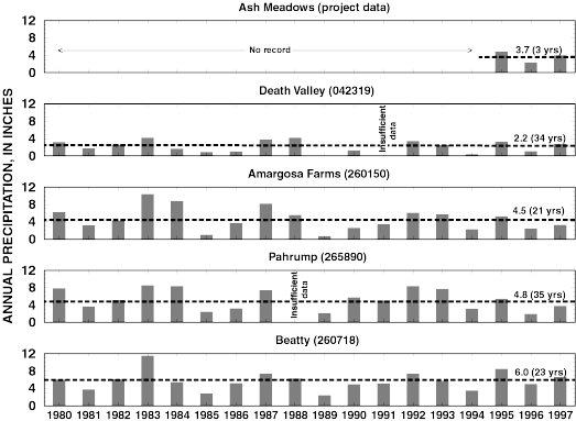
Figure 16. Annual precipitation measured in Ash Meadows and reported at long-term weather stations in general area, 1980-97. Dashed line approximates mean annual precipitation. Number above dashed line is computed mean annual precipitation. Number in parentheses above dashed line is number of years from which mean is computed. Number in parentheses above each plot is National Weather Service station identifier.