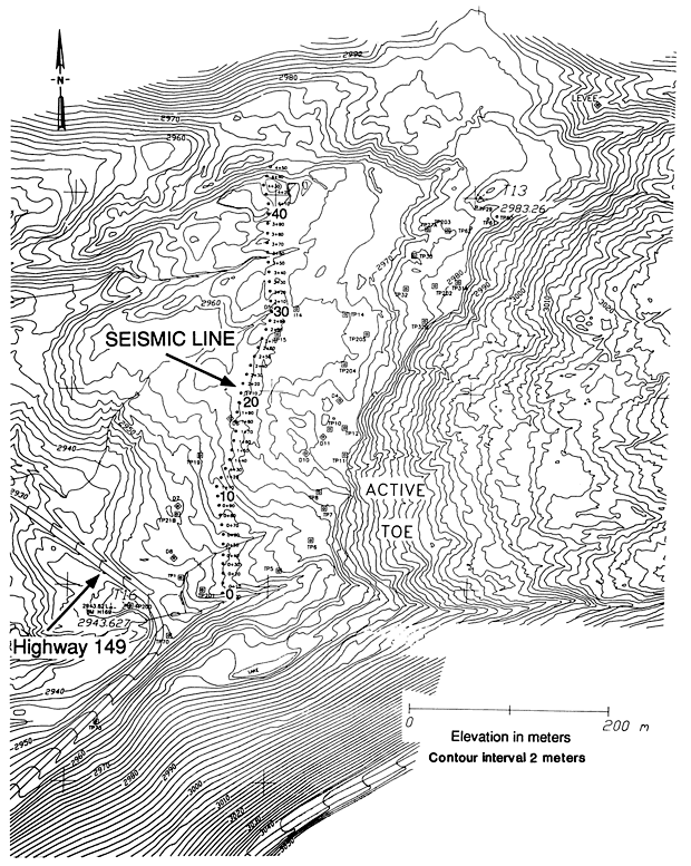
Figure 1.-- Location map of co-located north-south seismic refraction and reflection profiles. Seismic lines are located on the older, inactive portion of the slide, just below the active toe. Solid circles are stations for the refraction survey. Diamonds and squares are preexisting survey grid stations. Large numbers (0, 10, 20, 30, and 40) on the seismic line are reference positions, located about 100 m apart, that are used in the text to describe the data. These numbers also annotate the data at the top of figures 4 and 5. Small numbers (0+10, 0+20, etc.) annotate intermediate seismic stations. Stations beyond position 40 are in a marshy area. Elevations in meters. Contour interval 2 m. Click on the shotline for detail!

![]() U.S. Department of the Interior |
U.S. Geological Survey
U.S. Department of the Interior |
U.S. Geological Survey
URL: http://pubsdata.usgs.gov/pubs/bul/b2130/ch13fig1.htm
Page Contact Information: GS Pubs Web Contact
Page Last Modified: Friday, 23-Mar-2012 14:25:17 EDT