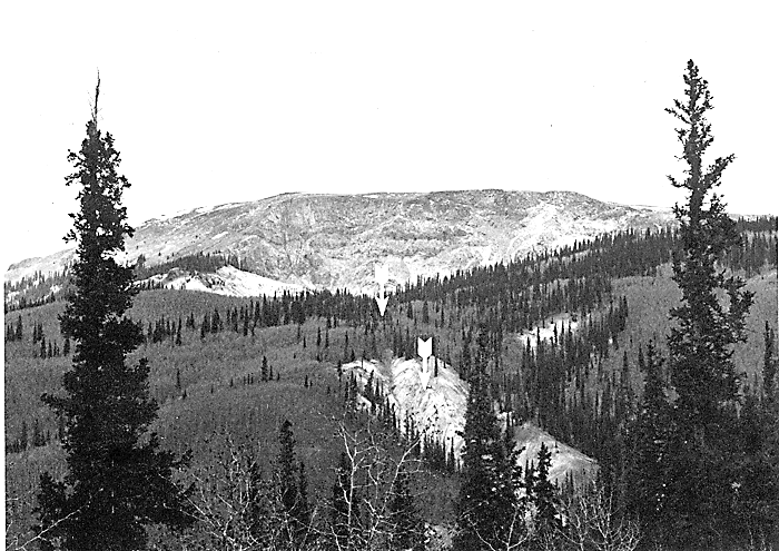
Figure 1.--Panoramic view (looking north) of the area of the newly identified landslide deposit (middle foreground). Arrows point to the exposed lower (distal) part of the deposit and the tree-covered, hummocky upper part. The 250-m-high main scarp of the Slumgullion landslide is in background. Photograph taken from Windy Point Overlook, located approximately 0.8 km south of the deposit.

![]() U.S. Department of the Interior |
U.S. Geological Survey
U.S. Department of the Interior |
U.S. Geological Survey
URL: http://pubsdata.usgs.gov/pubs/bul/b2130/ch5fig1.htm
Page Contact Information: GS Pubs Web Contact
Page Last Modified: Friday, 23-Mar-2012 14:25:08 EDT