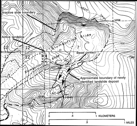
Figure 2.--Topographic map of the upper area of the Slumgullion landslide showing the location of the newly identified landslide deposit. The previously recognized active and inactive landslide boundaries are from Parise and Guzzi (1992). The X=s mark the locations of radiocarbon sample sites AC-2, AC-4, AC-5, and AC-6. Arrows indicate the apparent direction of movement of landslide debris at the time of deposition. Contour interval 40 feet. Base from U.S. Geological Survey 1:24,000 Cannibal Plateau, 1963 (photorevised 1982); 1:24,000 Lake San Cristobal, 1964; 1:24,000 Lake City, 1963 (photorevised 1982); 1:24,000 Slumgullion Pass, 1986.

![]() U.S. Department of the Interior |
U.S. Geological Survey
U.S. Department of the Interior |
U.S. Geological Survey
URL: http://pubsdata.usgs.gov/pubs/bul/b2130/ch5fig2.htm
Page Contact Information: GS Pubs Web Contact
Page Last Modified: Friday, 23-Mar-2012 14:25:08 EDT