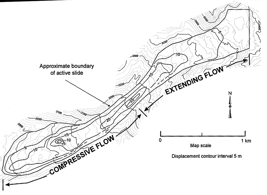
Figure 2.-- Map of active part of the Slumgullion landslide showing contours of horizontal displacement between 1985 and 1990. Contours were drawn by hand from magnitudes of vectors shown in figure 1.

![]() U.S. Department of the Interior |
U.S. Geological Survey
U.S. Department of the Interior |
U.S. Geological Survey
URL: http://pubsdata.usgs.gov/pubs/bul/b2130/ch9fig2.htm
Page Contact Information: GS Pubs Web Contact
Page Last Modified: Friday, 23-Mar-2012 14:24:51 EDT