![]()
|
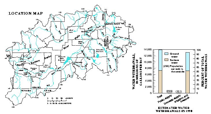
Location Map and Estimated Water Withdrawals in 1990
|
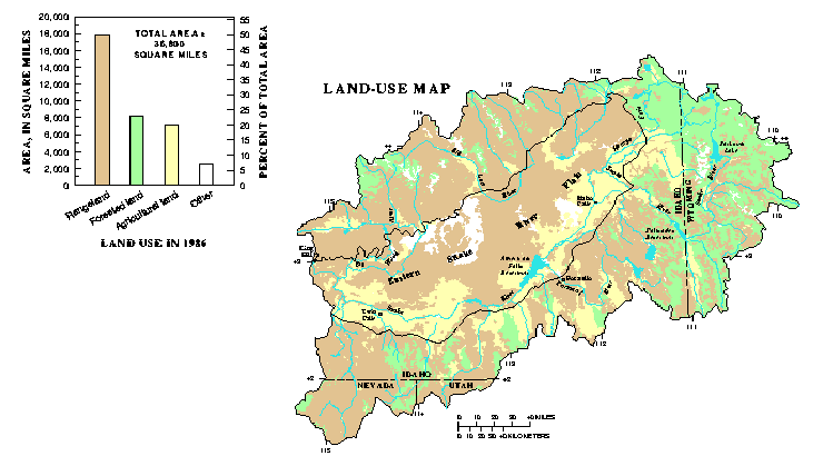
Land-Use Map and 1986 Land Use Bar Chart
|
Climate in the upper Snake River Basin is influenced predominantly by eastward-moving airmasses from the Pacific Ocean. The semiarid eastern Snake River Plain receives 8 to 10 inches of precipitation annually. The semihumid mountainous parts of the basin receive the greatest amount of precipitation as snow, generally between November and March. Mountains in the northeastern part of the basin may receive more than 60 inches of precipitation annually.
The Snake River is the regional drainage for streams and ground water in the upper Snake River Basin. Five main-stem and numerous tributary reservoirs regulate streamflow in the basin, primarily for agricultural use, flood control, and hydroelectric power production. The major source of ground water in the basin is the fractured basalt aquifer underlying the eastern Snake River Plain. In 1990, about 53 percent of the water used in the upper Snake River Basin was withdrawn from surface-water supplies and 47 percent from ground water, primarily for irrigation and livestock.
About 18,000 square miles, or about 50 percent, of the upper Snake River Basin is rangeland; forested land and agricultural land compose 23 and 21 percent of the basin, respectively. Forested land is located primarily in the mountainous eastern part of the basin where precipitation is the greatest. Agricultural land is concentrated on the Snake River Plain, primarily along the Snake River and near the mouths of tributary drainage basins.
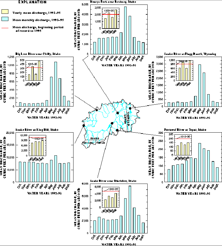
Stream discharges in the upper Snake River Basin during water years 1992-95 were largest during May and June in response to spring snowmelt in mountainous areas of the basin. However, stream discharge at the outlet of the basin was relatively stable throughout the year because of reservoir regulation and the large quantity of ground water discharged to the river as springs between Milner Dam and King Hill. Large stream discharges in response to individual storms were rare during the study.
In the northern and eastern parts of the basin, hydrologic conditions were wetter than normal, and stream discharges larger than long-term averages during water years 1993 and 1995. The opposite was true during water years 1992 and 1994--conditions were drier than normal and stream discharges were below average throughout the basin. In the southern part of the basin and in the main-stem Snake River, stream discharges were smaller than long-term averages during all 4 years of the study.