USGS

Water Quality in the Rio Grande Valley, Colorado, New Mexico, and Texas, 1992-95

Table of contents || Previous section || Next section || Glossary


WATER-QUALITY CONDITIONS IN A NATIONAL CONTEXT

|| Surface water || Ground water ||

Comparison of Stream Quality in the Rio Grande Valley with Nationwide NAWQA Findings

Map of 20 NAWQA study units sampled during 1992-95 (8,720 bytes)

Seven major water-quality characteristics were evaluated for stream sites in each NAWQA Study Unit. Summary scores for each characteristic were computed for all sites that had adequate data. Scores for each site in the Rio Grande Valley were compared with scores for all sites sampled in the 20 NAWQA Study Units during 1992-95. Results are summarized by percentiles; higher percentile values generally indicate poorer quality compared with other NAWQA sites. Water-quality conditions at each site also are compared to established criteria for protection of aquatic life. Applicable criteria are limited to nutrients and pesticides in water, and semivolatile organic compounds, organochlorine pesticides and PCBs in sediment. (Methods used to compute rankings and evaluate aquatic-life criteria are described by Gilliom and others, in press.)

EXPLANATION

Ranking of stream quality relative to all NAWQA stream sites-- Darker colored circles generally indicate poorer quality. Bold outline of circle indicates one or more aquatic-life criteria were exceeded.

Explanation of percentiles and colors


NUTRIENTS in water

Map: nutrients (13,509 bytes)
 

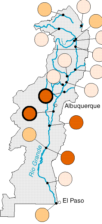
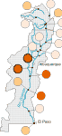
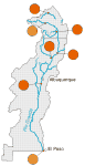
Nutrient concentrations downstream from urban areas and in a sediment- laden tributary were among the highest in the Nation. The impact of reservoirs on reducing nutrient concentrations is shown by the reduced concentrations at the two lower sites.

ORGANOCHLORINE PESTICIDES and PCBs in bed sediment and biological fish tissue

Map: organochlorine pesticides and PCBs (10,511 bytes)
 

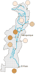
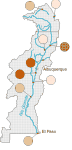
The largest concentrations of organochlorines and PCBs were at sites downstream from urban areas. Three sites had levels above the national NAWQA median.

PESTICIDES in water

Map: pesticides (10,640 bytes)
 

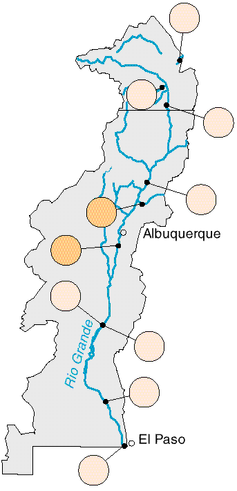
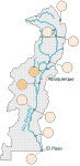
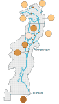
Pesticide concentrations in surface water ranked among the lowest of all NAWQA sites nationwide. Within the Study Unit, the two sites with the highest concentrations were below urban land-use areas.

TRACE ELEMENTS in bed sediment

Map: trace elements (11,070 bytes)
 

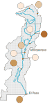
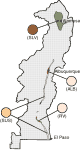
For the trace elements measured for this comparison, one site was in the highest 25 percent nationwide. Two sites in the lower part of the Study Unit have levels greater than the median for all NAWQA sites.

SEMIVOLATILE ORGANIC COMPOUNDS in bed sediment

Map: semivolatile organic compounds (10,826 bytes)
 

Six of the nine sites have concentrations lower than the national median. Two sites located downstream from urban areas ranked among the highest in the Nation for semivolatile organic compounds in sediment.

FISH COMMUNITY DEGRADATION

Map: fish community degradation (11,207 bytes)
 

On the basis of attributes used to provide a broad overview of the fish community structure--introduced species, omnivorous species, percent tolerant species, and external anomalies--all of the sites were above the national median. The ranking was strongly influenced by the predominance of introduced and omnivorous species at many of the sites.

STREAM HABITAT DEGRADATION

Map: stream habitat (11,282 bytes)
 

Four of 10 sites in the Study Unit were above the national median; however, all sites showed some signs of degradation. One site ranked as highly degraded compared with other sites. The rankings were influenced most by the lack of dense riparian vegetation.
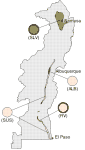
CONCLUSIONS

Compared to other NAWQA Study Units, in the Rio Grande Valley

  • Based on the water-quality data collected and presented here, land use in the middle part of the Study Unit has a major impact on nutrient concentrations.
  • Pesticide concentrations have not affected the quality of surface water at the sampled sites.
  • Fish community rankings were strongly influenced by the predominance of introduced and omnivorous species.

|| Surface water || Ground water ||

Comparison of Ground-Water Quality in the Rio Grande Valley with Nationwide NAWQA Findings

Map of 20 NAWQA study units sampled during 1992-95 (8,720 bytes)

Five major water-quality characteristics were evaluated for ground-water studies in each NAWQA Study Unit. Ground-water resources were divided into two categories:
(1) drinking-water aquifers, and (2) shallow ground water underlying agricultural or urban areas. Summary scores were computed for each characteristic for all aquifers and shallow ground-water areas that had adequate data. Scores for each aquifer and shallow ground-water area in the Rio Grande Valley were compared with scores for all aquifers and shallow ground-water areas sampled in the 20 NAWQA Study Units during 1992-95. Results are summarized by percentiles; higher percentile values generally indicate poorer quality compared with other NAWQA ground-water studies. Water-quality conditions for each drinking-water aquifer also are compared to established drinking-water standards and criteria for protection of human health. (Methods used to compute rankings and evaluate standards and criteria are described by Gilliom and others, in press.)

EXPLANATION

Drinking-water aquifers

Aquifer subunit survey (SUS)

Shallow ground-water areas

Agricultural = Rincon Valley (RV); Cropland = San Luis Valley (SLV); Urban = Albuquerque (ALB)

Ranking of ground-water quality relative to all NAWQA ground-water studies-- Darker colored circles generally indicate poorer quality. Bold outline of circle indicates one or more standards or criteria were exceeded.

Explanation of percentiles and colors

RADON

Map: radon (11,200 bytes)
 

Radon concentrations in the San Luis Valley were among the highest measured nationwide. However, radon concentrations in the rest of the Study Unit were smaller than the national median value.
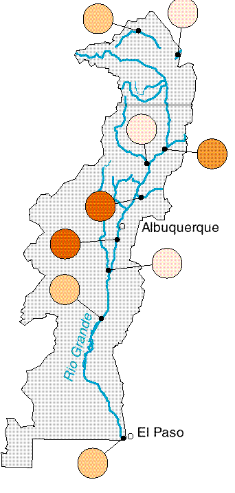
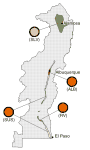
NITRATE

Map: nitrate (9,490 bytes)
 

Nitrate concentrations throughout most of the Study Unit were among the lowest in the Nation. However, in the San Luis Valley, nitrate concentrations were higher than the national median and, along with the Rincon Valley area, exceeded drinking-water standards in some wells.
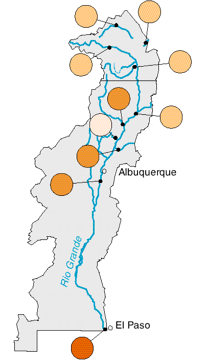
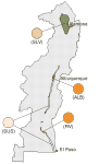
DISSOLVED SOLIDS

Map: dissolved solids (9,538 bytes)
 

The median dissolved-solids concentration in water from the Albuquerque and Rincon land-use studies and aquifer subunit survey ranked in the top 25 percent nationwide. Drinking-water standards were exceeded in some wells in all areas.

VOLATILE ORGANIC COMPOUNDS

Map: volatile organic compounds (8,572 bytes)
 

The percentage of wells with VOC detections in urban and agricultural areas ranked in the middle categories nationwide. No VOCs were detected in aquifer subunit survey samples.
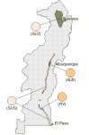
PESTICIDES

Map: pesticides (9,022 bytes)
 

Pesticide detections for the San Luis Valley and aquifer subunit survey were among the lowest of all NAWQA ground-water studies and were only slightly higher in the Albuquerque area and Rincon Valley. No standards were exceeded in any samples from the four areas.

CONCLUSIONS

Compared to other NAWQA Study Units, in the Rio Grande Valley

  • Pesticide concentrations detected in shallow ground water in the agricultural and urban land-use areas have not exceeded any drinking-water standards.
  • Radon concentrations in the San Luis Valley and in parts of the aquifer subunit survey area may be high enough to be of potential health concern.
  • Dissolved-solids concentrations are higher in the middle to lower parts of the study area. This may indicate interaction of ground water and surface water along the Rio Grande and deeper water has been recharged at basin boundaries and traveled large distances.

U.S. Geological Survey Circular 1162

Table of contents || Previous section || Next section || Glossary

Suggested citation:
Levings, G.W., Healy, D.F., Richey, S.F., and Carter, L.F., 1998, Water Quality in the Rio Grande Valley, Colorado, New Mexico, and Texas, 1992-95: U.S. Geological Survey Circular 1162, on line at <URL: https://water.usgs.gov/pubs/circ1162>, updated May 18, 1998 .

This page is a subpage of <URL:http://water.usgs.gov/pubs/circ1162>
Email questions and comments to GS-W_NAWQA_Outreach@usgs.gov
Last modified: Mon Jul 27 10:20:55 1998