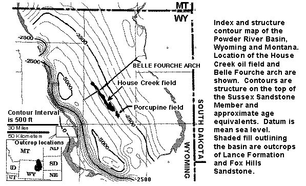
Figure 1. Structure contour map on the top of the Upper Cretaceous Sussex Sandstone Member of the Cody Shale, and approximate age equivalents, Powder River Basin, Wyoming and Montana. Location of the House Creek field is shown. Areal extent of the Sussex "B" sandstones is delineated by black-colored fields. Shaded fill outlining the basin are outcrops of Lance Formation and Fox Hills Sandstone. The rectangle located next to the 30-miles scale bar defines the area of studied outcrops of the Sussex and Shannon Members, much of the Salt Creek anticline, and the towns of Midwest and Edgerton. Contour interval is 500 ft. Datum is mean sea level. A detailed (176 KB) version is named indexfig.gif.
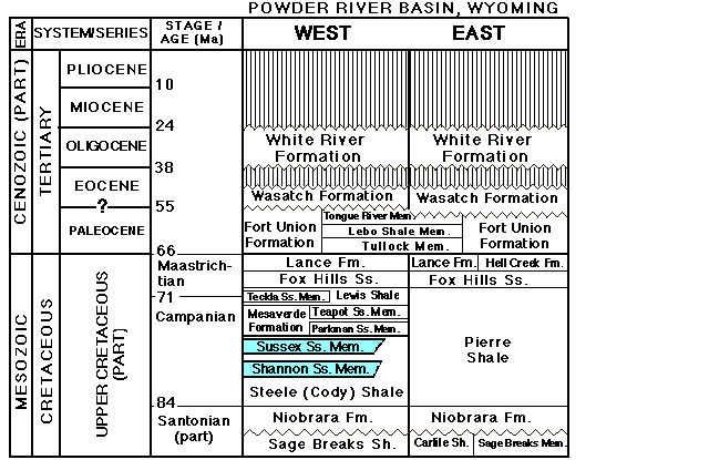
Figure 2. Stratigraphic nomenclature for Upper Cretaceous and Tertiary rocks, Powder River Basin (stratprb.gif, 32 KB).
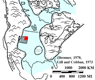
Figure 3. Map showing Cretaceous epicontinental seaway paleogeography during Campanian time (Late Cretaceous) (modified from Brenner, 1978, reprinted by permission, Gill and Cobban, 1973) (wseaways.gif). The large rectangle is Wyoming, the small one shows location of the Powder River Basin.
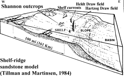
Figure 4. Basin morphology during deposition of shelf sandstone beds in the Powder River Basin (Tillman and Martinsen, 1984 reprinted by permission). The House Creek field is located about 10 miles (16 km) east of and approximately parallel to Hartzog Draw field. Oil in the Hartzog Draw and Heldt Draw fields is produced from the Upper Cretaceous Shannon Sandstone.
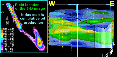
Figure 5. This north-south-oriented vertical slice of the 3-D porosity model (3dns_img.htm) shows upward and westward (landward) increase in sediment thickness, and progressive westward deposition of later sands in the Sussex "B" sandstone (wedgessx.gif). Blue on the 3-D model is primarily mudstone and sandstones containing less than 8 percent porosity, green is mainly fine- to medium-grained sandstones exhibiting 8 to 12 percent porosity, and yellow contours are mainly medium-grained trough-cross-bedded sandstones that contain greater than 12 percent porosity. Respective average porosity of the "B" sandstone and of reservoir intervals are about 8 percent and 12 percent. Slice width and thickness are about 2.5 mi (4 km) and 50 ft (15 m). Vertical exaggeration is 60x. Yellow dots are well sample locations. Index contour map shows cumulative oil production per well; contour interval is 40,000 barrels.
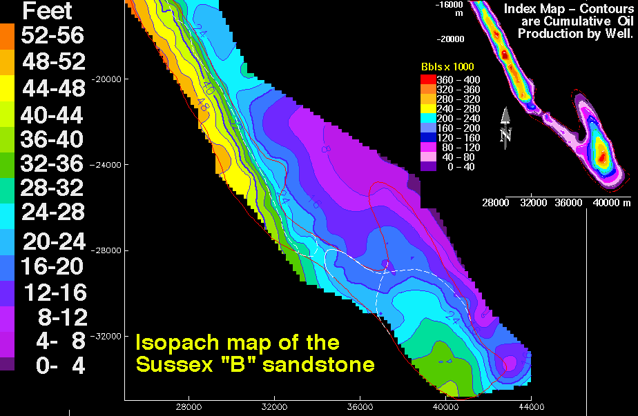
Figure 6. Isopach map of the Sussex "B" sandstone showing thickness in feet of the interval between bounding disconformities; contour interval is 4 ft (1.2 m). Map scales are meters. The small index contour map is cumulative oil production; contour interval is 40,000 barrels. The thin red line outlines the boundary of the House Creek field. Thin white lines in the southern half of the field are limits of sand ridge 1 and overlying sand ridge 2. The large-scale 64 KB image is named ssxiso.gif .
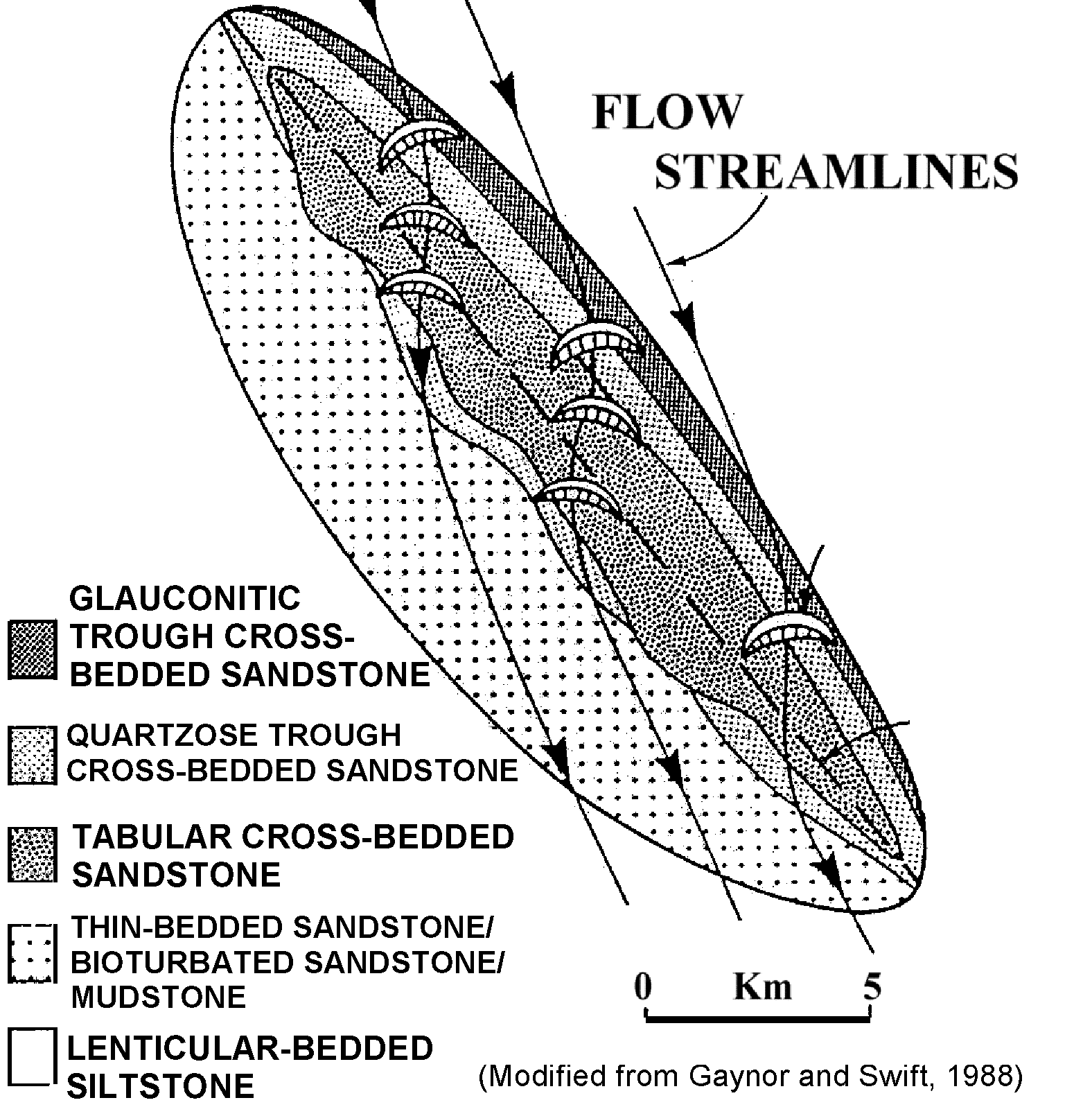
Figure 7. Plan view of lithofacies distribution on a sand ridge, and generalized flow streamlines (srplanvs.gif). Flow streamline arrows are the directions of currents over the sand ridge. Scale is approximate. Click sand Ridge - plan view (Gaynor and Swift, 1988, reprinted by permission) to see the detailed (srplanvw.gif) image (208 KB).
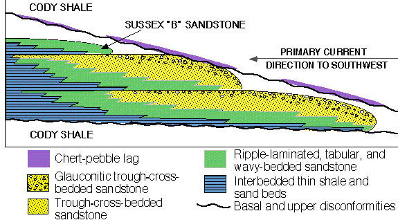
Figure 8. Idealized east-west-oriented vertical section across three stacked sand ridges (ssxflowu.gif). General facies types are listed. No vertical or horizontal scales.
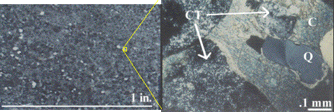
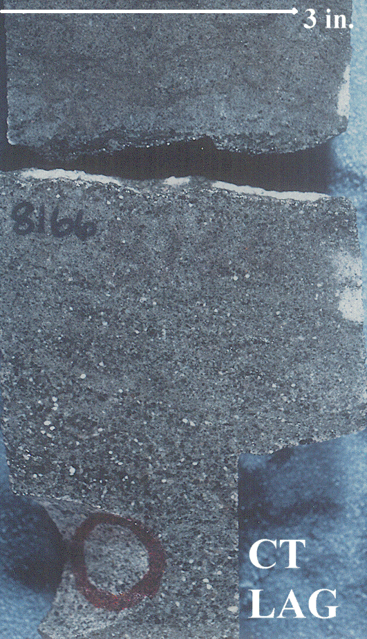
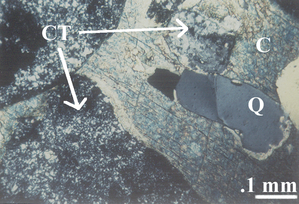
Figure 9. A. Chert-pebble-lag core photograph, and B. crossed-nicols photomicrograph of a chert-pebble lag, No. 14-9 Federal well. Chert pebble lag core links the detailed (576 KB) ctlagc.gif core image. The bimodal grain distribution (mix of large and small grains) is visible on both images. Chert pebble thin section shows the large-scale (736 KB) ctlagts.gif photomicrograph image. Labels are Q quartz, CT chert, and C calcite. Quartz grains incorporated from underlying central-ridge facies sandstones commonly "float" in a matrix of (blue stained) ferroan carbonate cement.