Table of contents | Glossary | Geology | Depositional model | Heterogeneity | Diagenetic history | Petroleum geology | 1) East-West porosity slices | North-South porosity slices | 3) Onion views of 3-D images | 4) Horizontal slices of porosity | 5) Horizontal and East-West permeability and porosity slices
GIF graphic images are stored in the 3dgifns (3-D north-south-oriented GIF files) directory. GIF and TARGA files located in folders are named and numbered such that external viewers can correctly sequence files. Images can be displayed as slide shows using an external viewer, such as JPEGView or LView, or can be accessed as the nsporvf.MOV (north-south vertical porosity slices, single forked) stand-alone movie in the movies folder. Movies are called up much quicker directly from the folder than using the below text hook, although the animation speed is similar.
Technical information on data sources and methodologies is stored in techinfo.htm. Access and start the movie with north-south movie (nsporvf.MOV). Before the movies can be opened, you may need to copy to your hard drive a movie-viewing program; information on how to acquire this freeware and software is listed in the readme for movies file.
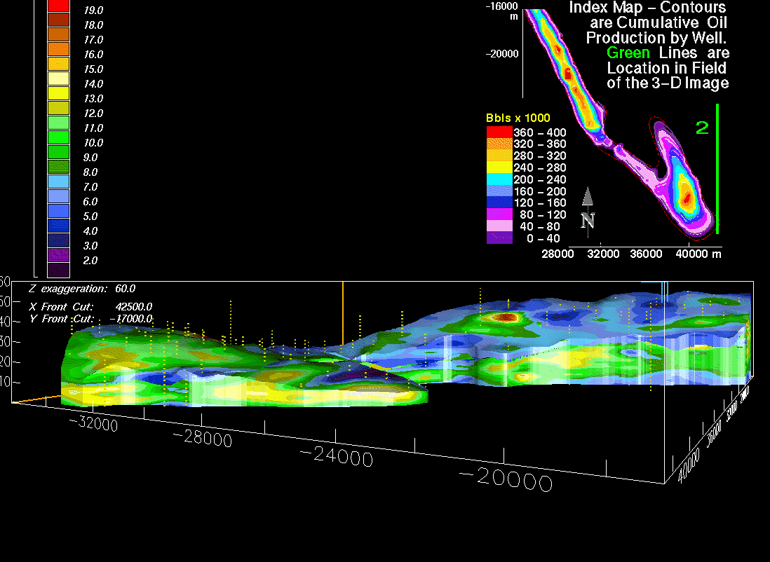
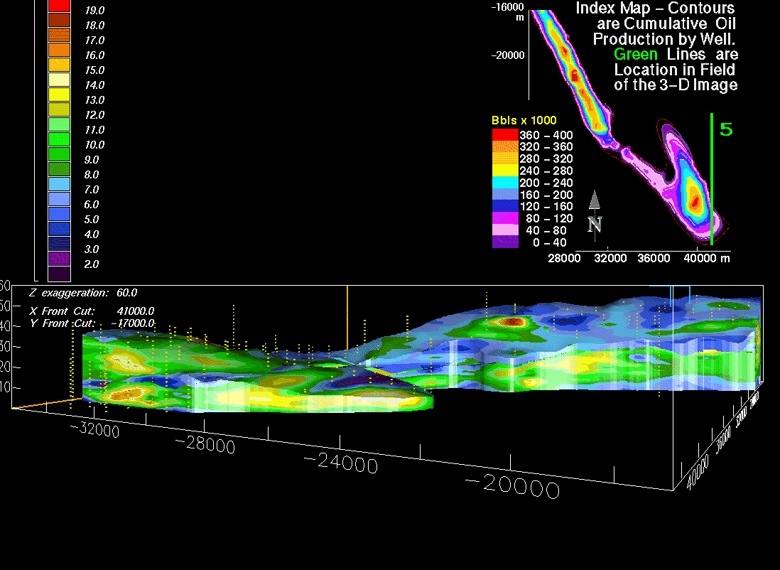
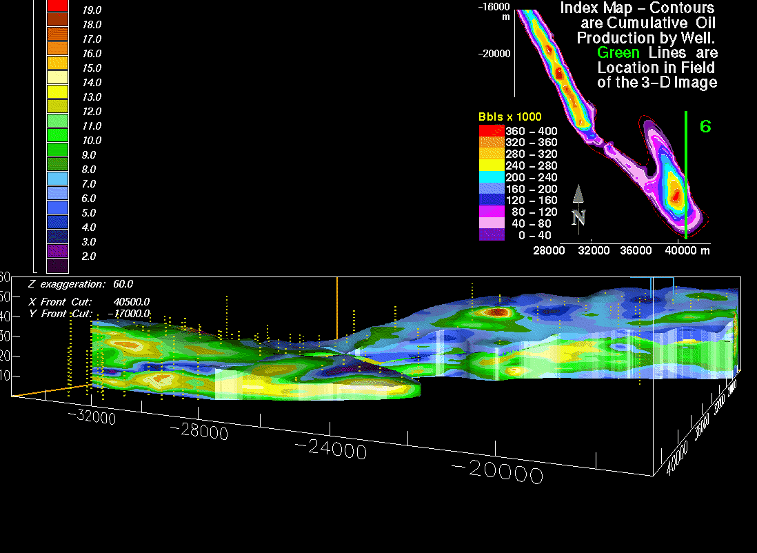
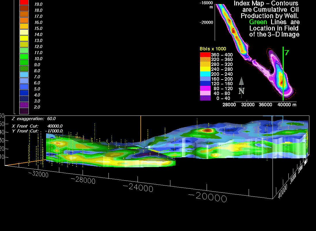
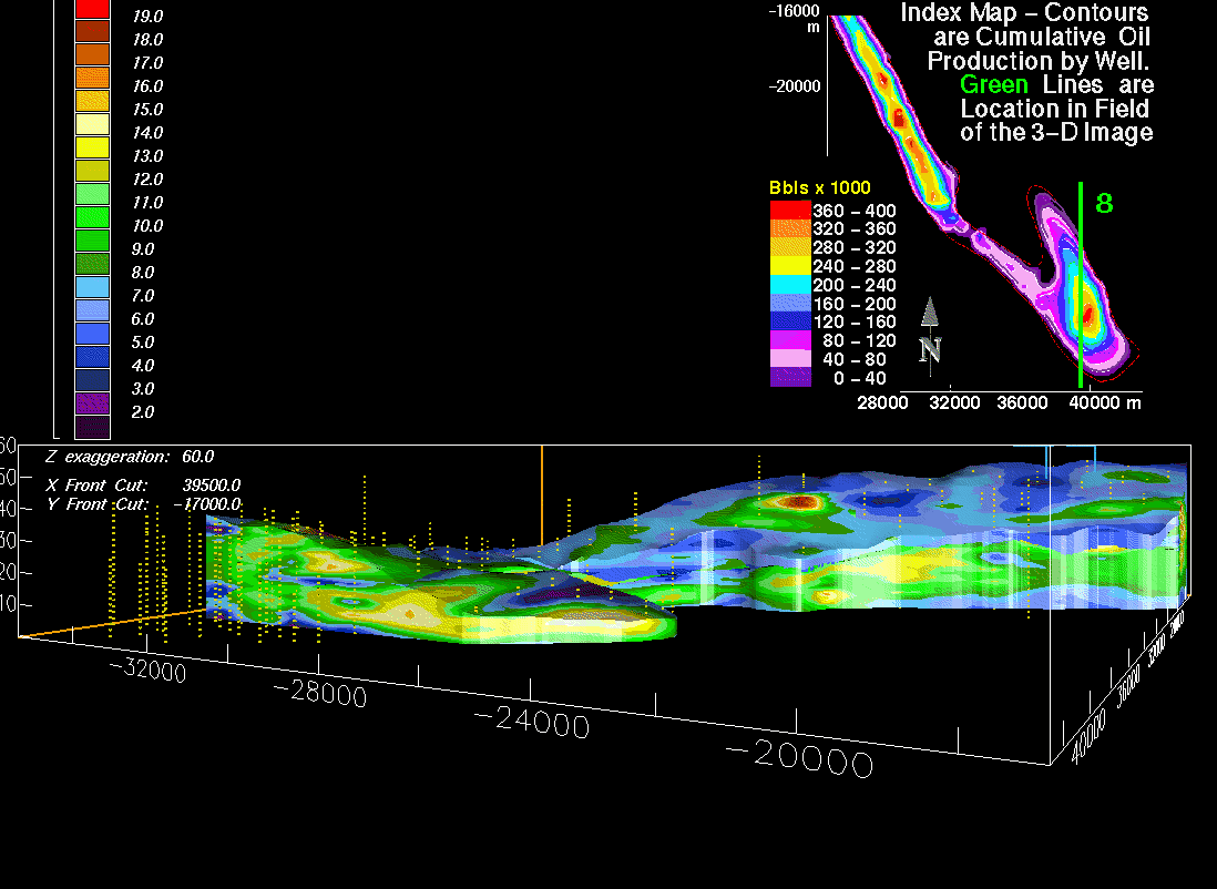
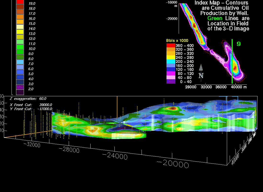
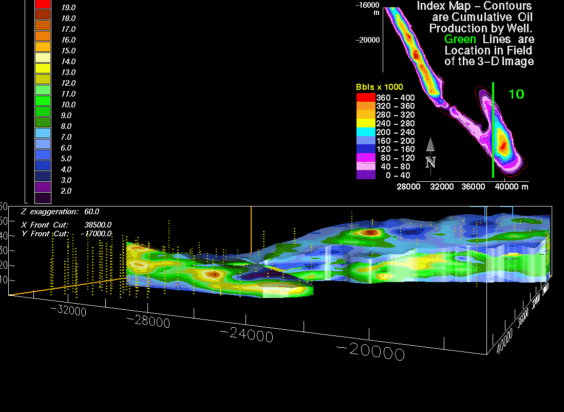
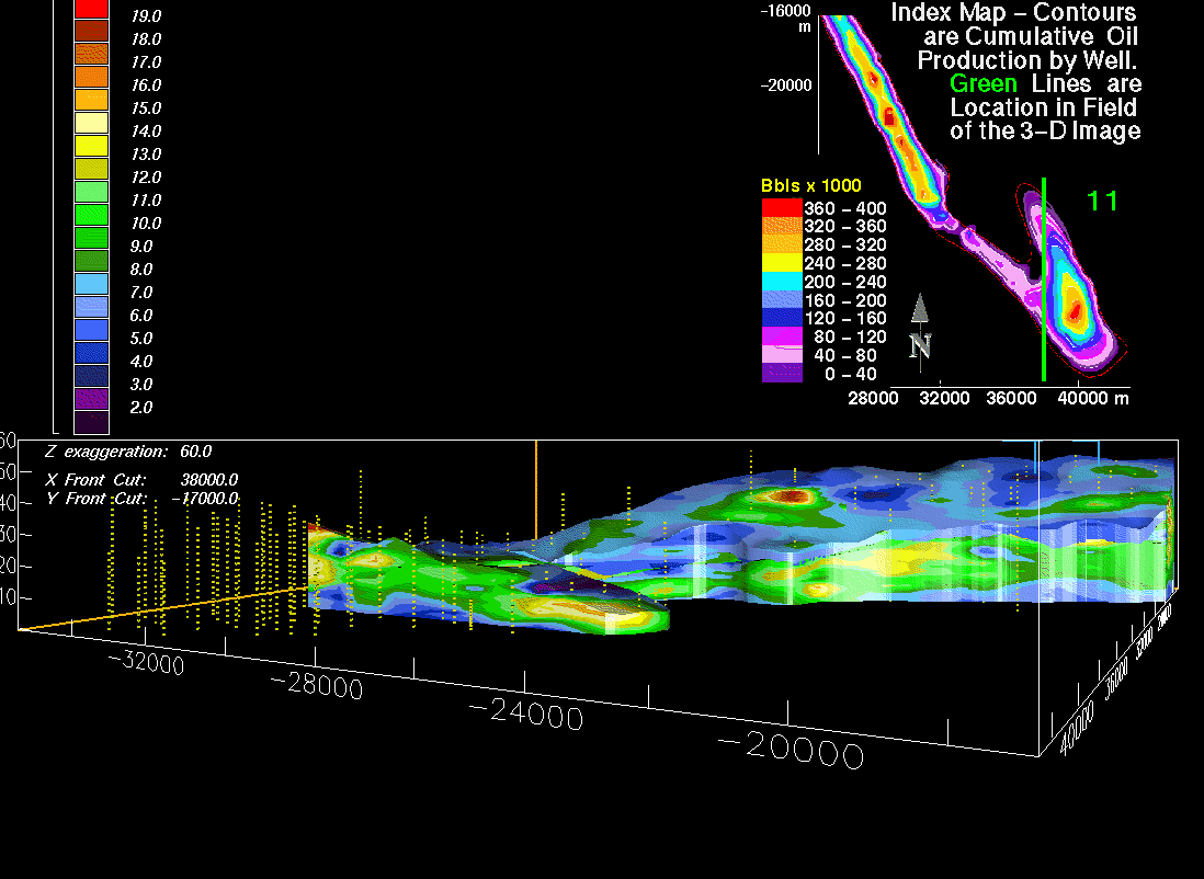
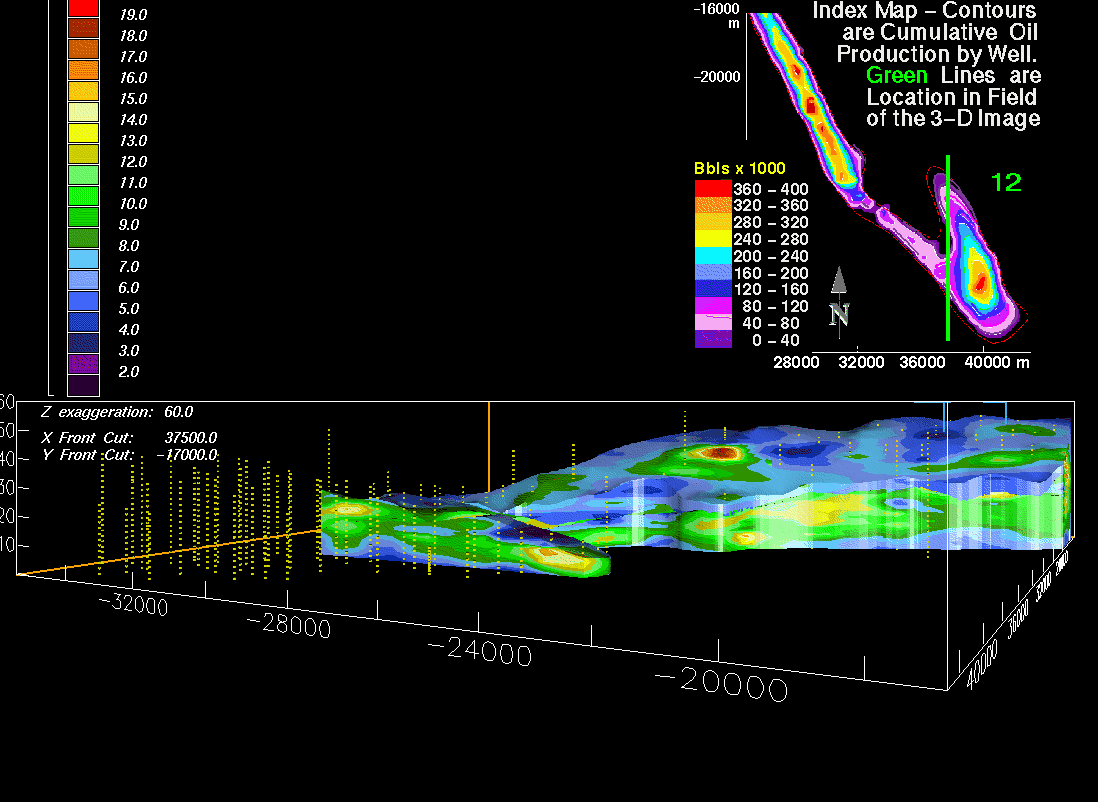
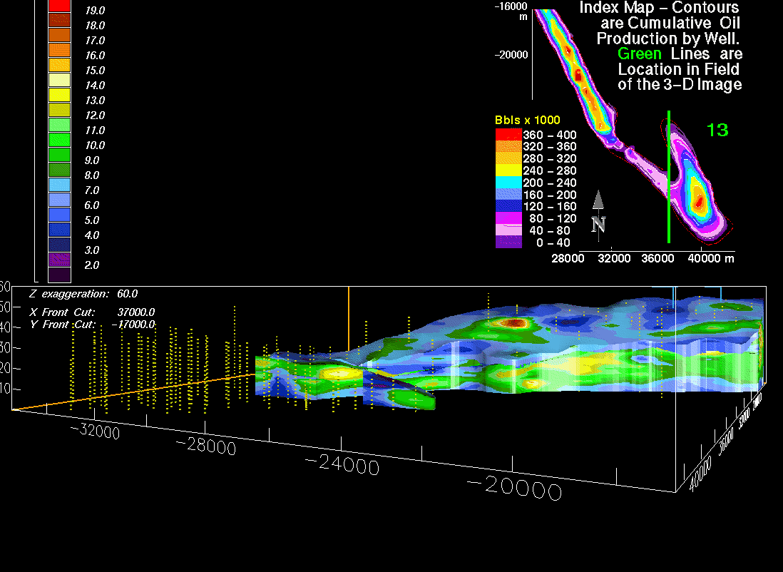
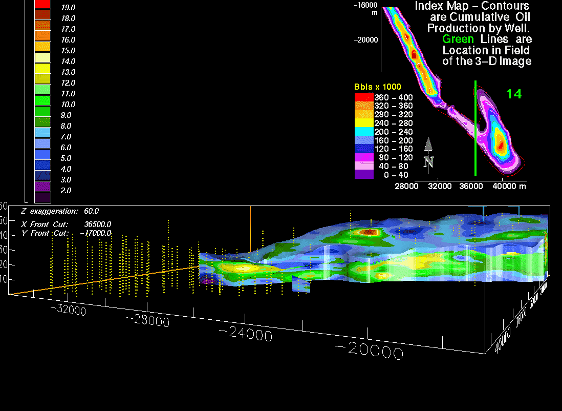
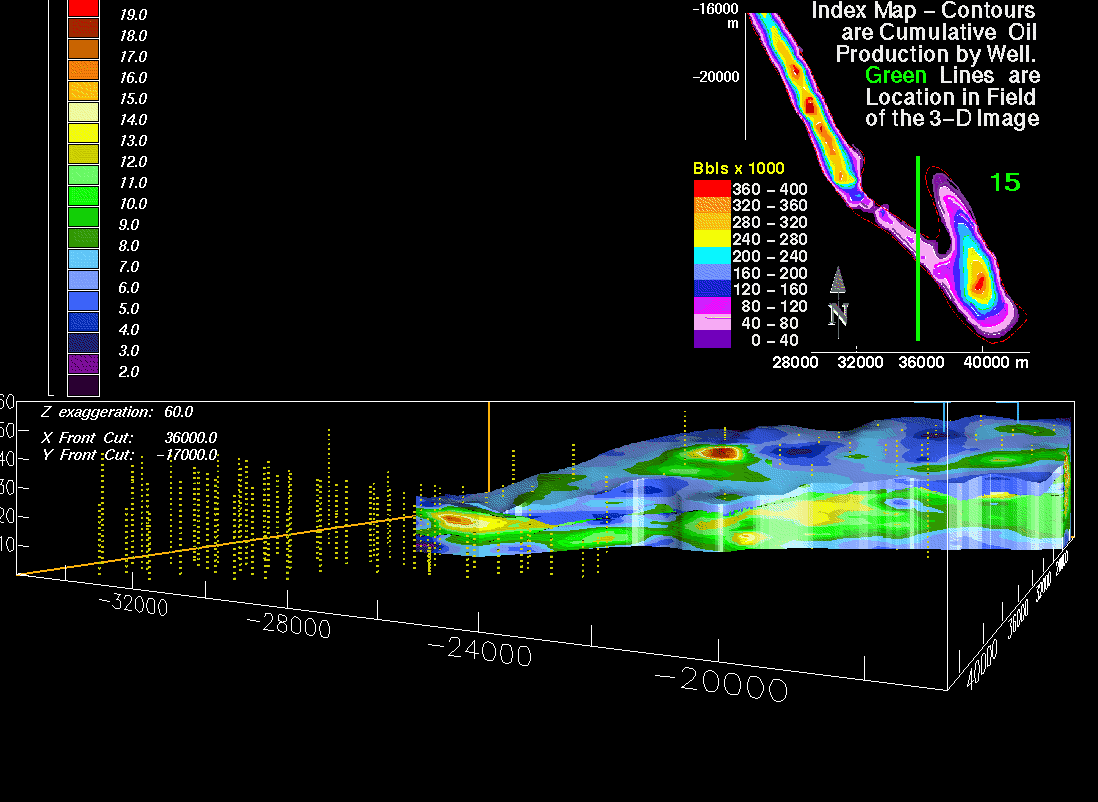
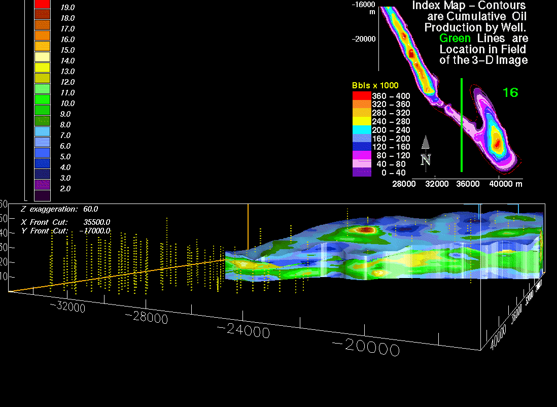
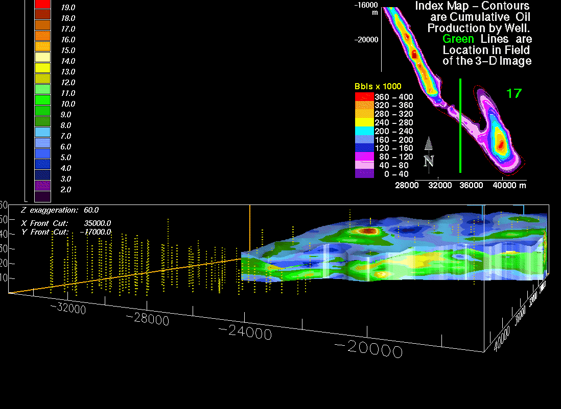
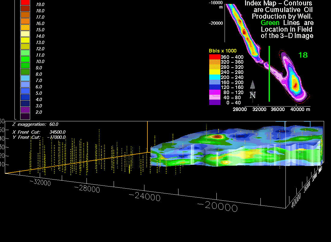
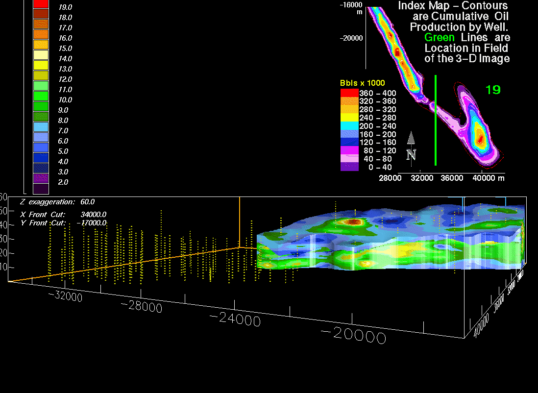
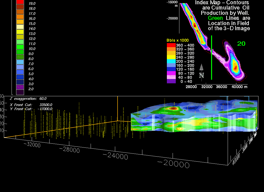
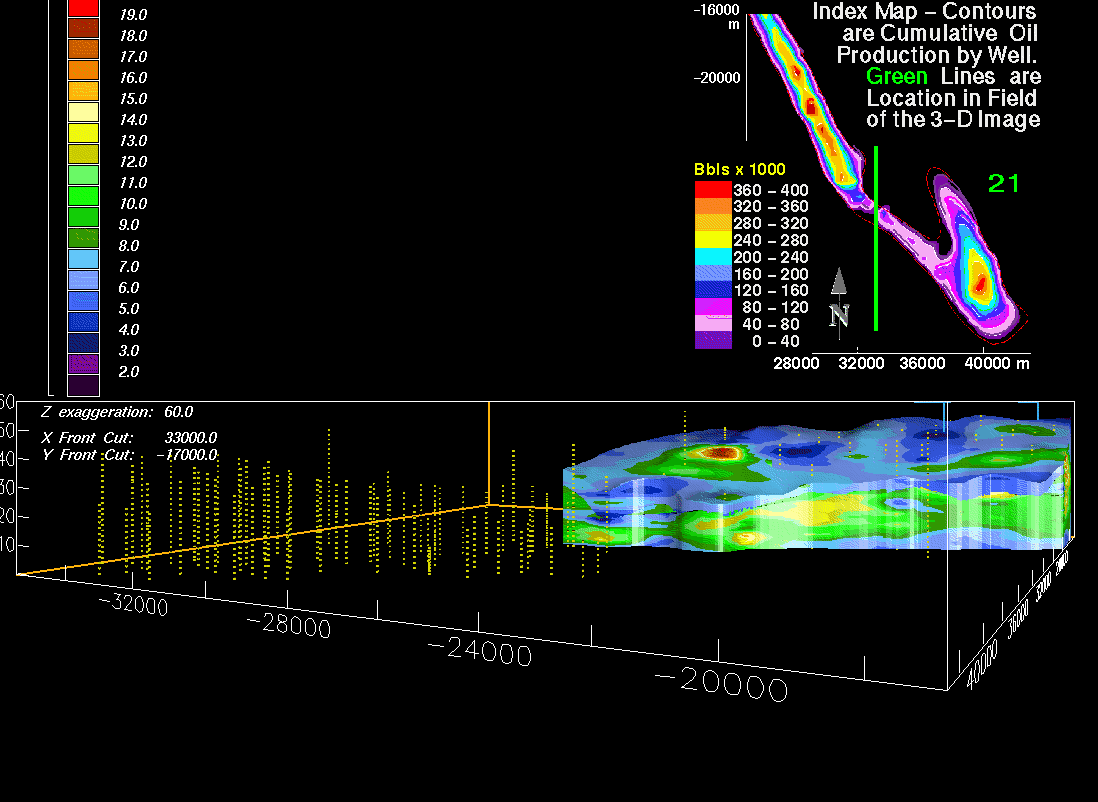
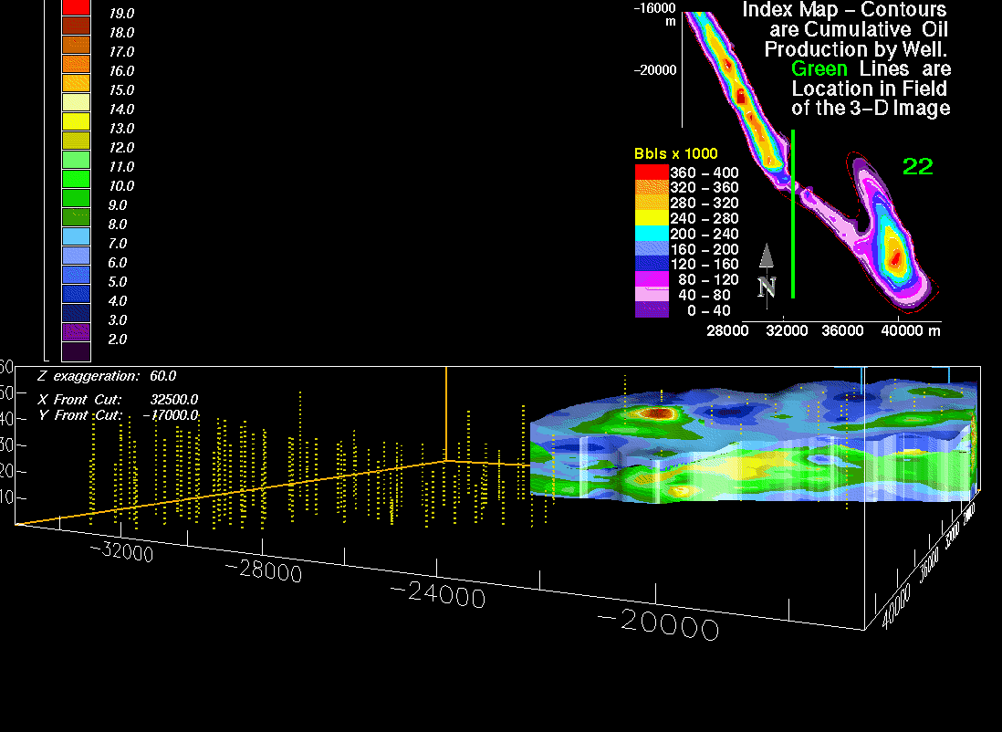
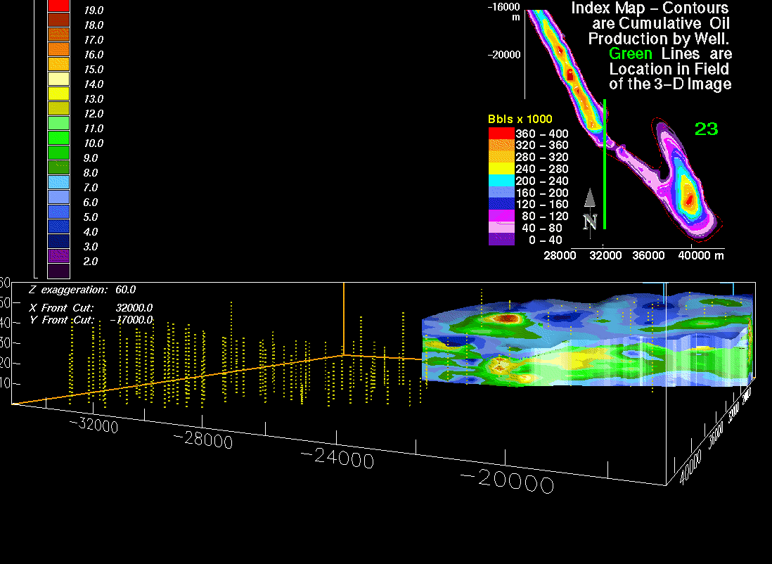
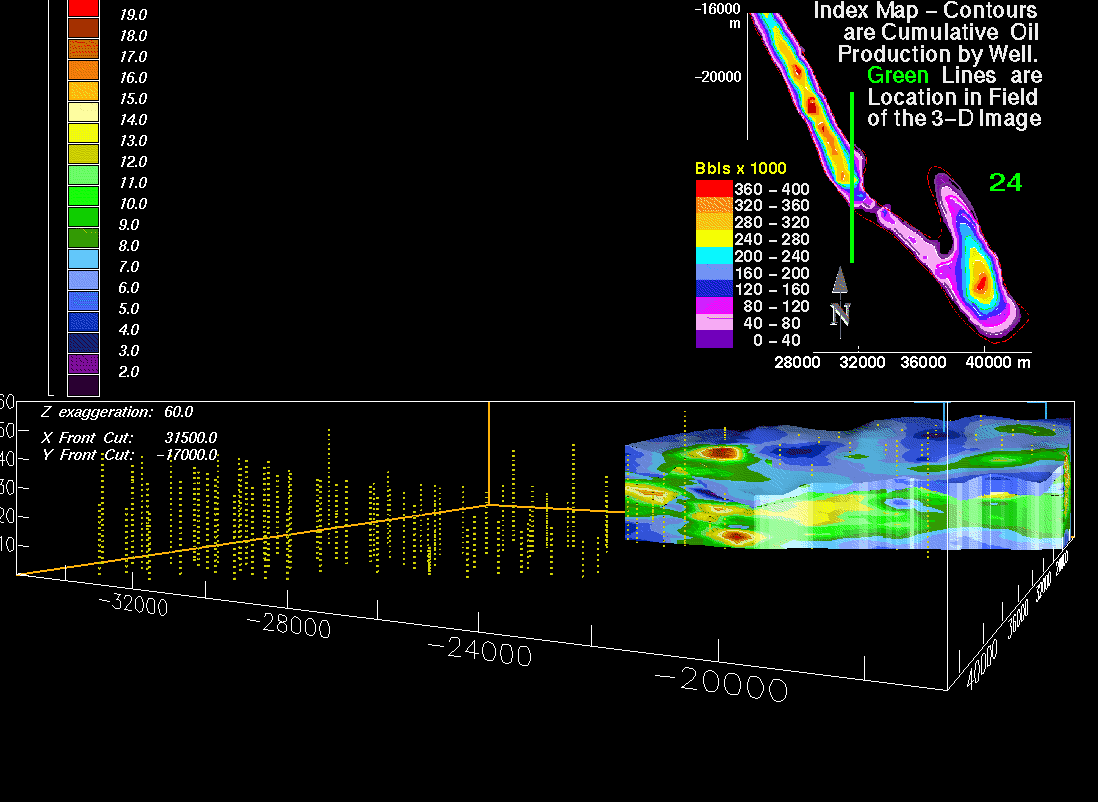
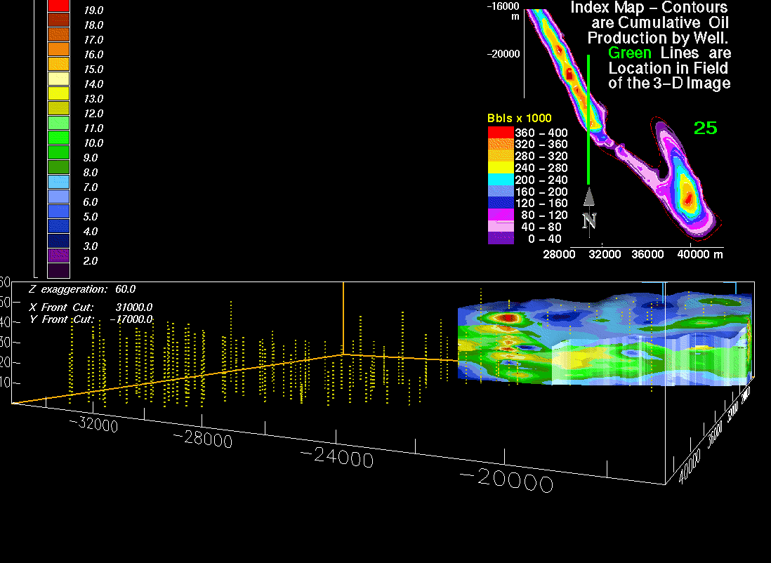
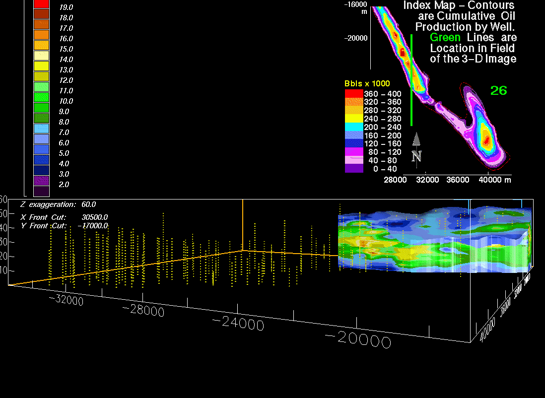
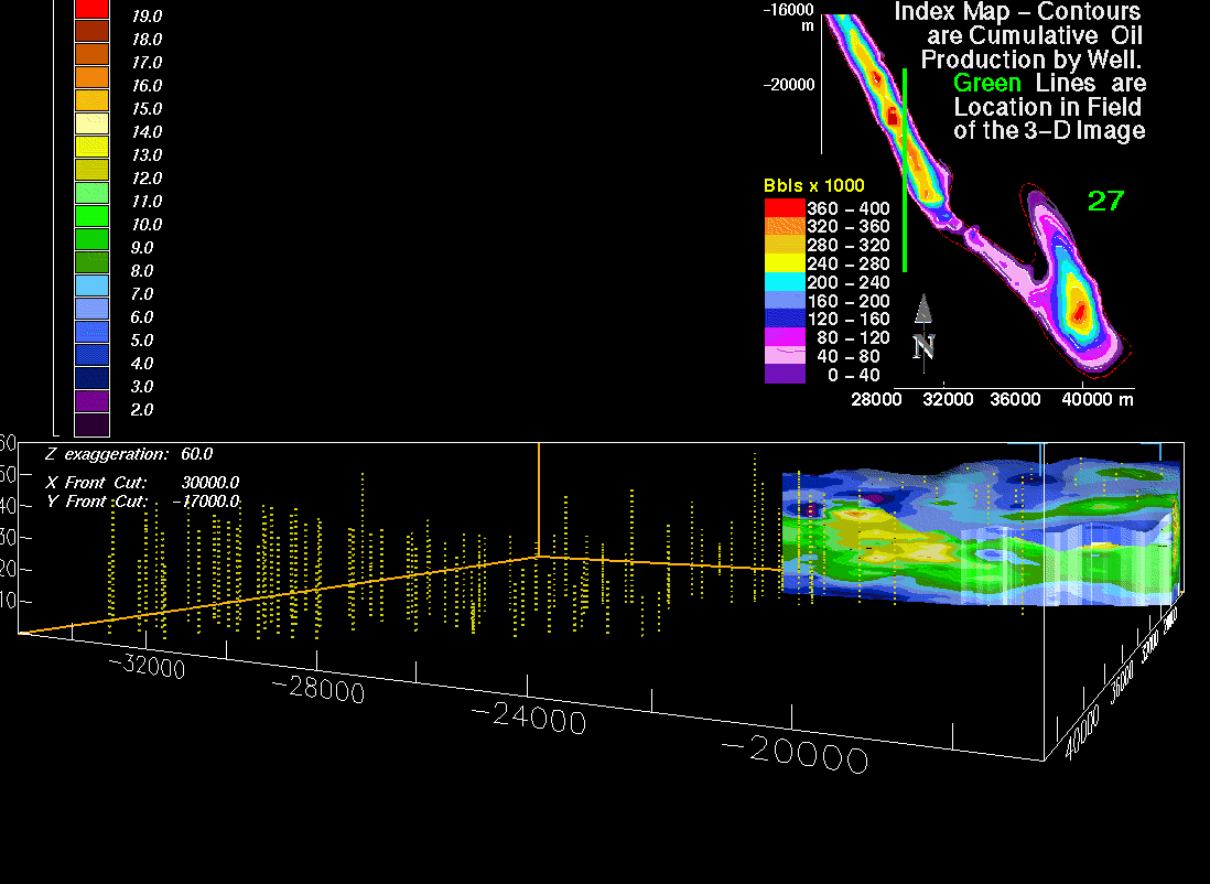
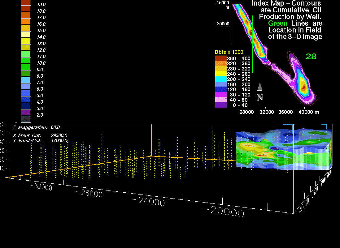
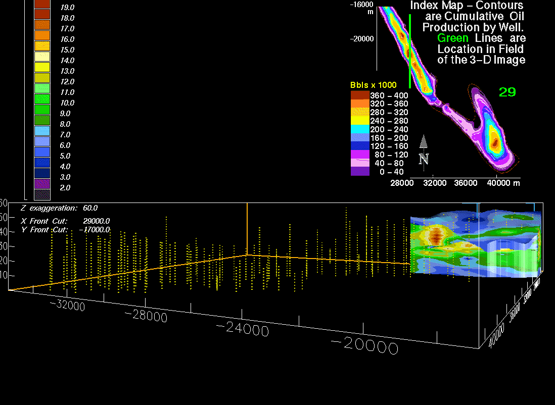
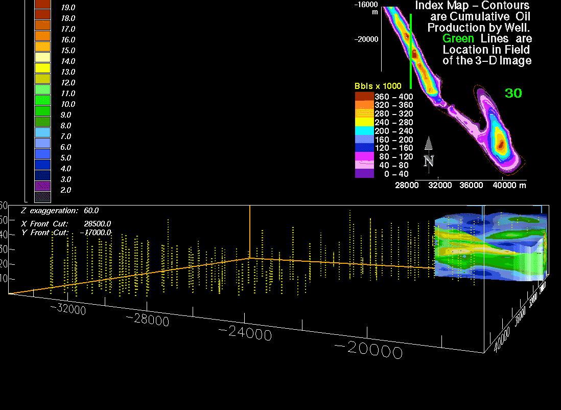
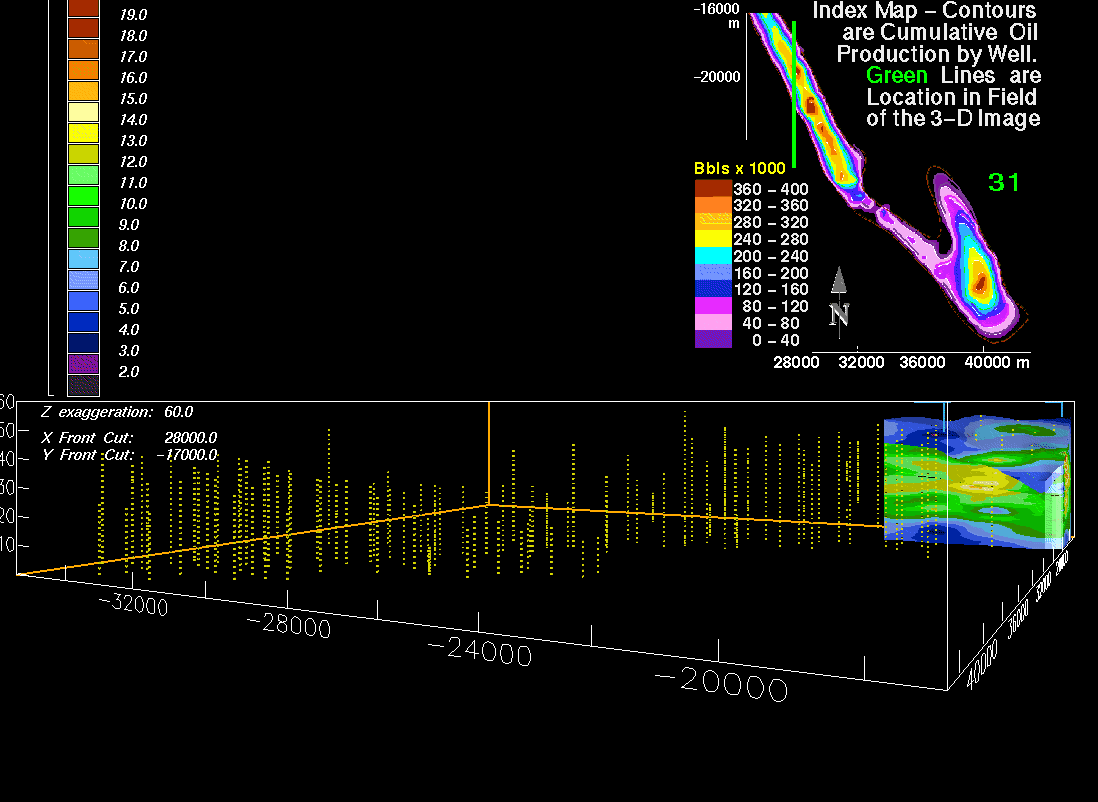
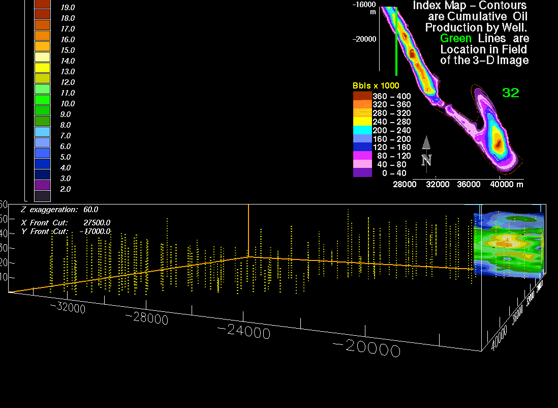
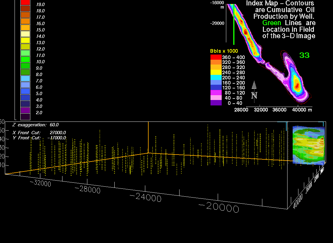
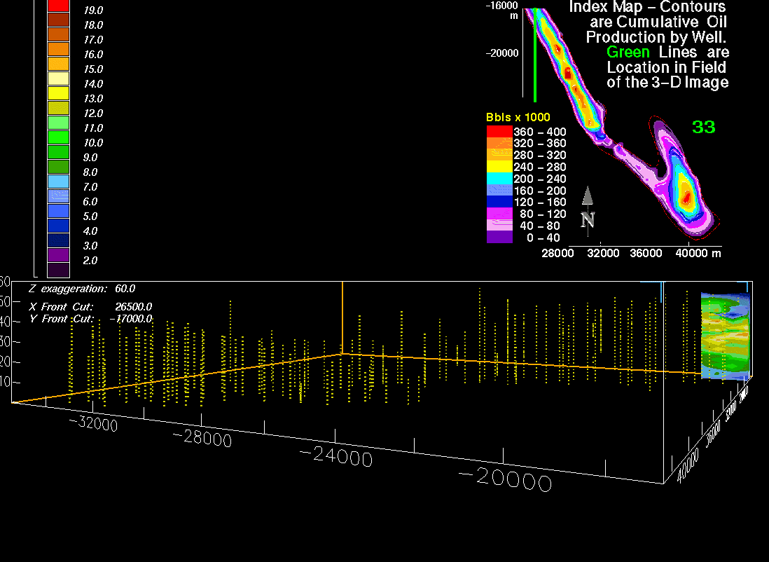
The above image is north-south-oriented vertical slice 7 of the Sussex "B" sandstone (slice 7 is located at X-axis location 40,000 m on the following index map). The 3-D model is rotated clockwise about 30 degrees. Yellow dots are borehole and sample locations. The below index plan-view map shows cumulative oil production. Also shown are location and orientation of the slice; these index maps are included on each image. Illustrated on the above map are:
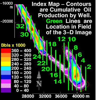
Slide show images north-south-oriented vertical slices are spaced at 500-m (1,524 ft) intervals; spacing is approximate on the above map. Explanation and index map are displayed on images. Color bars list porosity in increments of 1 percent and contours of 40 MBO per well; a barrel of oil is equivalent to 42 U.S. gallons (158.76 liters). Vertical exaggeration of the 3-D porosity model is 60 times.