Data Series 840
The lidar data were acquired at a horizontal spacing (or nominal pulse spacing) of 0.5 meters (m) or less. The USGS conducted two ground surveys in small areas on the Chandeleur Islands on February 5, 2012. DAS calculated a root mean square error (RMSEz) of 0.034 m by comparing the USGS ground survey point data to triangulated irregular network (TIN) models built from the lidar elevation data.
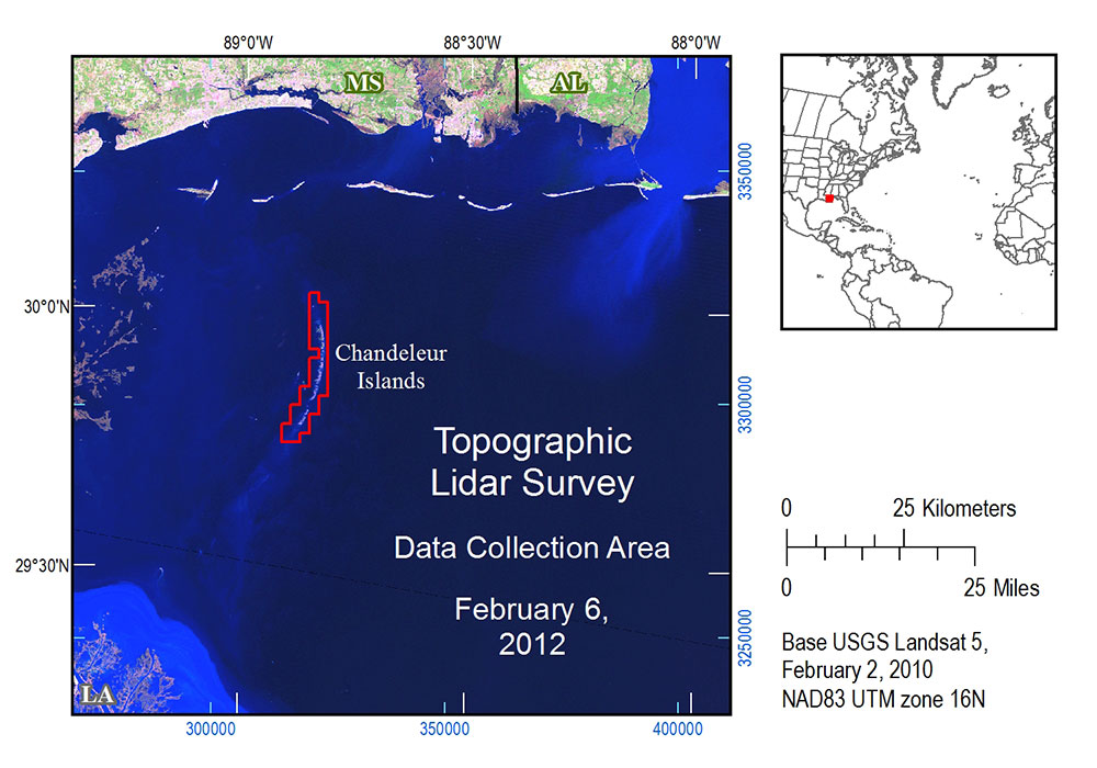
This lidar survey was conducted to document the topography and topographic change of the Chandeleur Islands. The survey supports detailed studies of Louisiana, Mississippi and Alabama barrier islands that resolve annual and episodic changes in beaches, berms and dunes associated with processes driven by storms, sea-level rise, and even human restoration activities. These lidar data are available to Federal, State and local governments, emergency-response officials, resource managers, and the general public.
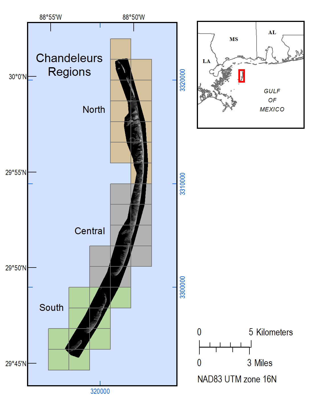
The bare earth DEM and classified LAS files are organized into 2-kilometer (km) square areas called tiles. The Tile Index shapefile and maps locate the tiles by filename.
The DEM and LAS metadata files apply to all the tiles.
The bare earth DEMs can be downloaded in one zipped file containing all tiles or as individual tiles from file directories organized by region. The DEM files are 32-bit floating point IMG files. The classified LAZ (LASzipped LAS files) tiles can be downloaded by regions or as individual tiles from file directories organized by region. The LAS files are version 1.2. The coordinate system for the DEM and LAS files is North American Datum 1983, National Spatial Reference System 2007 (NAD83(2007)), in decimal degrees. The vertical datum for both is North American Vertical Datum 1988, Geoid 2009 (NAVD88, GEOID09). Vertical datum transformation can be made using VDatum. LAZ files can be unzipped using LASzip.
| All DEMs | DEM Individual Tile Directories |
|---|---|
| All DEMs (57 MB .zip) | North Central South |
| LAZ by Region | LAZ Individual Tile Directories |
|---|---|
| North (428 MB) Central (480 MB) South (362 MB) |
North Central South |
The data acquisition was supported by B.J. Reynolds and Phil Thompson from the USGS St. Petersburg Coastal and Marine Science Center (SPCMSC]), who conducted the Chandeleur Islands ground surveys; James M. Duncan (USGS National Geospatial Technical Operations Center) for lidar contracting; Mitch Jordan, Digital Aerial Solutions, LLC for data acquisition and post-processing.
Guy, K.K., Plant, N.G., and Bonisteel-Cormier, J.M., 2014, Topographic lidar survey of the Chandeleur Islands, Louisiana, February 6, 2012: U.S. Geological Survey Data Series 840, 1 p., https://dx.doi.org/10.3133/ds840.
ISSN 2327–638X (online)

![]() U.S. Department of the Interior |
U.S. Geological Survey
U.S. Department of the Interior |
U.S. Geological Survey
URL: http://pubsdata.usgs.gov/pubs/ds/0840/ds840title.html
Page Contact Information: GS Pubs Web Contact
Page Last Modified: Monday, 28-Nov-2016 19:28:11 EST
