Skip Links

USGS - science for a changing world

Data Series 860

Baseline Coastal Oblique Aerial Photographs Collected from Dauphin Island, Alabama, to Breton Island, Louisiana, August 8, 2012

Contents

Skip Links


Home | Abbreviations | Contents | Photos and Maps | Navigation Data | Logs | Metadata | Index


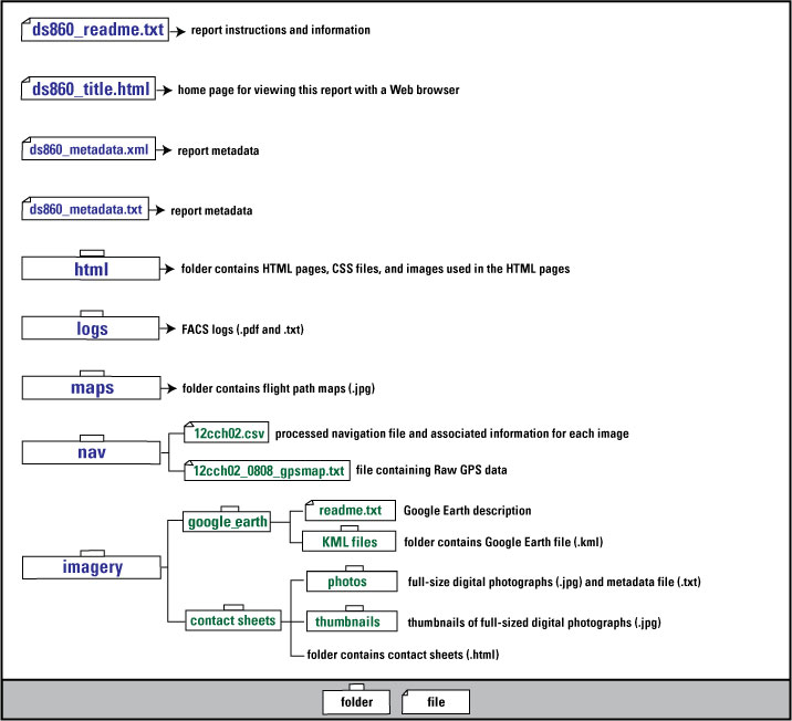
Click on files or folders to view the file or access folder contents.

Disc Contents ds860_readme.txt ds860_title.html ds860_metadata.xml ds860_metadata.txt html folder facs logs folder maps folder navigation folder processed navigation file raw navigation file in Nav folder imagery folder google_earth folder google earth read-me google earth KML folder contactsheets folder contact sheets photos contact sheets thumbnails

NOTE: PDF files may be viewed using free Adobe Reader software. If unable to access the PDF files, please contact Karen L.M. Morgan.


Home | Abbreviations | Contents | Photos and Maps | Navigation Data | Logs | Metadata | Index


Accessibility FOIA Privacy Policies and Notices

Take Pride in America logo USA.gov logo U.S. Department of the Interior | U.S. Geological Survey
URL: http://pubsdata.usgs.gov/pubs/ds/0860/html/ds860_contents.html
Page Contact Information: GS Pubs Web Contact
Page Last Modified: Monday, 28-Nov-2016 19:32:17 EST