Data Series 903
| IntroductionProtecting the mainland Gulf of Mexico shoreline of Mississippi is a series of east-west trending barrier islands. These islands include, from west to east respectively, Cat, West Ship, East Ship, Horn, and Petit Bois Islands. These islands are part of the Gulf Islands National Seashore Mississippi District (fig. 1). These islands play an integral role in protecting the populated mainland from storm surge, maintain salinity gradients within Mississippi Sound, provide habitat for nesting wildlife, and are a popular tourist destination. 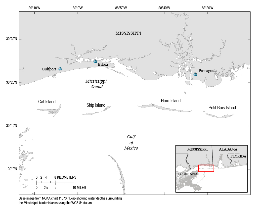 Figure 1. Study location map of the Mississippi barrier island complex, which is part of the Gulf Islands National Seashore (GUIS). [Click to enlarge] Natural processes such as hurricanes and sea-level rise, as well as anthropogenic influences, have greatly modified the shape and extent of the islands. Morton (2007) estimates that since the mid-1800s, Horn Island has lost 24 percent of its land area, while neighboring Ship Island has lost 64 percent. In the past, East and West Ship Islands have been a continuous barrier island with chronic breaching between them. In 1969, Hurricane Camille created the latest breach event between the islands and the breach was further widened by Hurricane Katrina in 2005. The sediment cores collected during USGS cruise 10CCT05 were collected in part to ground truth interpretations from previously collected seismic data. Figure 2 shows how core locations were selected along seismic data tracklines collected from several geophysical surveys completed in the area prior to the 2010 coring cruise (https://pubs.usgs.gov/ds/611/html/location.html). The data from this study provide a better understanding of the land-area change, morphology, habitat, and geology of the Mississippi barrier islands, which is a highly dynamic area controlled by sediment supply, sediment transport, and sea level (Morton, 2007; Otvos and Carter, 2008; Morton and Rogers, 2009). Funding and support for this study were provided by the Northern Gulf of Mexico (NGOM) Ecosystem Change and Hazard Susceptibility project. The primary objectives of this project are to “understand the evolution of coastal ecosystems on the northern gulf coast, the impact of human activities on these ecosystems, and the vulnerability of ecosystems and human communities to more frequent and more intense hurricanes in the future” (http://ngom.usgs.gov/overview/goal.html). Associated geophysical data collected from the Mississippi barrier islands as part of the NGOM project are presented in previously published reports (DeWitt and others, 2011a,b,c; Forde and others, 2011a,b,c,d; Pendleton and others, 2011; and Pfeiffer and others, 2011). Other USGS publications associated with the NGOM project include Morton, 2008; Buster and Morton, 2011; Flocks and others, 2011; and Twichell and others, 2011. 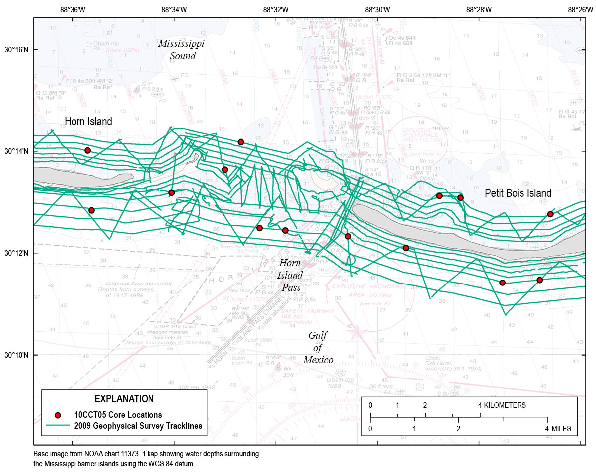 Figure 2. USGS cruise 10CCT05 core sites displayed with previously collected geophysical tracklines along the Mississippi barrier islands. [Click to enlarge] |

![]() U.S. Department of the Interior |
U.S. Geological Survey
U.S. Department of the Interior |
U.S. Geological Survey
URL: http://pubsdata.usgs.gov/pubs/ds/0903/html/ds903_intro.html
Page Contact Information: GS Pubs Web Contact
Page Last Modified: Monday, 28-Nov-2016 20:32:23 EST
