|
Purpose and Project Description
These remotely sensed, geographically referenced elevation measurements of lidar-derived seamless (bare-earth and submerged) topography datasets were produced by the U.S. Geological Survey (USGS), St. Petersburg Coastal and Marine Science Center, St. Petersburg, Florida.
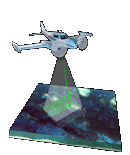
This project provides highly detailed and accurate datasets acquired on August 7 and 8, 2012, for a portion of the Chandeleur Islands, Louisiana. An innovative airborne lidar system, known as the second-generation Experimental Advanced Airborne Research Lidar (EAARL-B), was used during data acquisition. The EAARL-B system is a raster-scanning, waveform-resolving, green-wavelength (532-nanometers) lidar designed to map nearshore bathymetry, topography, and vegetation structure simultaneously. The EAARL-B sensor suite includes the raster-scanning, water-penetrating full-waveform adaptive lidar, down-looking red-green-blue (RGB) and infrared (IR) digital cameras, two precision dual-frequency kinematic carrier-phase Global Positioning System (GPS) receivers, and an integrated miniature digital inertial measurement unit, which provide for sub-meter georeferencing of each laser sample.
Elevation measurements were collected over the survey area by using the EAARL-B system, which was deployed on a twin-engine Cessna 310 aircraft with a single pilot and lidar operator as crew. Thirty-five flightlines were flown over the survey area of approximately 383 square kilometers. The resulting data were then processed using the Airborne Lidar Processing System (ALPS), a custom-built processing system developed originally in a National Aeronautics and Space Administration (NASA)-USGS collaboration. Processing algorithms have been developed to extract the range to the first and last significant return within each waveform. Specialized filtering algorithms have been implemented to determine the "bare earth" under vegetation from a point cloud of last return elevations.
The results of ALPS processing are provided in American Standard Code for Information Interchange (ASCII) XYZ, American Society for Photogrammetry and Remote Sensing (ASPRS) LAS v1.2, and GeoTIFF formats. The data are in the Universal Transverse Mercator 16 North projected coordinate system and are referenced vertically to the North American Vertical Datum of 1988 (GEOID12A) and horizontally to the North American Datum of 1983 (GRS80 ellipsoid). Comparisons to ground-truth observations indicate that the nominal vertical elevation accuracy expressed as the root mean square error (RMSE) is 15 centimeters. The datasets are made available for use as a management tool to research scientists and natural-resource managers.
For more information about similar projects, please visit the Lidar for Science and Resource Management Web site. |