Skip Links

USGS - science for a changing world

Data Series 917

Archive of Sidescan Sonar and Swath Bathymetry Data Collected During USGS Cruise 13CCT04 Offshore of Petit Bois Island, Gulf Islands National Seashore, Mississippi, August 2013

By Nancy T. DeWitt,1 James G. Flocks,1 Jack L. Kindinger,1 Julie C. Bernier,1 Kyle W. Kelso,1 Dana S. Wies,1 Dave P. Finlayson,1 and William R. Pfeiffer2

1U.S. Geological Survey.
2Cherokee Nation Technology Solutions – Tampa, Florida.

Oblique aerial photograph looking west along Petit Bois Island, September, 2012; link to reportAbstract

In August of 2013, the U.S. Geological Survey conducted a geophysical survey offshore of Petit Bois Island, Mississippi. This effort was part of the U.S. Geological Survey Gulf of Mexico Science Coordination partnership with the U.S. Army Corps of Engineers to assist the Mississippi Coastal Improvements Program and the Northern Gulf of Mexico Ecosystem Change and Hazards Susceptibility Project, by mapping the shallow geologic stratigraphic framework of the Mississippi Barrier Island Complex.

This geophysical survey will provide additional data necessary for scientists to define, interpret, and provide baseline bathymetry and seafloor habitat for this area, and to aid scientists in predicting future geomorphological changes of the islands with respect to climate change, storm impact, and sea-level rise. Furthermore, these data will provide information for barrier island restoration, particularly in Camille Cut, and protection for the historical Fort Massachusetts on Ship Island, Mississippi.

The geophysical data were collected during one cruise (USGS Field Activity Numbers 13CCT04) aboard the Research Vessel Tommy Munro offshore along the gulf side of Petit Bois Island, Gulf Islands National Seashore, Mississippi. Data were acquired with the following equipment: a Systems Engineering and Assessment, Ltd., SWATHplus interferometric sonar (468 kilohertz (kHz)), an EdgeTech 424 (4-24 kHz), an EdgeTech 525i chirp subbottom profiling system, and a Klein 3900 sidescan sonar system.

This report serves as an archive of the processed interferometric swath bathymetry and sidescan sonar data. Geographic information system data products include an interpolated digital elevation model, an acoustic backscatter mosaic, trackline maps, and point data files. Additional files include error analysis maps, Field Activity Collection System logs, and formal Federal Geographic Data Committee metadata.

NOTE: These data are scientific in nature and are not to be used for navigation. Any use of trade names is for descriptive purposes only and does not imply endorsement by the U.S. Government.

First posted July 20, 2015

For additional information, contact:
Director, St. Petersburg Coastal and Marine Science Center
U.S. Geological Survey
600 4th Street South
St. Petersburg, FL 33701
(727) 502-8000
http://coastal.er.usgs.gov/

Part or all of this report is presented in Portable Document Format (PDF). For best results viewing and printing PDF documents, it is recommended that you download the documents to your computer and open them with Adobe Reader. PDF documents opened from your browser may not display or print as intended. Download the latest version of Adobe Reader, free of charge.


Suggested citation:

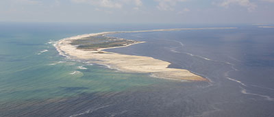
DeWitt, N.T., Flocks, J.G., Kindinger, K,L., Bernier, J.C., Kelso, K.W., Wiese, D.S., Finlayson, D.P., and Pfeiffer, W.R., 2015, Archive of Sidescan Sonar and Swath Bathymetry Data Collected During USGS Cruise 13CCT04 Offshore of Petit Bois Island, Gulf Islands National Seashore, Mississippi, August 2013: U.S. Geological Survey Data Series Report 917, 1 DVD, https://dx.doi.org/10.3133/ds917.

ISSN 2327-638X (online)


Contents

Abstract

Introduction

Survey Overview and Acquisition

Data Processing

Error Analysis

Survey Products

Data Downloads

Logs

Acronyms

References


Accessibility FOIA Privacy Policies and Notices

Take Pride in America logo USA.gov logo U.S. Department of the Interior | U.S. Geological Survey
URL: http://pubsdata.usgs.gov/pubs/ds/0917/index.html
Page Contact Information: GS Pubs Web Contact
Page Last Modified: Monday, 28-Nov-2016 20:36:11 EST