Data Series 945
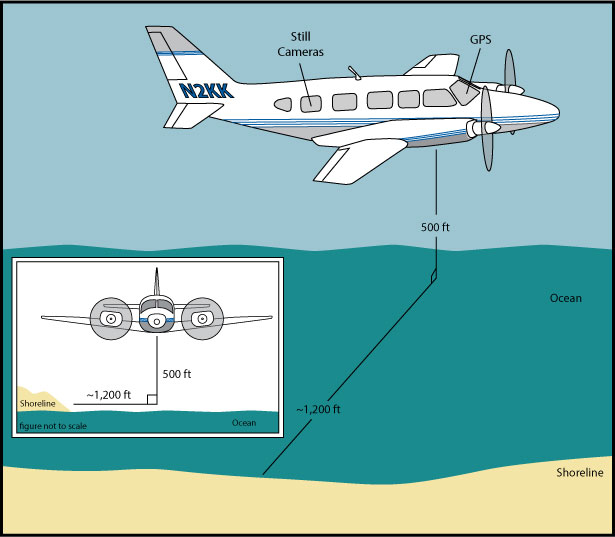 |
Figure 2. Acquisition Geometry. The aircraft was flown at a constant altitude of 500 feet (ft) and about 1,000 ft offshore. Best attempts were made to keep the same relative distance between the aircraft and the shoreline in order to keep a constant field of view. |

![]() U.S. Department of the Interior |
U.S. Geological Survey
U.S. Department of the Interior |
U.S. Geological Survey
URL: http://pubsdata.usgs.gov/pubs/ds/0945/html/ds945_fig2.html
Page Contact Information: GS Pubs Web Contact
Page Last Modified: Monday, 28-Nov-2016 20:36:56 EST
