Skip Links

USGS - science for a changing world

Data Series 946

Ocean City, Maryland, Inset Map


Home | Abbreviations | Contents | Photos and Maps | Navigation Data | Logs | Metadata | Index


Click on a segment name to view the contact sheet.

Ocean City, Maryland, Inset Map ds946_2009_0521_174000g.html ds946_2009_0521_174500.html ds946_2009_0521_175000.html
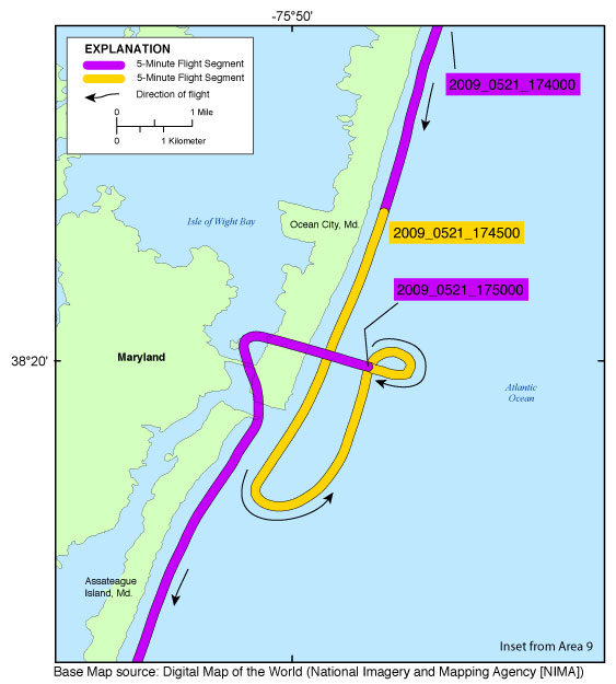
Figure 8. Ocean City, Maryland, Inset Map (Area 9). Map showing the flight path of the coastal oblique aerial survey from Ocean City, Maryland, through the north end of Assateague Island, Maryland, on May 21, 2009. Purple and yellow colored lines correspond to 5-minute flight segments that link to contact sheets of associated photo thumbnails. Click on the 5-minute segment name to view each contact sheet.


Full Survey Area | 09ACH01 - Area 1 | 09ACH01 - Area 2 | 09ACH01 - Area 3 | 09ACH01 - Area 4 | 09ACH01 - Area 5 | 09ACH01 - Area 6 | 09ACH01 - Area 7 | 09ACH01 - Area 8 | 09ACH01 - Area 9 | 09ACH01 - Area 10 | 09ACH01 - Area 11

Cape Elizabeth Area Inset Map | Chatham Inset Map | Cupsoque Inset Map | Ocean City, New Jersey, Inset Map | Ocean City, Maryland, Inset Map

Home | Abbreviations | Contents | Photos and Maps | Navigation Data | Logs | Metadata | Index

Accessibility FOIA Privacy Policies and Notices

Take Pride in America logo USA.gov logo U.S. Department of the Interior | U.S. Geological Survey
URL: http://pubsdata.usgs.gov/pubs/ds/0946/html/ds946_inset8_oceancitymd.html
Page Contact Information: GS Pubs Web Contact
Page Last Modified: Monday, 28-Nov-2016 20:37:55 EST