USGS - science for a changing world

Data Series 960


Back-Island and Open-Ocean Shorelines, and Sand Areas of the Undeveloped Areas of New Jersey Barrier Islands, March 9, 1991, to July 30, 2013

Skip Links

Citation Page
Abstract
Data Processing
Data Downloads
Abbreviations
Acknowledgments
References
 

Data Downloads

All metadata are included with all downloads.

Map showing the location of six study areas
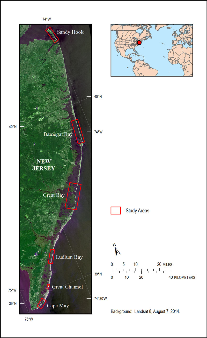
Figure 2. Map showing the location of six study areas. They are Sandy Hook, Barnegat Bay, Great Bay, Ludlum Bay, Great Channel and Cape May. [larger version]

Sandy Hook sandy_hook.zip (2.6 MB)

Barnegat Bay

barnegat_bay.zip (2.4 MB)
Great Bay great_bay.zip (3.1 MB)

Ludlum Bay

ludlum_bay.zip (1.3 MB)

Great Channel

great_channel.zip (493 KB)

Cape May

cape_may.zip (1 MB)
Base Lines and Transects baselines_transects.zip (154 KB)

Accessibility FOIA Privacy Policies and Notices

Take Pride in America logo USA.gov logo U.S. Department of the Interior | U.S. Geological Survey
URL: http://pubsdata.usgs.gov/pubs/ds/0960/ds960_data-products.html
Page Contact Information: GS Pubs Web Contact
Page Last Modified: Monday, 28-Nov-2016 20:44:11 EST