Data Series 979
Click on a segment name to view the contact sheet.
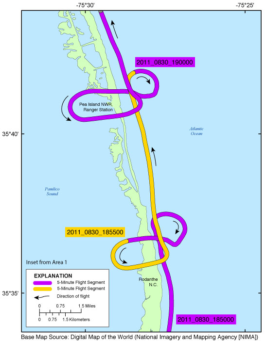
| Figure 4. Rodanthe and Pea Island National Wildlife Refuge (NWR) inset map (Area 1). Map showing the flight path of the post-Hurricane Irene coastal oblique aerial survey from the ranger station in the Pea Island National Wildlife Refuge, North Carolina, to Rodanthe, North Carolina, on August 30, 2011. Purple and yellow lines correspond to 5-minute flight segments that link to contact sheets of associated photo thumbnails. Click on the 5-minute segment name to view each contact sheet. |

![]() U.S. Department of the Interior |
U.S. Geological Survey
U.S. Department of the Interior |
U.S. Geological Survey
URL: http://pubsdata.usgs.gov/pubs/ds/0979/html/ds979_inset04_rodanthepeaisl.html
Page Contact Information: GS Pubs Web Contact
Page Last Modified: Monday, 28-Nov-2016 20:44:26 EST
