Data Series 988
Click on a segment name to view the contact sheet.
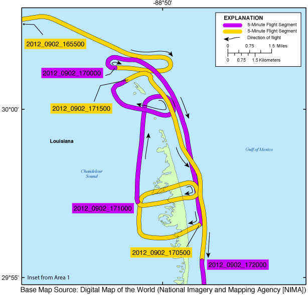
| Figure 4. Northern benchmark inset map (Area 1). Map showing the flight path of the post-Hurricane Isaac coastal oblique aerial survey of the northern benchmark, Chandeleur Islands, Louisiana, on September 2, 2012. Purple and yellow lines correspond to 5-minute flight segments that link to contact sheets of associated photo thumbnails. Click on the 5-minute segment name to view each contact sheet. |

![]() U.S. Department of the Interior |
U.S. Geological Survey
U.S. Department of the Interior |
U.S. Geological Survey
URL: http://pubsdata.usgs.gov/pubs/ds/0988/html/ds988_inset04_northbenchmark.html
Page Contact Information: GS Pubs Web Contact
Page Last Modified: Monday, 28-Nov-2016 20:45:46 EST
