Data Series 993
| IntroductionLagoonal estuaries and adjacent wetlands play a critical role in determining the response and resiliency of coastal systems and communities to extreme storm impacts. Understanding sediment fluxes and transport, geomorphic changes, hydrodynamics, and wetland stability are key to assessing the impact on estuarine health and the vulnerability of adjacent wetlands. The stratigraphic record provides a temporal history of responses in the natural system and can guide the modern-day understanding of recovery processes and long-term sustainability. Hurricane Sandy traveled from the Caribbean along the U.S. eastern seaboard before making landfall on October 29, 2012, as an extratropical cyclone near Brigantine, New Jersey, with sustained winds of 130 kilometers per hour. The winds, storm surge, and waves caused considerable damage to the infrastructure on the barrier island system and the mainland surrounding Barnegat Bay, as well as severe dune erosion along the shore (Sopkin and others, 2014). This project is a component of the U.S. Geological Survey (USGS) science plan developed immediately following Hurricane Sandy, to guide scientific investigation that will support recovery and restoration efforts (Buxton and others, 2013). Scientists at the USGS St. Petersburg Coastal and Marine Science Center (SPCMSC) and the USGS Woods Hole Coastal and Marine Science Center (WHCMSC) developed a multidisciplinary study of sediment transport and hydrodynamics to understand the mechanisms that govern estuarine and wetland responses to storm forcing. Barnegat Bay is a shallow, brackish estuary located along the central coast of New Jersey (fig. 1). The long, narrow bay extends 67 kilometers from Bay Head southward to Little Egg Harbor and is 6.5 kilometers at its widest point. The average water depth of the bay is 1.5 meters, in general, shallowest in the eastern portion and deepening toward the mainland. The shoreline of the bay is bound to the east by the Island Beach peninsula and Long Beach barrier island, with extensive segments of both barrier systems heavily developed for commercial and residential use. Three inlets connect the bay to the Atlantic Ocean, Manasquan Inlet (via the Point Pleasant Canal), Barnegat Inlet, and Little Egg Inlet. Salt marshes, freshwater marshes, and forested wetlands, as well as numerous coastal communities, border the bay along the mainland to the west. Several tributary streams discharge freshwater directly into the bay, including Toms River, Forked River, Oyster Creek, Cedar Creek, and Mill Creek. This study focused on two micro-tidal basins within Barnegat Bay, one to the west of Barnegat Inlet and Little Egg Harbor to the south. The sampling location selection was based on a combination of geophysical data collected before and after Hurricane Sandy (Andrews and others, 2015) and model simulations run for fair-weather and hurricane conditions (Defne and Ganju, 2015; Defne and others, 2016) that showed contrasting particle residence times for the two sub-bays (fig. 2). Time-lapsed geophysical data showed slight coarsening of sediments in the bay following Hurricane Sandy, especially around inlets. Model data showed a strong contrast in particle residence times near Barnegat Inlet (a day or less) and Little Egg Harbor (several days) despite both being influenced by astronomical tides. The purpose of this study was sediment core collection and physical and chemical characteristics analyses including Be-7, Pb-210, bulk density, porosity, x-radiographs, and grain-size distribution. These data will provide maps of (1) sediment surface grain-size distribution and vertical changes in distribution with sediment depth, (2) temporal changes in sediment characteristics defined by geochronology, and (3) sediment erodibility and mobility based on field measurements and grain size. These data will serve as a critical baseline dataset for understanding the current sedimentological regime and can be applied to future storm datasets to contribute to the understanding of estuarine and wetland evolution. Additionally, the new datasets and maps will have long-term benefits for the future management of coastal systems and associated resources and infrastructure. The analytical results can be downloaded from the data downloads page. 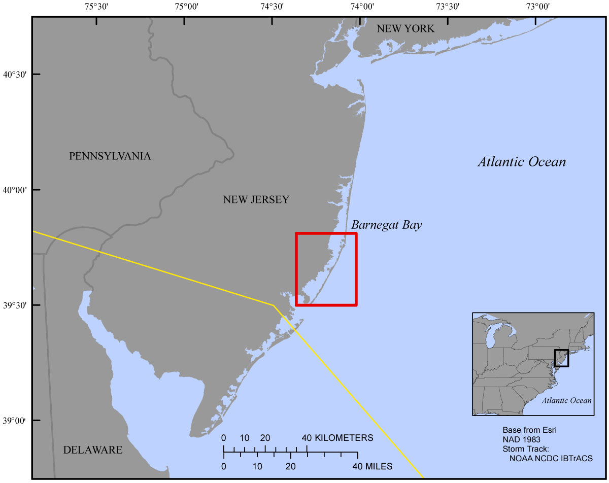 Figure 1. Regional map showing the location of Barnegat Bay along the eastern shore of New Jersey. The extent of the study area is indicated by the red box. The storm track is indicated by the yellow line (Knapp and others, 2010). [Click to enlarge]
|

![]() U.S. Department of the Interior |
U.S. Geological Survey
U.S. Department of the Interior |
U.S. Geological Survey
URL: http://pubsdata.usgs.gov/pubs/ds/0993/ds993_intro.html
Page Contact Information: GS Pubs Web Contact
Page Last Modified: Monday, 28-Nov-2016 20:50:10 EST
