Data Series 1034
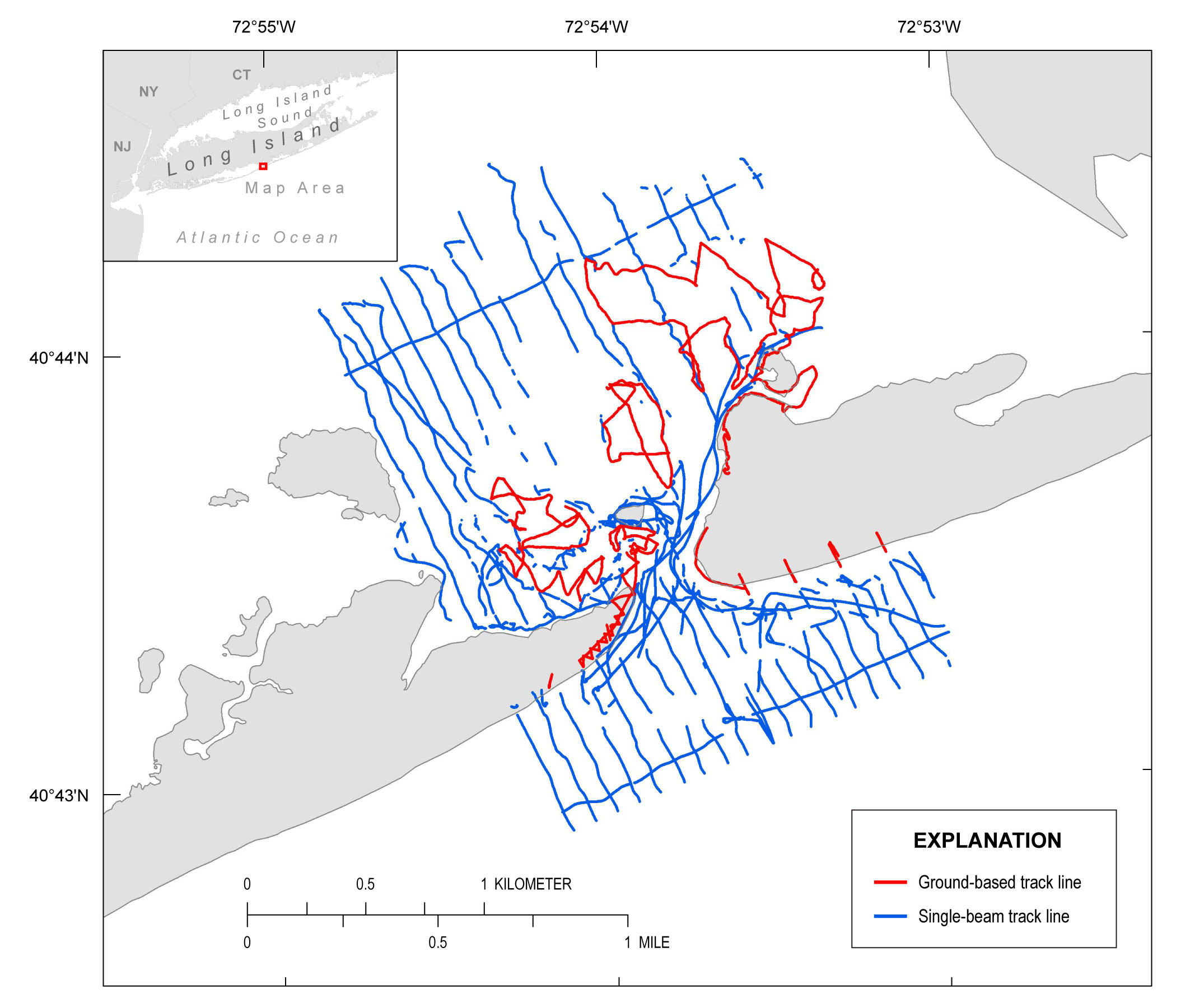
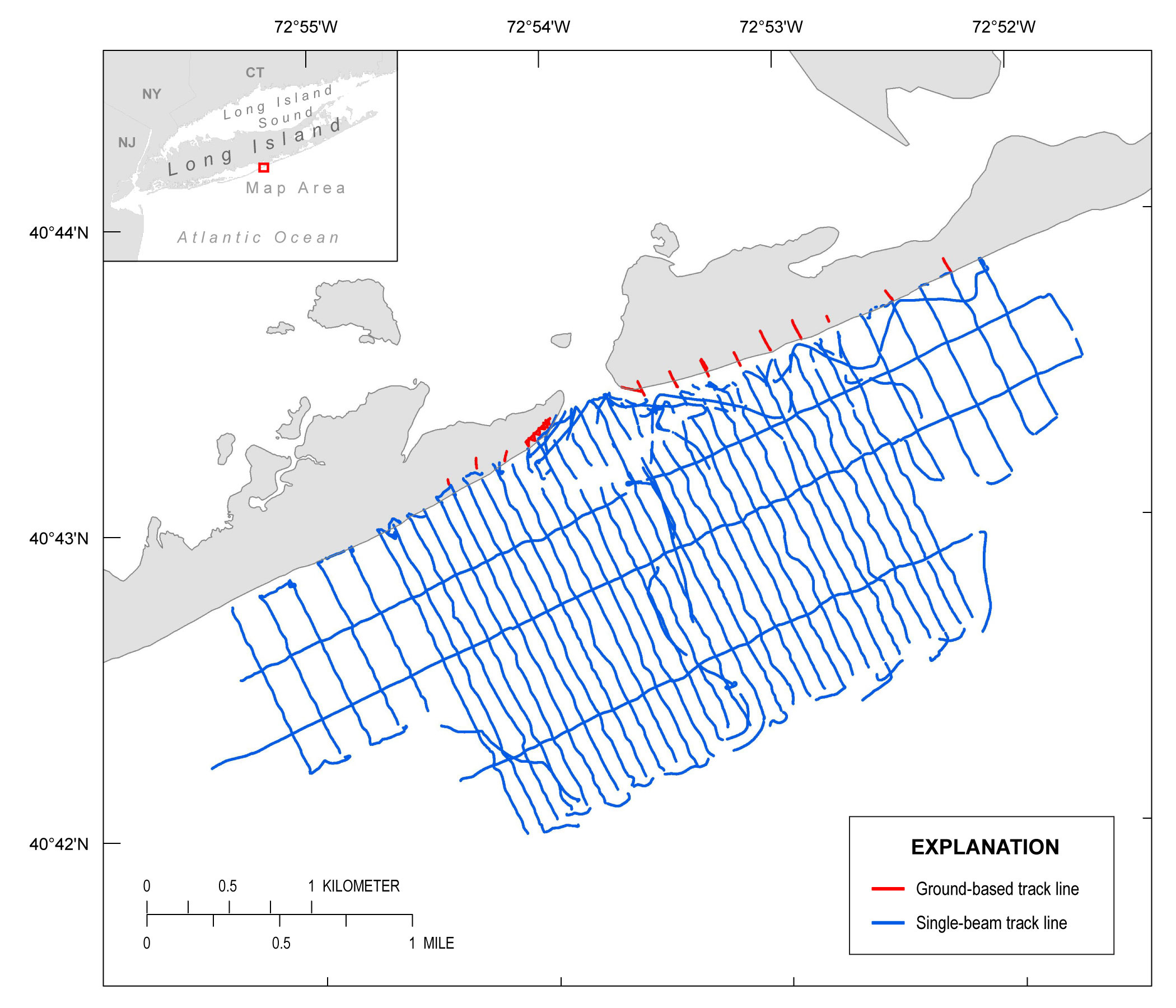
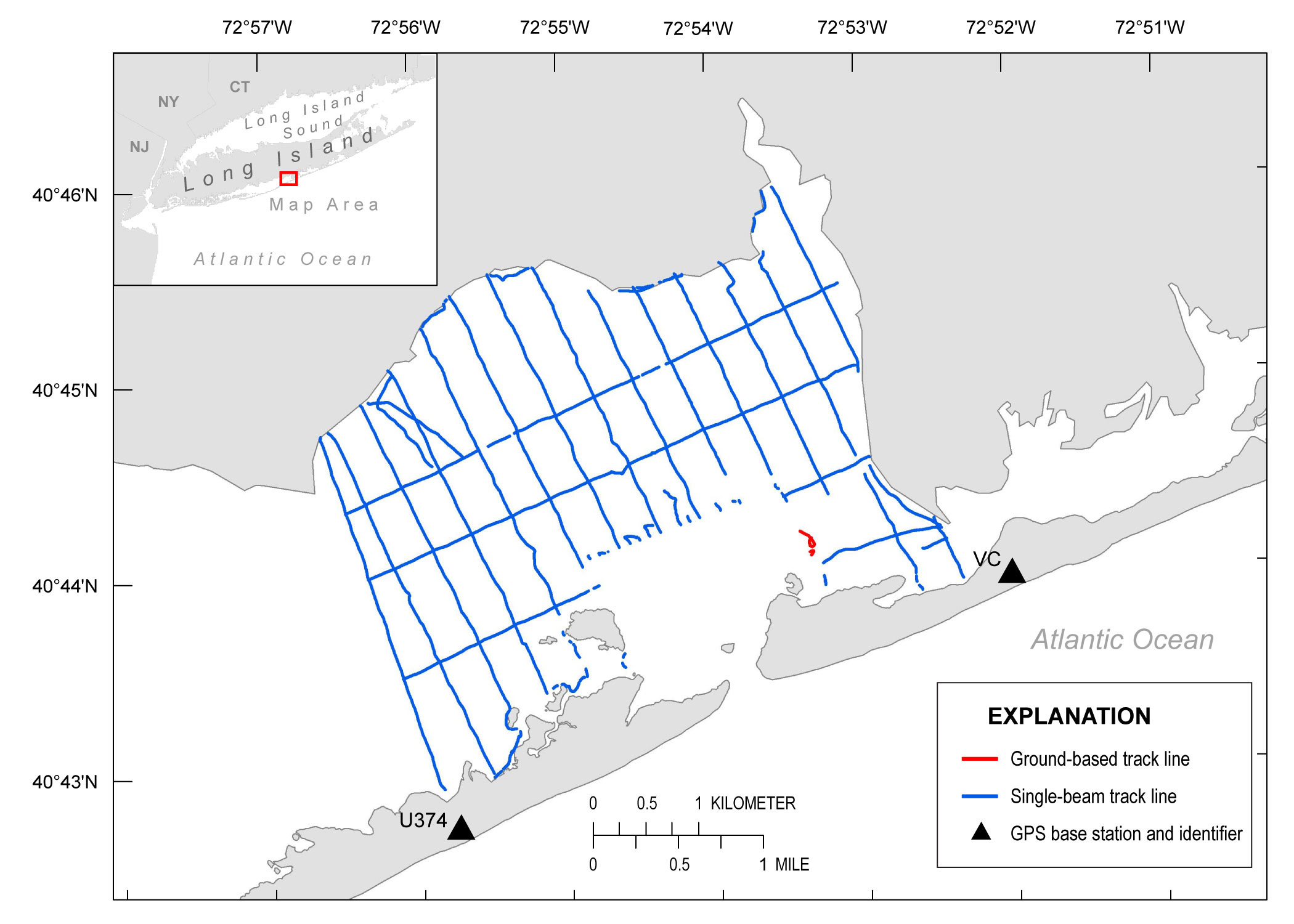
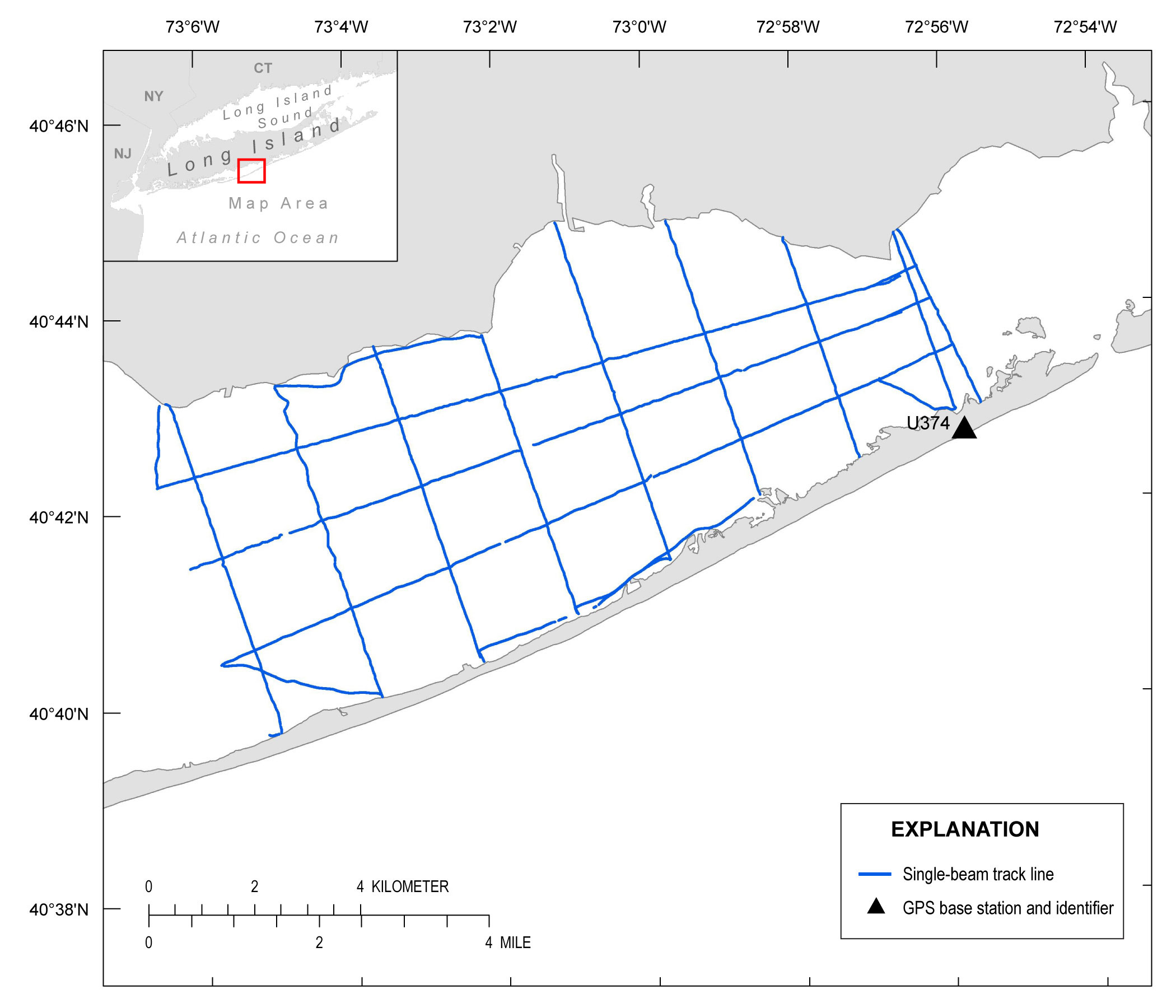
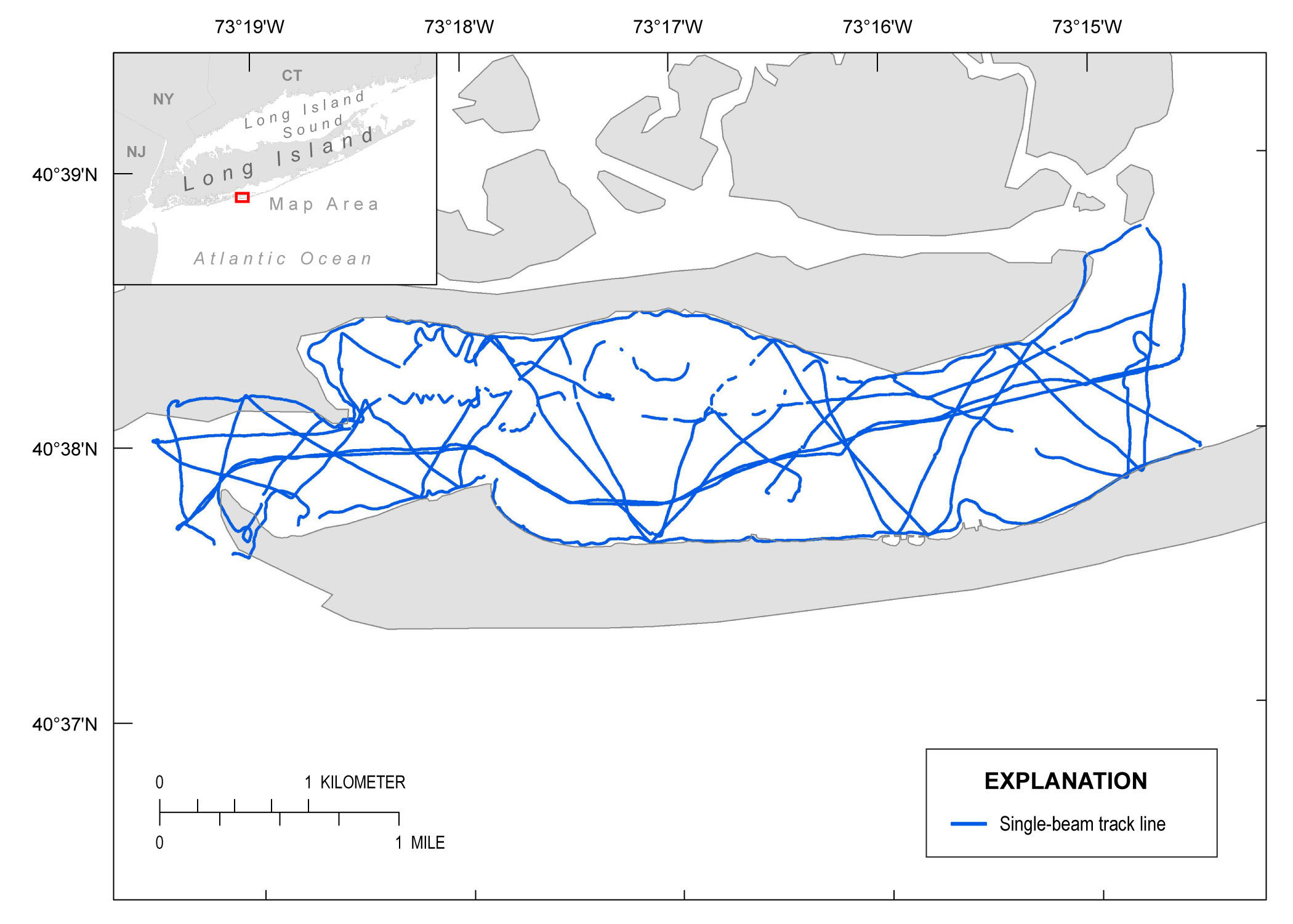
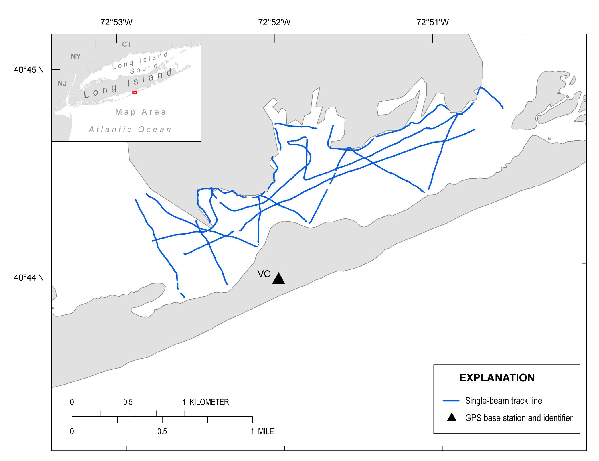
| Survey OverviewShore-perpendicular transects were surveyed within Great South Bay, Bellport Bay, the wilderness breach, and on the shoreface using single-beam echosounders and global positioning systems (GPS) mounted on two personal watercraft (PWC). Transects within the wilderness breach are spaced 100 meters (m) apart and extend 1.8 kilometers (km) into the bay (fig. 3). Transects on the shoreface are spaced 100 m apart, extending 1.5 km eastward and westward from the wilderness breach and 2 km seaward from the pre-Hurricane Sandy shoreline. Between 1.5 and 2.5 km from the wilderness breach, the shoreface transects are spaced 200 m apart and extend 1 km seaward (fig. 4). Transects within Bellport Bay (fig. 5) and Great South Bay (fig. 6) extend from the southern shore of Long Island to the bay side of Fire Island and are spaced 400 m apart in Bellport Bay and 2 km apart in Great South Bay. Three shore-parallel lines cross each transect within the bays and on the shoreface. Operators did not follow transects in Fire Island Inlet (fig. 7) and Narrow Bay (fig. 8) because of variations in water depth and channel positions; however, they surveyed as much of the area as possible. A backpack GPS was used to collect elevation data on subaerial and shallow flood shoals where the PWCs were unable to survey near the wilderness breach (figs. 3–5). Elevations of the wilderness breach shorelines and beach profiles were collected using a wheel-mounted GPS (figs. 3–4).
|

![]() U.S. Department of the Interior |
U.S. Geological Survey
U.S. Department of the Interior |
U.S. Geological Survey
URL: http://pubsdata.usgs.gov/pubs/ds/1034/ds1034_overview.html
Page Contact Information: GS Pubs Web Contact
Page Last Modified: Wednesday, 22-Mar-2017 08:28:08 EDT