Data Series 1059
| Introduction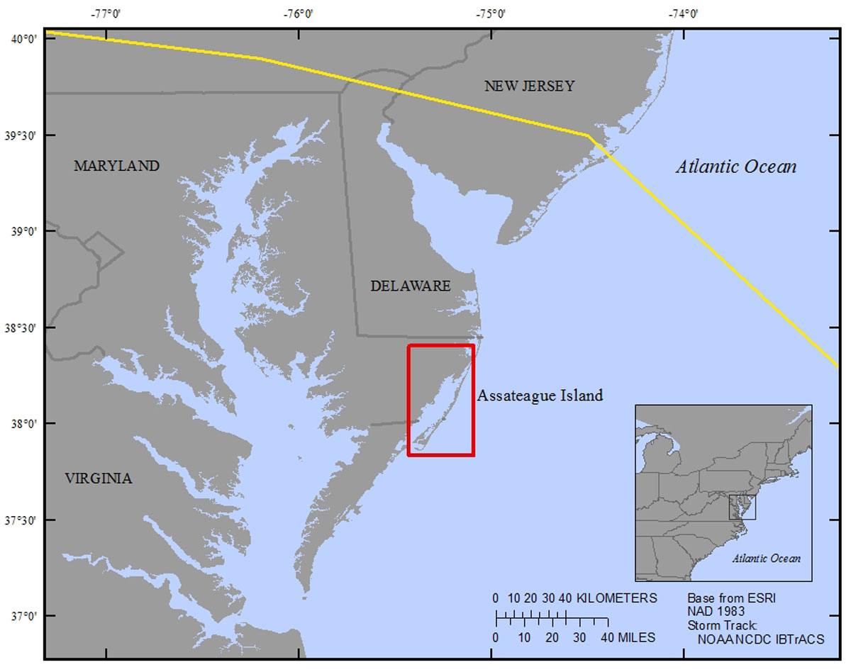 Figure 1. Regional map showing the location of Assateague Island along the east coast of the United States and the extent of the study area (indicated by the red box). Hurricane Sandy’s storm track is indicated by the yellow line (Knapp and others, 2010). [Click to enlarge] Scientists from the U.S. Geological Survey (USGS), St. Petersburg Coastal and Marine Science Center (SPCMSC) conducted a seasonal collection of estuarine, overwash, and marsh surface sediments from Chincoteague Bay, Tom’s Cove, and the surrounding Assateague Island and Delmarva Peninsula in the spring (March–April) and fall (October) of 2014 after Hurricane Sandy. The sediment sampling efforts were part of a larger USGS study (Barrier Island and Estuarine Wetland Physical Change Assessment) to create a baseline of the sediment distribution patterns in the bay and the provenance of the materials (Ellis and others, 2015), as well as understand the long-term geologic processes occurring on and around Assateague Island and the mainland marshes of the Delmarva Peninsula and provide ground-truth measurements for remote sensing analysis (Smith and others, 2015). The deliverables associated with the cited USGS Open File Reports (OFRs) include site information, water quality parameters, sediment parameters (bulk density, water content, loss on ignition (LOI)), grain-size parameters, associated shear stresses, x-radiographs of marsh cores, photographs of peat augers, and alpha spectroscopy data. In addition to the above deliverables, surplus material from the sediment parameters split was analyzed for metals, percent carbon and nitrogen, δ13C, and δ15N as part of a complementary USGS Coastal and Marine Geology Program (CMGP) Sea-level and Storm Impacts on Estuarine Environments and Shorelines (SSIEES) project. The geochemical subsample analyzed for metals and stable carbon and nitrogen isotopes at each site can be used for comparison with past data sets (Wells and others, 1998; Wells and others, 2003), to create a modern baseline of the natural distribution of the area, to understand the seasonal variability as it relates to the health of the local environment, and marsh-to-bay interactions. The use of multiple proxies such as metals, stable carbon and nitrogen isotopes, and grain-size, allows for a more cohesive snapshot of factors influencing the environment and could aid in tracking environmental change. |

![]() U.S. Department of the Interior |
U.S. Geological Survey
U.S. Department of the Interior |
U.S. Geological Survey
URL: http://pubsdata.usgs.gov/pubs/ds/1059/ds1059_intro.html
Page Contact Information: GS Pubs Web Contact
Page Last Modified: Wednesday, 01-Nov-2017 12:11:03 EDT
