Data Series 1077
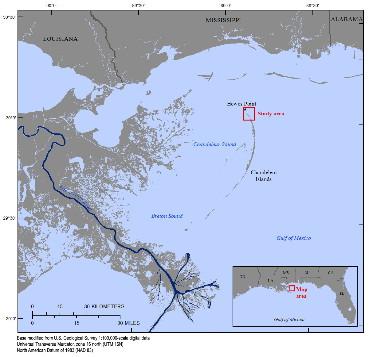
| IntroductionThe Chandeleur Islands are a chain of barrier islands measuring approximately 80 kilometers (km) in length and located about 40 km east of the Louisiana mainland. Water bodies surrounding the barrier islands include Chandeleur and Breton Sounds to the west-southwest, and the Gulf of Mexico to the north and east (fig. 1). These barrier islands offer storm protection for threatened wetlands, marshes, and coastal cities and reduce the effects of hurricane-related storm surge on humans and wildlife residing in coastal Louisiana. These barrier islands formed through the subsidence, erosion, and reworking of the deltaic headland of the former St. Bernard Delta complex, which was abandoned about 1,800 to 2,000 years ago. In recent decades, the combined effects of reduced sediment supply, frequent storms, and relative sea-level rise have contributed to land loss along the Chandeleur Islands at rates that are among the highest for northern Gulf of Mexico barrier islands (Bernier and others, 2017). High-resolution geophysical data in the form of interferometric swath bathymetry (Fredericks and others, 2016) and subbottom profiles (Forde and others, 2018) were collected around the northern Chandeleur Islands by U.S. Geological Survey (USGS) scientists from September 14 to 28, 2015, as part of the Barrier Island Evolution Research (BIER) project. The objective of the BIER project is to improve the understanding of depositional and erosional processes that drive the morphologic evolution of barrier islands across annual to interannual time scales (1 to 5 years) (Plant and others, 2014). This multidisciplinary study addresses a research gap between the very short time scale (hours to days) of storm-induced coastal change and the longer time scales (decades to millennia) associated with the historic and geologic evolution of the coastal system. The Geologic Analysis subtask seeks to understand geologic variability (changes in stratigraphy, modern sediment distribution and composition, and morphology), which has long been associated with barrier island evolution over centennial and millennial time scales. The relative importance of geologic variability over shorter time scales (days to years), however, remains poorly understood. To address medium-term relations between geologic variability and storm and non-storm processes, high-resolution information from highly dynamic nearshore, surf zone, and backbarrier areas must be obtained, and observed geologic variability must be suitably parameterized for integration with predictive models. Quantifying changes in morphology and sediment distribution over short time scales can demonstrate how geologic variability influences medium-term barrier island response and near-term barrier island trajectories and can help to refine sedimentological boundary conditions for morphologic evolution models. Project objectives that are directly applicable to this geophysical survey are as follows:
|

![]() U.S. Department of the Interior |
U.S. Geological Survey
U.S. Department of the Interior |
U.S. Geological Survey
URL: http://pubsdata.usgs.gov/pubs/ds/1077/ds1077_intro.html
Page Contact Information: GS Pubs Web Contact
Page Last Modified: Thursday, 01-Feb-2018 08:58:47 EST