Skip header
 Identifier symbol and link to USGS Home page

U.S. Geological Survey Data Series 118, usSEABED: Atlantic Coast Offshore Surficial Sediment Data Release, version 1.0 Skip navigational side bar

Home | Contents | Site Map | Introduction | usSEABED | dbSEABED | Data Catalog | References Cited | Contacts | Acknowledgments | Frequently Asked Questions


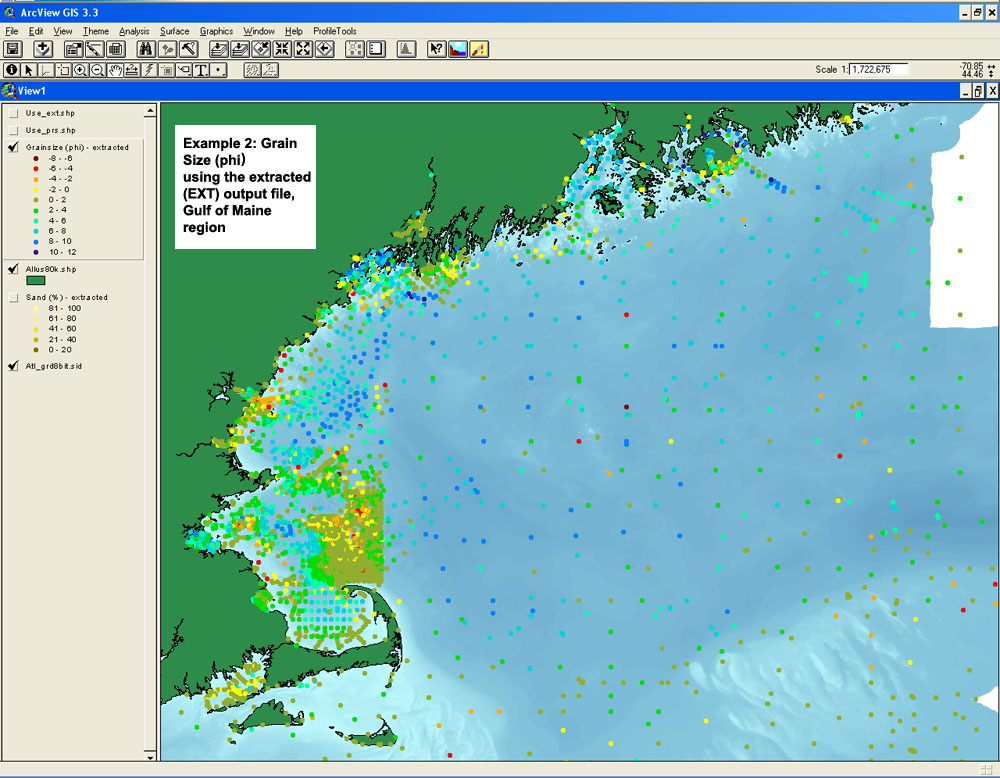
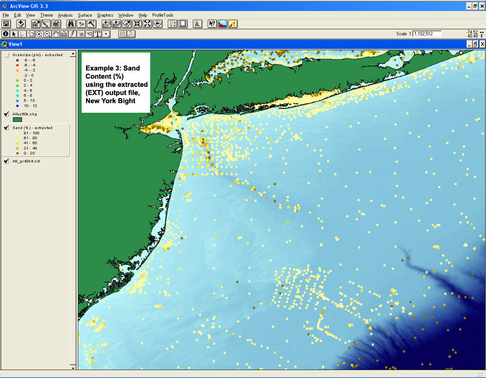
The following three images show just a few ways in which the data can be displayed within a GIS:

Click on each for a larger image.

Example 1. Munsell color using the extracted and parsed outputs, east coast, Florida.
Example 1. Munsell color using the extracted (EXT) and parsed (PRS) outputs, east coast, Florida.

Example 2. Grain size (phi) using the extracted (EXT) output file, Gulf of Maine region.

Example 3. Sand content (%) using the extracted (EXT) output file, New York Bight.
Example 3. Sand content using the extracted output file, New York Bight.


Skip Footer Information

Home | Contents | Site Map | Introduction | usSEABED | dbSEABED | Data Catalog | References Cited | Contacts | Acknowledgments | Frequently Asked Questions


[an error occurred while processing this directive]