Link to USGS home page.
Data Series 138: On-line Report

Nebraska, Kansas, and Oklahoma Aeromagnetic and Gravity Maps and Data: A Web Site for Distribution of Data

by

Ronald E. Sweeney and Patricia L. Hill

Data Series 138

2005


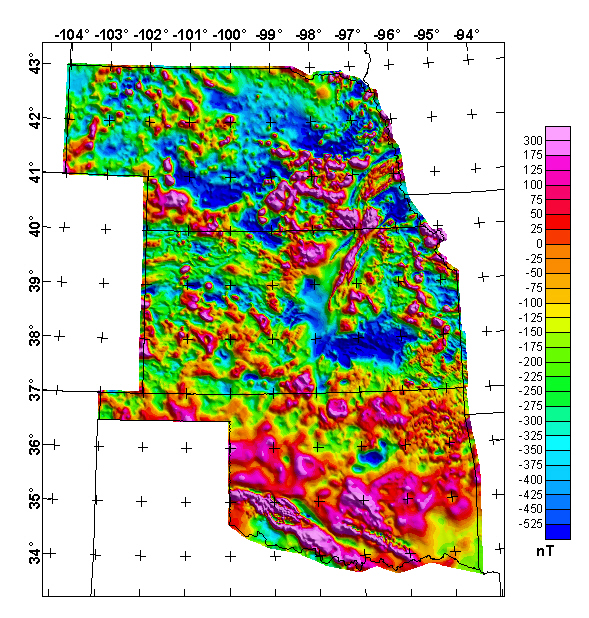
Nebraska, Kansas, and Oklahoma Merged Aeromagnetic Anomaly Map (NE. illumination), Continued to 1,000 ft above ground.

Nebraska, Kansas, & Oklahoma Composite Aeromagnetic Map 1000 Ft Above Ground
The grids for this map in two formats are available from the data directory as neksok_final.***

See detailed magnetic surveys Read processing details See the magnetic survey index map See Bouguer gravity map See isostatic gravity map Download gridded data Read project description

Any use of trade, product, or firm names in this publication is for descriptive purposes only and does not imply endorsement by the U.S. Government.


Top || NE, KS, & OK Mag || References

For additional information contact:

Team Chief Scientist,
USGS Crustal Imaging and Characterization
Box 25046, Mail Stop 964
Denver, CO 80225

http://crustal.usgs.gov/