Data Series 119
Area G Map
Home | Acronyms | Contents | Navigation | Profiles | Logs | Metadata | Software
Click on a trackline name to view the interactive profile image, MAP to
view the line navigation map, or PRINT to view the printable profile image.
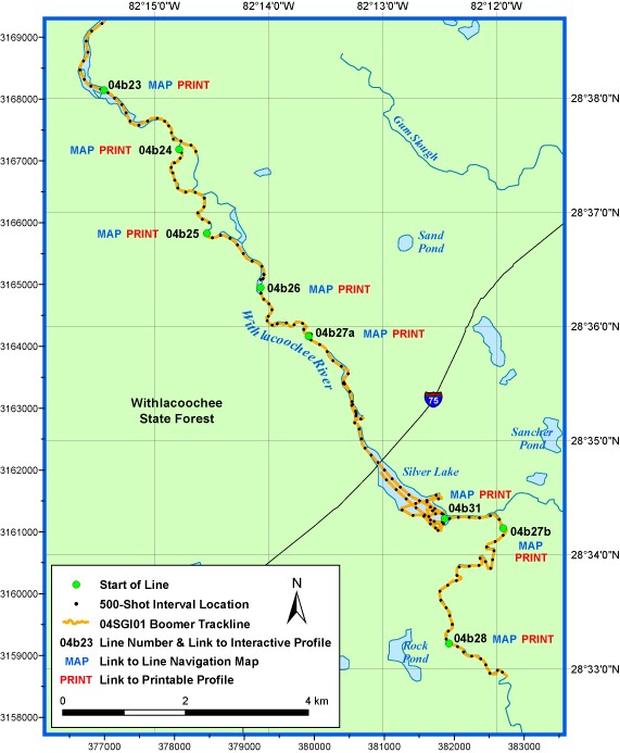
Full Survey Area | Area A | Area B | Area C | Area D | Area E | Area F | Area G | Area H
Home | Acronyms | Contents | Navigation | Profiles | Logs | Metadata | Software

![]() U.S. Department of the Interior |
U.S. Geological Survey
U.S. Department of the Interior |
U.S. Geological Survey
URL: https://pubsdata.usgs.gov/pubs/ds/2007/119/html/area_g.html
Page Contact Information: Publishing Services
Page Last Modified: Monday, 28-Nov-2016 12:21:47 EST
