Data Series 355
Oregon Composite Magnetic Anomaly Map (NE illumination) at simulated flight altitude of 305 m (1,000 ft) above ground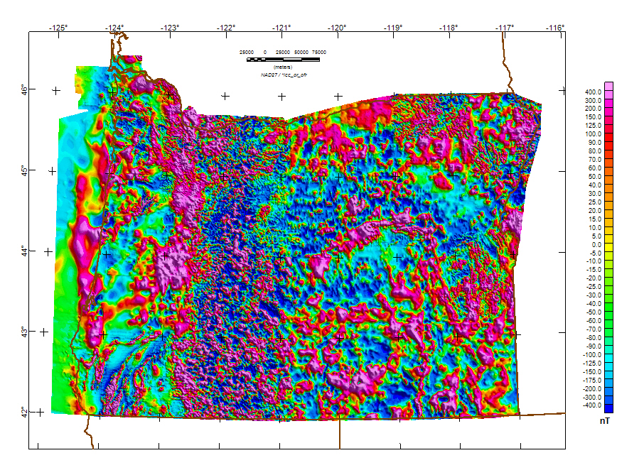
The grid for this map is available from the data directory as magor.grd |
Version 1.0 Posted August 2008
Contains: gridded data. Refer to the Readme file for more information.
For additional information about this report, contact: Bob Kucks |

![]() U.S. Department of the Interior | U.S. Geological Survey
U.S. Department of the Interior | U.S. Geological Survey
URL: http://pubsdata.usgs.gov/pubs/ds/355/oregon.htm
Questions or Assistance: Contact USGS
Last modified: Monday, 28-Nov-2016 13:03:28 EST
