Data Series 391
|
|
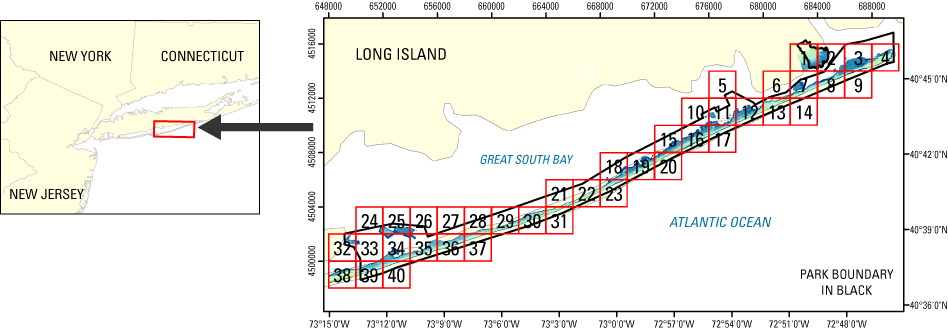
EAARL Coastal Topography–Fire Island National Seashore 2007Amar Nayegandhi,1 John C. Brock,2 C. Wayne Wright,3 Sara Stevens,4 Xan Yates,1 and Jamie M. Bonisteel1 1Jacobs Technology Inc., St. Petersburg, FL; 2U.S. Geological Survey, Coastal and Marine Geology Program, Reston, VA; 3U.S. Geological Survey, Florida Integrated Science Center, St. Petersburg, FL; 4National Park Service, Northeast Coastal and Barrier Network, Kingston, RI This DVD contains Lidar-derived first surface (FS) and bare earth (BE) topography GIS datasets of Fire Island National Seashore in New York. These datasets were acquired on April 29-30 and May 15-16, 2007. Click on a tile number (1-40) to view the corresponding images and links to each data directory.
|

![]() U.S. Department of the
Interior | U.S. Geological Survey
U.S. Department of the
Interior | U.S. Geological Survey
URL: https://pubsdata.usgs.gov/pubs/ds/391/index.html
Page Contact Information: Feedback
Maintained by: Publishing Service Center
Page Last Modified: Monday, 28-Nov-2016 13:13:50 EST