Data Series 395
|
|
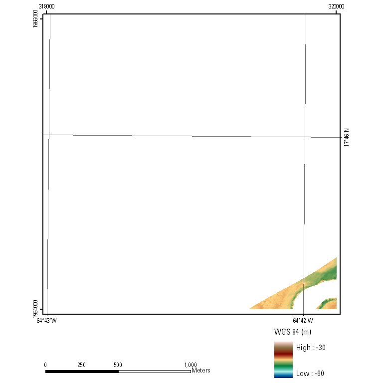
EAARL Submerged Topography–U.S. Virgin Islands 2003UTM Tile e318_n1966_20
PLEASE NOTE: GeoTIFF files can only be viewed using software capable of reading georeferenced 32-bit floating point format imagery, such as Global Mapper or ESRI ArcMap, and must use the WGS84 UTM Zone 20 projection. |

![]() U.S. Department of the
Interior | U.S. Geological Survey
U.S. Department of the
Interior | U.S. Geological Survey
URL:
Page Contact Information: Feedback
Page Last Modified: