Data Series 406

LIDAR Illustration

Home Link

Purpose Link

Metadata Link

Collaborators

Acronyms Link

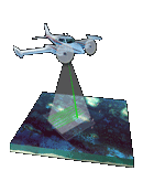
EAARL Coastal Topography–St. John, U.S. Virgin Islands 2003: First Surface


Collaborators


Funding for this project was provided by the U.S. Geological Survey - Coastal and Marine Geology Program and by the NPS - Inventory and Monitoring Program's South Florida-Caribbean Network.


U.S. Geological Survey Logo and Link

U.S. Geological Survey

Center for Coastal and Watershed Studies

FISC: Florida Integrated Science Center


National Park Service Logo and Link

National Park Service

Inventory and Monitoring Program

South Florida-Caribbean Network


NASA Cooperator Logo and Link

National Aeronautics and Space Administration

Wallops Flight Facility

EAARL: Experimental Advanced Airborne Research Lidar


Accessibility FOIA Privacy Policies and Notices

Take Pride in America home page USA Gov LinkU.S. Department of the Interior | U.S. Geological Survey
URL: pubsdata.usgs.gov /pubs/ds/406/html/collaborators.html
Page Contact Information: Feedback
Page Last Modified: Monday, 28-Nov-2016 14:16:31 EST