U.S. Geological Survey Data Series 582
1U.S. Geological Survey, St. Petersburg, FL 33701.
2U.S. Geological Survey, Tampa, FL 33612.
3St. Johns River Water Management District, Palatka, FL 32178.
U.S. Department of the Interior
U.S. Geological Survey
St. Petersburg Coastal and Marine Science Center
Publications are available from USGS Information Services, Box 25286, Federal Center, Denver, CO 80225-0046 (telephone 1-888-ASK-USGS; e-mail: infoservices@usgs.gov).
Page Contents: |
||||
 |
||||
This Digital Versatile Disc (DVD) publication was prepared by an agency of the United States Government. Although these data have been processed successfully on a computer system at the U.S. Geological Survey, no warranty expressed or implied is made regarding the display or utility of the data on any other system, nor shall the act of distribution imply any such warranty. The U.S. Geological Survey shall not be held liable for improper or incorrect use of the data described and (or) contained herein. Reference herein to any specific commercial product, process, or service by trade name, trademark, manufacturer, or otherwise does not constitute or imply its endorsement, recommendation, or favoring by the United States Government or any agency thereof.
This disc is readable on any computing platform that has standard DVD driver software installed. The minimum software requirements are a Web browser, a portable document format (PDF) reader, and a text editor. If you cannot fully access the information on this page, please contact USGS Information Services at infoservices@usgs.gov or 1-888-ASK-USGS.
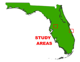
From February through July of 1997, the U.S. Geological Survey (USGS) conducted geophysical surveys of several Florida water bodies as part of the USGS Lakes and Coastal Aquifers (LCA) study. These areas include Lakes Dosson, Halfmoon and Round in west-central
For detailed information about the hydrologic setting of Lakes Dosson, Halfmoon and Round and the interpretation of some of these sub-bottom data, see Metz and Sacks (2002) at http://fl.water.usgs.gov/PDF_files/wri02_4032_metz.pdf (4.48 MB PDF).
The archived trace data are in standard Society of Exploration Geophysicists (SEG) SEG-Y format (Barry and others, 1975) and may be downloaded and processed with commercial or public domain software such as Seismic Unix (SU) (Cohen and Stockwell, 2005). Example SU processing scripts and USGS software for viewing the SEG-Y files (Zihlman, 1992) are also provided.
The USGS Saint Petersburg Coastal and Marine Science Center (SPCMSC) assigns a unique identifier to each cruise or field activity. For example, 97LCA01 tells us the data were collected in 1997 for the Lakes and Coastal Aquifers (LCA) study and the data were collected during the first field activity for that project in that calendar year. Refer to http://walrus.wr.usgs.gov/infobank/programs/html/definition/activity.html for a detailed description of the method used to assign the field activity ID.
The boomer sub-bottom processing system consists of an acoustic energy source that is made up of capacitors charged to a high voltage and discharged through a transducer in the water. The transducer is towed on a sled floating on the water surface and when discharged emits a short acoustic pulse, or shot, which propagates through the water and sediment column. The acoustic energy is reflected at density boundaries (such as the seafloor or sediment layers beneath the lake bottom), detected by the receiver (a hydrophone streamer), and recorded by a PC-based seismic acquisition system. This process is repeated at timed intervals (for example, 0.5 s) and recorded for specific intervals of time (for example, 100 ms). In this way, a two-dimensional (2-D) vertical image of the shallow geologic structure beneath the ship track is produced. Figure 1 displays the acquisition geometry for each activity. Refer to table 1 for a summary of acquisition parameters. Scanned images of the handwritten cruise logbook (5,491-KB PDF) are also provided as a PDF file.
The unprocessed seismic data are stored in SEG-Y format (Barry and others, 1975). For a detailed description of the data format, refer to the SEG-Y Format page. See the How To Download SEG-Y Data page for download instructions. The printable profiles provided here are GIF images that were filtered and gained using Seismic Unix software. Refer to the Software page for details about the processing and examples of the processing scripts.
The printable profiles can be viewed from the Profiles page.
Detailed information about the navigation system used can be found in table 1. To view the trackline maps and navigation files, and for more information about these items, see the Navigation page.
NOTE: Due to software malfunction, some lines were terminated early or did not have data collected; therefore, they are not included in this archive.
This disc contains a readme (2-KB text file) document, which provides a brief description of the report; a folder containing SEG-Y binary data files; GIS files, and all the Hypertext Markup Language (HTML) files, folders, and images used to produce the Web pages included in this report. The Disc Contents page contains a diagram with locations and links to all files and folders contained on this disc.
To access the information contained on this disc, use a Web browser to open the file index.html. This report is divided into seven sections: Acronyms and Abbreviations, Disc Contents, Navigation Data and Maps, Seismic Profiles, Field Activity Logs, FGDC Metadata, and Software. Links at the top and bottom of each page provide access to these sections. This report contains links to the USGS and collaborators or other resources that are only accessible if access to the Internet is available while viewing these documents.
Funding for this study was provided by the USGS Water Resources Discipline (current name is the Water Mission Area), Coastal and Marine Geology Program, SWFWMD, and SJRWMD. This document was improved by the reviews of Rob Wertz (USGS) and Kyle Kelso (Jacobs Technology Inc.) of the USGS - St. Petersburg, FL.
Barry, K.M., Cavers, D.A., and Kneale, C.W., 1975, Recommended standards for digital tape formats: Geophysics, v. 40, no. 2, p. 344-352. Also available on-line at http://www.seg.org/resources/publications/misc/technical-standards.
Cohen, J.K., and Stockwell, J.W., Jr., 2005, CWP/SU: Seismic Unix Release 39: A free package for seismic research and processing: Center for Wave Phenomena, Colorado School of Mines. Available on-line at http://www.cwp.mines.edu/cwpcodes/.
Metz, P.A., and Sacks, L.A., 2002, Comparison of the hydrogeology and water quality of a ground-water augmented lake with two non-augmented lakes in northwest Hillsborough County, Florida: U.S. Geological Survey Water-Resources Investigations Report 02-4032, 74 p. Also available online at http://fl.water.usgs.gov/PDF_files/wri02_4032_metz.pdf (4.48 MB PDF).
Zihlman, F.N., 1992, DUMPSEGY V1.0: A program to examine the contents of SEG-Y disk-image seismic data: U.S. Geological Survey Open-File Report 92-590, 28 p. Also available on-line at http://pubs.er.usgs.gov/usgspubs/ofr/ofr92590.

![]() U.S. Department of the Interior |
U.S. Geological Survey
U.S. Department of the Interior |
U.S. Geological Survey
URL: http://pubsdata.usgs.gov/pubs/ds/582/index.html
Page Contact Information: Feedback
Page Last Modified: Monday, 28-Nov-2016 16:47:40 EST
