USGS - science for a changing world

U.S. Geological Survey Data Series 653

Full Survey Area Map


Home | Acronyms | Contents | Navigation | Profiles | Logs | Metadata | Software


Click on a trackline name to view the seismic profile.

Trackline Map02b3802b3702b3602b3502b3902b4002b4502b4102b4302b4602b4402b4702b4902b4802b5002b3402b34a02b3302b3002b3202b3102b2902b2802b2602b2702b23a02b2302b2502b2402b2202b2102b2002b0902b0802b0702b1902b1802b1702b1602b1402b1302b1502b1202b1102b1002b0602b0502b0402b0202b0302b01

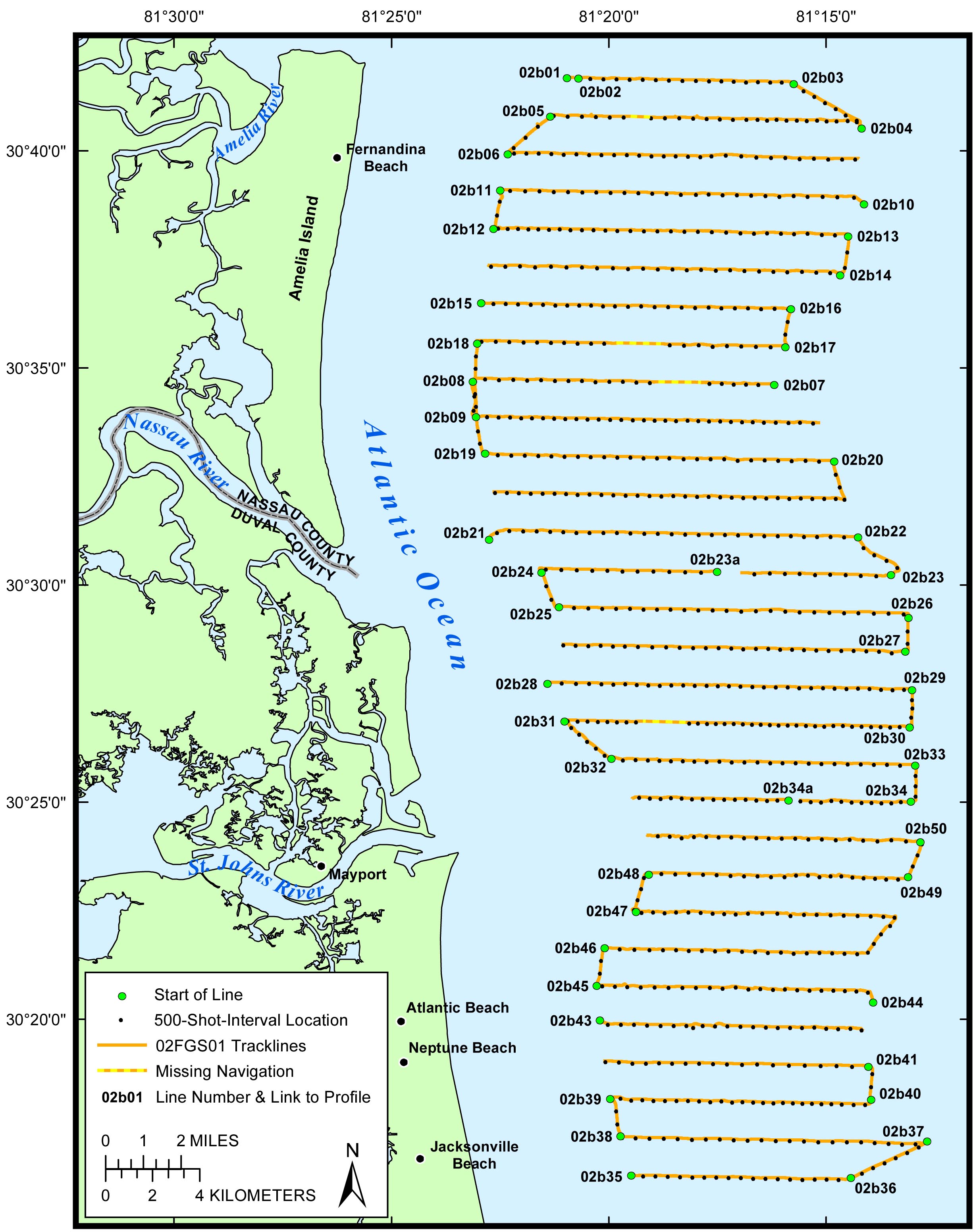
Figure 2. Location map of all digital boomer profile data collected during USGS field activity 02FGS01.


Home | Acronyms | Contents | Navigation | Profiles | Logs | Metadata | Software

Accessibility FOIA Privacy Policies and Notices

Take Pride in America logo USA.gov logo U.S. Department of the Interior | U.S. Geological Survey
URL: http://pubsdata.usgs.gov/pubs/ds/653/html/map.html
Page Contact Information: GS Pubs Web Contact
Page Last Modified: Monday, 28-Nov-2016 18:55:52 EST