 RETURN to Introduction
|
RETURN to Symbols
RETURN to Introduction
|
RETURN to Symbols
RETURN to Introduction
|
RETURN to Symbols
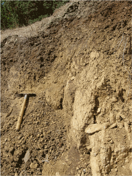
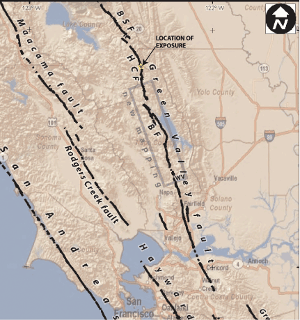
DS710 - Active traces of the Berryessa Fault
Natural Exposure [sort of]
| Below is a photograph of the main active trace of the Hunting Creek Fault, where it is well exposed by a road cut along Berryessa-Knoxville Road in the northeast "panhandle" of Napa County (located 10.8 km north of the traces documented in this report). Although not strictly natural, geologists often depend on road cuts where natural exposures are scarce. Here one may see a well developed vertical shear zone in weathered bedrock and older soils, and which has formed a distinct step in the base of the modern soil. |