U.S. Geological Survey Data Series 773

99FGS01 Map


Home | Acronyms | Contents | Navigation | Profiles | Logs | Metadata | Software | Metadata | Software | Index Page


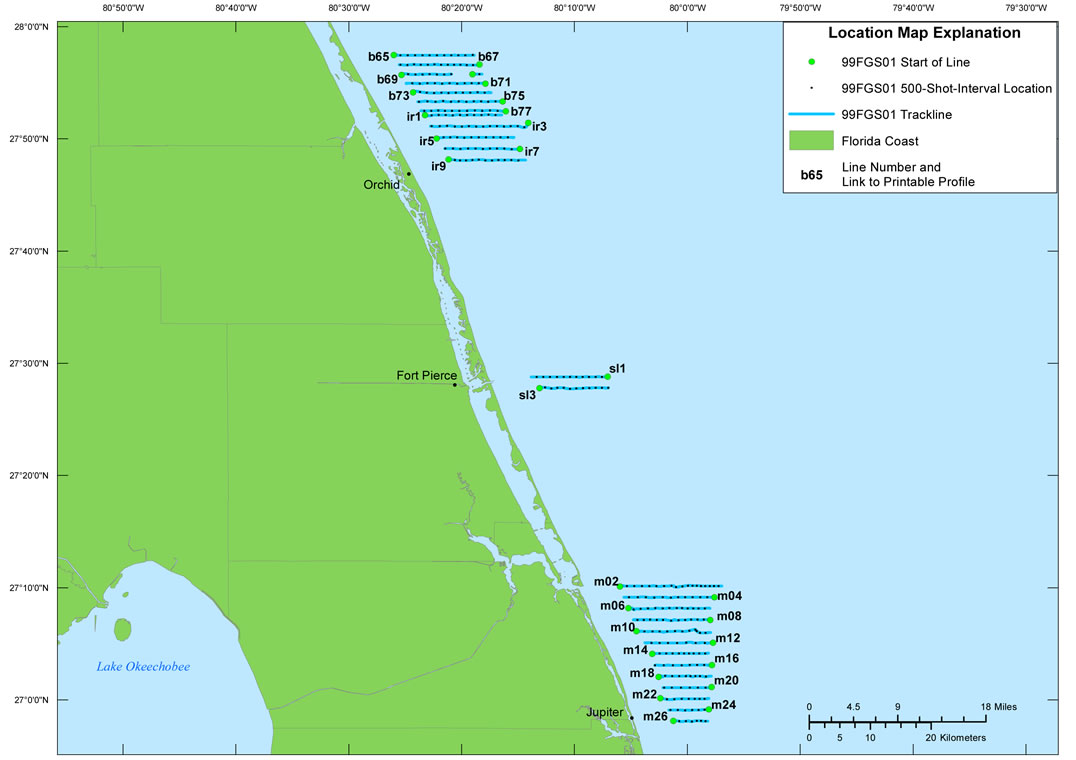
Click on the line name below to view the printable profile image.

Location Map | 99FGS01 | 99FGS02

99FGS01  Location Map m04 printable profilem08 printable profilem12 printable profilem16 printable profilem20 printable profilem24 printable profilem26 printable profilem22 printable profilem18 printable profilem14 printable profilem10 printable profilem06 printable profilem02 printable profilesl3 printable profilesl1 printable profilebir7 printable profileir3 printable profileb77 printable profileb75 printable profileir9 printable profileir5 printable profileir1 printable profileb71 printable profileb73 printable profileb67 printable profileb69 printable profile b65 printable profile

Figure 3. Detailed trackline map of digital subbottom profile data collected during USGS field activity 99FGS01, from Orchid to Jupiter, FL (refer to figure 1 for location).

Home | Acronyms | Contents | Navigation | Profiles | Logs | Metadata | Software| Metadata | Software | Index Page

Accessibility FOIA Privacy Policies and Notices

Take Pride in America logo USA.gov logo U.S. Department of the Interior | U.S. Geological Survey
URL: http://pubsdata.usgs.gov/pubs/ds/773/html/99fgs01.html
Page Contact Information: GS Pubs Web Contact
Page Last Modified: Monday, 28-Nov-2016 19:15:43 EST