Contours--Offshore Refugio Beach, California

Metadata also available as - [Outline] - [Parseable text] - [XML]

Frequently anticipated questions:


What does this data set describe?

Title: Contours--Offshore Refugio Beach, California
Abstract:
This part of SIM 3319 presents bathymetric contours for several seafloor maps of Offshore Refugio Beach, California (vector data file is included in "Contours_OffshoreRefugioBeach.zip," which is accessible from <http://pubs.usgs.ov/ds/781/OffshoreRefugioBeach/data_catalog_OffshoreRefugioBeach.html>). Contours of Offshore Refugio Beach, California, were clipped from a larger overall contour dataset of all California State Waters within the Santa Barbara Channel. These contours were generated from bathymetry data collected by the U.S. Geological Survey (USGS), by California State University, Monterey Bay, Seafloor Mapping Lab (CSUMB), and by Fugro Pelagos. The USGS conducted mapping within State waters in the summers of 2005, 2006, 2007, and 2008 using a combination of 117 kHz and 234.5 kHz SEA (AP) Ltd. SWATHplus-M phase-differencing sidescan sonars. CSUMB conducted mapping in the summers of 2006 and 2007 using a 244 kHz Reson 8101 multibeam echosounder. Fugro Pelagos conducted multibeam mapping in 2008 using a combination of 400 kHz Reson 7125, 240 kHz Reson 8101, and 100 kHz Reson 8111 multibeam echosounders. Fugro Pelagos also conducted coastal bathymetric and topographic lidar mapping in 2009 for the U.S. Army Corps of Engineers (USACE) Joint Lidar Bathymetry Technical Center of Expertise using the SHOALS-1000T bathymetric and the Leica ALS60 topographic lidar systems. All of these mapping missions combined to collect bathymetry from the 0-m isobath to beyond the 3-nautical mile limit of California’s state waters.
  1. How should this data set be cited?

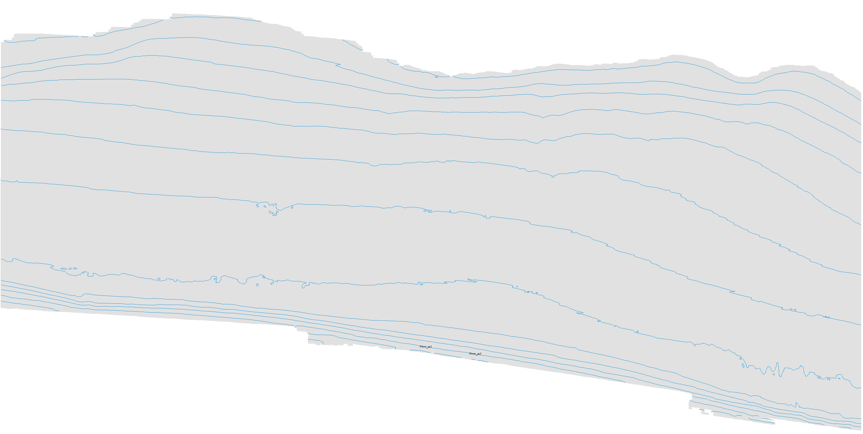
    Ritchie, Andrew C., Dartnell, Peter, Kvitek, Rikk G., and Johnson, Samuel Y., 2015, Contours--Offshore Refugio Beach, California:.

    This is part of the following larger work.

    Johnson, Samuel Y., Dartnell, Peter, Cochrane, Guy R., Golden, Nadine E., Phillips, Eleyne L., Ritchie, Andrew C., Krigsman, Lisa M., Dieter, Bryan E., Conrad, James E., Greene, H. Gary, Seitz, Gordon G., Endris, Charles A., Sliter, Ray W., Wong, Florence L., Erdey, Mercedes D., Gutierrez, Carlos I., Yoklavich, Mary M., Draut, Amy E., and Hart, Patrick E., 2015, California State Waters Map Series--Offshore of Refugio Beach Area, California: Scientific Investigations Map SIM 3319, U.S. Geological Survey, Reston, VA.

    Online Links:

  2. What geographic area does the data set cover?

    West_Bounding_Coordinate: -120.19
    East_Bounding_Coordinate: -119.99
    North_Bounding_Coordinate: 34.47
    South_Bounding_Coordinate: 34.39

  3. What does it look like?

    <https://pubs.usgs.gov/ds/781/OffshoreRefugioBeach/images/Contours_OffshoreRefugioBeach.jpg> (JPEG)
    Bathymetry contours offshore Refugio Beach.

  4. Does the data set describe conditions during a particular time period?

    Calendar_Date: 2015
    Currentness_Reference: Publication Date

  5. What is the general form of this data set?

    Geospatial_Data_Presentation_Form: Vector digital data

  6. How does the data set represent geographic features?

    1. How are geographic features stored in the data set?

      This is a Vector data set. It contains the following vector data types (SDTS terminology):

      • String (31)

    2. What coordinate system is used to represent geographic features?

      The map projection used is WGS 1984 UTM Zone 10N.

      Projection parameters:
      Scale_Factor_at_Central_Meridian: 0.9996
      Longitude_of_Central_Meridian: -123.0
      Latitude_of_Projection_Origin: 0.0
      False_Easting: 500000.0
      False_Northing: 0.0

      Planar coordinates are encoded using coordinate pair
      Abscissae (x-coordinates) are specified to the nearest 0.0001
      Ordinates (y-coordinates) are specified to the nearest 0.0001
      Planar coordinates are specified in Meter

      The horizontal datum used is WGS84.
      The ellipsoid used is NAVD 1988.
      The semi-major axis of the ellipsoid used is 6378137.0.
      The flattening of the ellipsoid used is 1/298.257223563.

  7. How does the data set describe geographic features?

    Contours_OffshoreCarpinteria.shp
    The shapefile attributes include FID - Internal Feature Number, SHAPE - feature geometry, ID - feature ID, and CONTOUR - contour depth value. The shapefile can be added to any ESRI ArcMap project. (Source: ESRI)

    FID
    Internal feature number. (Source: ESRI)

    Sequential unique whole numbers that are automatically generated.

    SHAPE
    Feature geometry (Source: ESRI)

    Polyline

    ID
    Unique identifier for each contour line. Value of 0 means the line segment has been generated during the smoothing process. (Source: ESRI)

    Range of values
    Minimum:0
    Maximum:137
    Units:integer count

    CONTOUR
    Contours are lines that connect points of equal depth based on the bathymetry grid. The contour values indicate the depth value the line represents. This makes it easier to identify features on the seafloor. After smoothing of the bathymetry grid, contour lines were generated at 10-meter intervals from -10 m to -100 m and 50-meter intervals from -100 to -250m. Values are negative to indicate depth below sea level. The value of 0 represents a line segment created during the smoothing process. (Source: USGS)

    Range of values
    Minimum:-10
    Maximum:-100
    Units:meters depth


Who produced the data set?

  1. Who are the originators of the data set? (may include formal authors, digital compilers, and editors)

  2. Who also contributed to the data set?

  3. To whom should users address questions about the data?

    Peter Dartnell
    U.S. Geological Survey, Pacifc Coastal and Marine Science Center
    Physical Scientist
    400 Natural Bridges Dr.
    Santa Cruz, CA 95060-5792
    USA

    (831) 460-7415 (voice)
    (831) 427-4709 (FAX)
    pdartnell@usgs.gov


Why was the data set created?

These data are intended for science researchers, students, policy makers, and the general public. These data can be used with geographic information systems or other software to identify bathymetric features.


How was the data set created?

  1. From what previous works were the data drawn?

  2. How were the data generated, processed, and modified?

    Date: 2012 (process 1 of 1)
    During the CSUMB mapping missions, an Applanix positioning and motion compensation system (POS/MV) was used to accurately position the vessel during data collection, and it also accounted for vessel motion such as heave, pitch, and roll (position accuracy, ±2 m; pitch, roll, and heading accuracy, ±0.02 degrees; heave accuracy, ±5%, or 5 cm). NavCom 2050 GPS receiver (CNAV) data were used to account for tidal-cycle fluctuations, and sound-velocity profiles were collected with an Applied Microsystems (AM) SVPlus sound velocimeter. Soundings were corrected for vessel motion using the Applanix POS/MV data, for variations in water-column sound velocity using the AM SVPlus data, and for variations in water height (tides) using vertical-position data from the CNAV receiver. Final XYZ soundings and bathymetric-surface models were referenced to the World Geodetic System of 1984 (WGS 1984) relative to the North American Vertical Datum of 1988 (NAVD 1988). During the USGS mapping missions, DGPS data and measurements of vessel motion (heave, pitch, and roll) were combined in a CodaOctopus F180 attitude-and-position system to produce a high-precision vessel-attitude packet. This packet was transmitted to the acquisition software in real time and combined with instantaneous sound-velocity measurements at the transducer head before each ping. The returned samples were projected to the seafloor using a ray-tracing algorithm that works with previously measured sound-velocity profiles. Statistical filters were applied to the raw samples that discriminate the seafloor returns (soundings) from unintended targets in the water column. The original soundings were referenced to the WGS 1984 relative to the MLLW (Mean Lower Low Water) tidal datum, but, through postprocessing using NOAA's VDatum tool, the soundings were transformed to NAVD 1988. Finally, the soundings were converted into 2-m-resolution bathymetric-surface-model grids. During the Fugro Pelagos mapping mission that was completed as part of the National Coastal Mapping Program of USACE, the Leica ALS60 topographic-lidar and the SHOALS-1000T bathymetric-lidar systems were mounted on an aircraft that flew survey lines at an altitude of 300 to 400 m (bathymetry) and 300 to 1,200 m (topography), at speeds of between 135 and 185 knots. The ALS60 system collected data at a maximum pulse rate of 200 kHz, and the SHOALS system collected data at 1 kHz. Information on aircraft position, velocity, and acceleration were collected using the Novatel and POS A/V 410 systems (SHOALS) and the onboard GPS/IMU system (ALS60). Aircraft-position data were processed using POSPac software, and the results were combined with the lidar data to produce 3-D positions for each lidar shot. Various commercial and proprietary software packages were used to clean the data, to convert all valid data from ellipsoid to orthometric heights, and to export the data as a series of first-return topography and bathymetry ASCII files. Final grids were provided in geographic coordinates referenced to the NAVD 1988. After projecting the data to a common projection and datum, all bathymetry data within State Waters of the Santa Barbara Channel were merged in WGS84 UTM 11N, de-sampled to 10-m resolution. A smooth arithmetic mean convolution function applying a weight of one-ninth to each cell in a 3-pixel by 3-pixel matrix was then applied iteratively to the grid ten times. Following smoothing, contour lines were generated at 10-meter intervals from 10 to 100 m and 50-meter intervals deeper than 100 m. Small gaps in contours were connected while leaving the CONTOUR fields blank to facilitate identification. Contours within the Offshore Refugio Beach map area were reprojected to UTM, zone 10.

    Person who carried out this activity:

    Andrew C. Ritchie
    U.S. Geological Survey, Pacific Coastal and Marine Science Center
    Physical Scientist
    400 Natural Bridges Dr.
    Santa Cruz, CA 95060-5792
    USA

    NA (voice)
    aritchie@usgs.gov

  3. What similar or related data should the user be aware of?


How reliable are the data; what problems remain in the data set?

  1. How well have the observations been checked?

    Not applicable.

  2. How accurate are the geographic locations?

    +/- 2 meters

  3. How accurate are the heights or depths?

    0.05 percent of the water depth.

  4. Where are the gaps in the data? What is missing?

    Complete

  5. How consistent are the relationships among the observations, including topology?

    Unspecified


How can someone get a copy of the data set?

Are there legal restrictions on access or use of the data?

Access_Constraints: None
Use_Constraints:
This information is not intended for navigational purposes.
Read and fully comprehend the metadata prior to data use. Uses of these data should not violate the spatial resolution of the data. Where these data are used in combination with other data of different resolution, the resolution of the combined output will be limited by the lowest resolution of all the data.
Acknowledge the U.S. Geological Survey in products derived from these data. Share data products developed using these data with the U.S. Geological Survey.
This database has been approved for release and publication by the Director of the USGS. Although this database has been subjected to rigorous review and is substantially complete, the USGS reserves the right to revise the data pursuant to further analysis and review. Furthermore, it is released on condition that neither the USGS nor the United States Government may be held liable for any damages resulting from its authorized or unauthorized use.
Although this Federal Geographic Data Committee-compliant metadata file is intended to document these data in nonproprietary form, as well as in ArcInfo format, this metadata file may include some ArcInfo-specific terminology.


Who wrote the metadata?

Dates:
Last modified: 29-Nov-2012
Last Reviewed: 29-Nov-2012
Metadata author:
Peter Dartnell
U.S. Geological Survey, Pacific Coastal and Marine Science Center
Physical Scientist
400 Natural Bridges Dr.
Santa Cruz, CA 95060-5792
USA

(831) 460-7415 (voice)
(831) 427-4709 (FAX)
pdartnell@usgs.gov

Metadata standard:
Content Standard for Digital Geospatial Metadata ("CSDGM version 2") (FGDC-STD-001-1998)


Generated by mp version 2.9.16 on Wed Mar 04 16:51:32 2015