![]()
To PREVIOUS Page
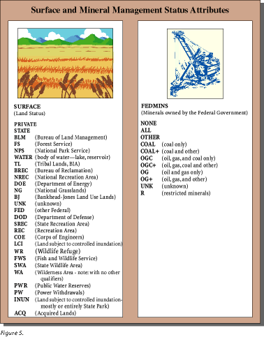
To Contents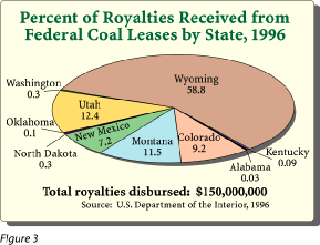 Federally owned coal also plays an important part in the U.S. economy: more than a quarter of a billion dollars in royalties are generated annually from production of Federal coal. Of that amount, about half is disbursed to the States in which the coal was produced (fig. 3). To develop a standardized digital library of Federal coal ownership data, the USGS in cooperation with the U.S. Bureau of Land Management (BLM) is collecting files of surface and mineral ownership and compiling them in ARC/INFO coverages. Before this project was undertaken, these ownership files existed only in specific BLM offices, in different formats, and with varying scales. For some areas, no digital ownership coverage existed; for those areas, we are 
|
constructing digital files. Once
the ownership coverages are generated and standardized, they are combined
with digital maps of coal deposits. This combination of digital data enables
the user to answer complex geospatial questions about coal quantity, quality,
availability, and recoverability. |
| To PREVIOUS Page To Contents |
| U. S.
Department of the Interior U. S. Geological Survey |
USGS
Fact Sheet FS-012-98 February 1998 |