
The U.S. Geological Survey has a patent pending, as of November 2001, for a new underwater microscope system, which has the capability to acquire and analyze digital images of sediment grains on a riverbed or sea bottom without the need to manually collect actual bottom samples. In this system, a close-up microscopic lens is installed on a modified version of a commercially available camera system. The underwater microscope camera is enclosed in a special housing that, together with ballasting, winching, and operational procedures, permits topside operators to work from a small vessel even in swift-moving rivers.
The system acquires a video image of the seabed at 1/4-inch distance from the focal plane of the lens and sends the video signal through a cable to a digital video recording console on the surface vessel. The image is received at the surface and recorded as digital video. Later, these digital video sequences are viewed on a computer, and quality frames of each bottom contact sample are saved. These images are then analyzed using one of several algorithms.
At least four different approaches can be used to determine grain size from video images of sediment: (1) Visual estimates by a human operator (2) Use of an edge-detection algorithm to recognize and measure individual grains (3) Use of two-dimensional fast fourier transform or wavelets to measure grain size (4) Spatial autocorrelation
The underwater microscope system is designed to assist sedimentologists, marine geologists, or any other scientists interested in studying the surficial bottom sediments in lakes, rivers, and oceans. Improvements to the system’s lens design are in development to permit gravel characterizations that would have applications in aquaculture and fish wildlife studies.
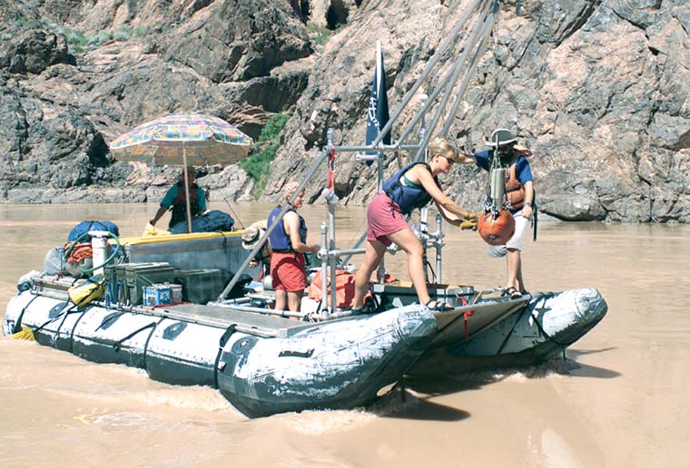 |
| U. S. Geological Survey raft deploying underwater microscope system in Colorado River. |
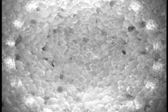 |
| Typical video frame showing bottom sediment (image is 1 cm across) |
 |
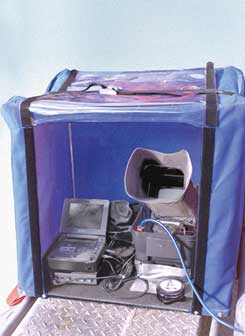 |
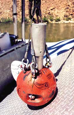
| Video camera assembly including stabilizer fin, camera pressure case, and bridle assembly. | Topside video console, including video monitor and digital recorder |
| For technical information,
contact: Hank Chezar U.S. Geological Survey 345 Middlefield Road, MS–999 Menlo Park, CA 94025 Phone: (650) 329-5331 hchezar@usgs.gov |
For licensing information,
contact: Julia Giller or Neil Mark USGS Technology Enterprise Office National Center, MS–211 12201 Sunrise Valley Dr. Reston, VA 20192 Phone: (703) 648-4403 Fax (703) 648-4408 jgiller@usgs.gov |
Download a PDF version of this fact sheet (332 KB)
Download the current version of Acrobat Reader for free
| Help | PDF help | Geopubs main page | Fact Sheets |
| Department
of the Interior | Privacy Statement
| Disclaimer | Accessibility
|
URL of this
page: https://pubs.usgs.gov/fs/2001/fs135-01
Maintained by: Michael Diggles
Created: December 30, 2001
Last modified: May 24, 2005 (mfd)