Fact Sheet 2006–3129
By Elizabeth A. Ahearn, Kernell G. Ries III, and Peter A. Steeves
This fact sheet is available in PDF Format (854 KB)
If you have Adobe® Acrobat® or Adobe®Acrobat® Reader® installed on your computer, you may view and print the PDF version of this report. Acrobat Reader, is a free download from Adobe Systems, Inc. Users with disabilities can view information concerning accessibility at access.Adobe.com.
An important mission of the U. S. Geological Survey (USGS) is to provide information on streamflow in the Nation's rivers. Streamflow statistics are used by water managers, engineers, scientists, and others to protect people and property during floods and droughts, and to manage land, water, and biological resources. Common uses for streamflow statistics include dam, bridge, and culvert design; water-supply planning and management; water-use appropriations and permitting; wastewater and industrial discharge permitting; hydropower-facility design and regulation; and flood-plain mapping for establishing flood-insurance rates and land-use zones.
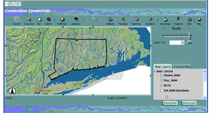
In an effort to improve access to published streamflow statistics, and to make the process of computing streamflow statistics for ungaged stream sites easier, more accurate, and more consistent, the USGS and the Environmental Systems Research Institute, Inc. (ESRI) developed StreamStats (Ries and others, 2004). StreamStats is a Geographic Information System (GIS)-based Web application for serving previously published streamflow statistics and basin characteristics for USGS data-collection stations, and computing streamflow statistics and basin characteristics for ungaged stream sites. The USGS, in cooperation with the Connecticut Department of Environmental Protection and the Connecticut Department of Transportation, has implemented StreamStats for Connecticut.
Ahearn, E.A., Ries, K.G., Steeves, P.A., October 2006, Streamstats: U.S. Geological Survey Web Application for Streamflow Statistics for Connecticut: U.S. Geological Survey fact sheet 2006–3129, 4 p.
For further information, contact:
Virginia deLima, Director
Connecticut Water Science Center
101 Pitkin St.
East Hartford, CT 06108
Voice: 860-291-6740
Fax: 860-291-6799
Email: vdelima@usgs.gov
Visit our web site: http://ct.water.usgs.gov

![]() U.S. Department of the Interior |
U.S. Geological Survey
U.S. Department of the Interior |
U.S. Geological Survey
URL: https://pubs.usgs.gov/fs/2006/3129/
Page Contact Information: USGS Publishing Network
Page Last Modified: Tuesday, 29-Nov-2016 17:25:04 EST
