Fact Sheet 2006-3138

U.S. GEOLOGICAL SURVEY
Back to Table of Contents

Figure - refer to figure caption for alternative text description

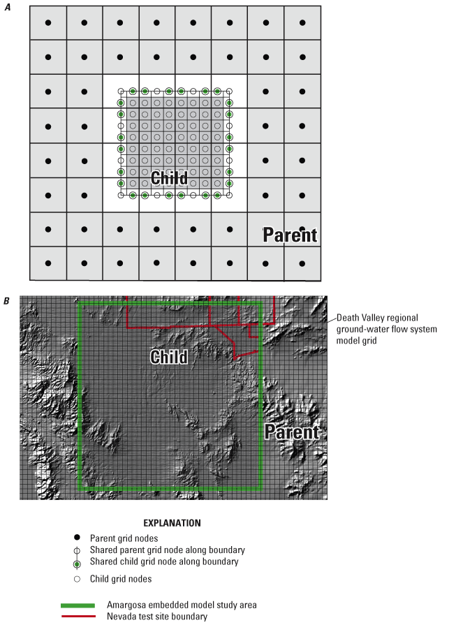
Figure 6. A, The linking of parent (regional-scale) grid and the child (local-scale) grid of an embedded model (modified from Mehl and Hill, 2005) with B, the southern Amargosa model grid embedded in the Death Valley regional ground-water flow system model grid.

Back to Table of Contents


AccessibilityFOIAPrivacyPolicies and Notices

Take Pride in America home page.FirstGov buttonU.S. Department of the Interior | U.S. Geological Survey
Persistent URL: https://pubs.water.usgs.gov/fs20063138
Page Contact Information: Publications Team
Page Last Modified: Tuesday, 29-Nov-2016 17:24:01 EST