USGS Fact Sheet 2008-3099
U.S. Geological Survey Fact Sheet 2008-3099, 4 pages (Published December 2008)
by Andrew E. Knaak and John K. Joiner
![]() This Web-only publication is available in pdf format in two sizes:
This Web-only publication is available in pdf format in two sizes:
(A) 11 by 17 inches (2 Mb)
(B) 8 1/2 by 11 inches (4 Mb).
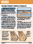 The U.S. Geologic Survey (USGS) Georgia Water Science Center (GaWSC) maintains a long-term hydrologic monitoring network of more than 260 real-time streamflow stations and more than 100 noncontinuous streamflow stations throughout Georgia. This network is operated by the USGS GaWSC in cooperation with more than 50 different partners at Federal, State, and local government levels. One of the many benefits of data collected from this monitoring network is that it allows for the analysis of the overall hydrologic condition of streams and lakes of Georgia.
To view the PDF document, you need the Adobe Acrobat® Reader installed on your computer. (A free copy of the Acrobat® Reader may be downloaded from Adobe Systems Incorporated.)
Suggested citation: Knaak, A.E., and Joiner, J.K., 2008, Hydrologic Streamflow Conditions for Georgia, 2007: U.S. Geological Survey Fact Sheet 2008–3099,, 4 p., Web-only publication available at https://pubs.usgs.gov/fs/2008/3099/
Recent USGS publications on Georgia or Georgia Water-Resources Information
For more information, please contact webmaster-ga@usgs.gov.

![]() U.S. Department of the Interior |
U.S. Geological Survey
U.S. Department of the Interior |
U.S. Geological Survey
URL: https://pubsdata.usgs.gov/pubs/fs/2008/3099/index.html
Page Contact Information: Publications Team
Page Last Modified: Tuesday, 29-Nov-2016 18:22:57 EST