![]()
|
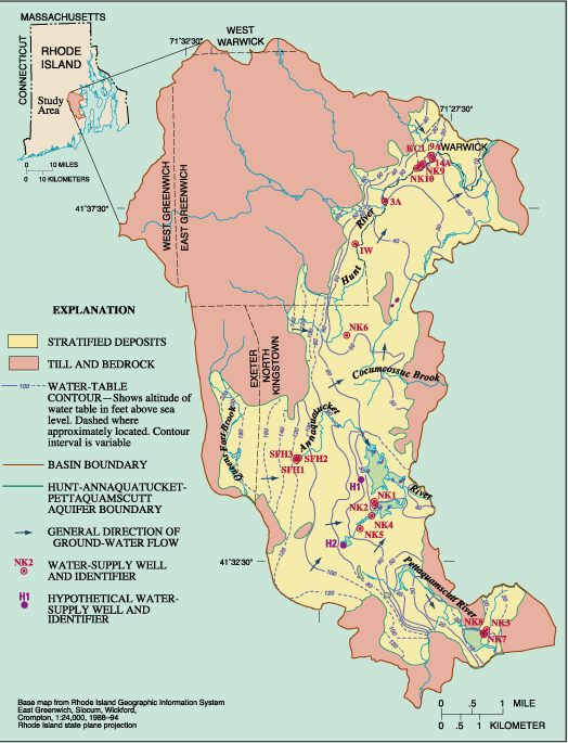
Figure 1. Location of the Hunt-Annaquatucket-Pettaquamscutt Basin, Rhode Island, and map of the water table in the Hunt-Annaquatucket-Pettaquamscutt aquifer, October 1996. |
| U.S. Geological Survey |
Figure 1 |
USGS Fact Sheet FS-063-01 |
| U.S. Department of Interior |
October, 2001 |
Return to Fact Sheet-063-01