Skip Links

USGS - science for a changing world

U.S. Geological Survey Geologic Quadrangle Map GQ–1766

Geologic Map of the Lead Mountain 15’ Quadrangle, San Bernardino County, California

By Keith A. Howard, Keith J. Jagiello, Todd T. Fitzgibbon, and Barbara E. John

Thumbnail of and link to report PDF (3.3 MB)Abstract

The Lead Mountain 15’ quadrangle in the Mojave Desert contains a record of Jurassic, Cretaceous, Tertiary, and Quaternary magmatism. Small amounts of Mesoproterozoic(?) augen gneiss and Paleozoic and Mesozoic(?) metasedimentary rocks are preserved in small patches; they are intruded by voluminous Jurassic plutons of quartz diorite to granite composition and by Late Cretaceous granite of the Cadiz Valley batholith. Jurassic intrusive rocks include part of the Bullion Mountain Intrusive Suite and also younger dikes inferred to be part of the Jurassic Independence dike swarm. A contact-metamorphosed aureole 2 km wide in the Jurassic plutonic rocks fringes the Cadiz Valley batholith.

Early Miocene dacitic magmatism produced a dense swarm of dikes in the eastern Bullion Mountains and the volcanic-intrusive remnant of a volcano at Lead Mountain. Tilting of the dike swarm from inferred vertical orientations may have resulted from Miocene tectonic extension. Conglomerate of Pliocene and (or) Miocene age is also tilted. Younger volcanism is recorded by Pliocene basalt of the Deadman Lake volcanic field, basalt of Lead Mountain (approximately 0.36 Ma), and the even younger basalt of Amboy. Quaternary sedimentation built alluvial fans and filled playas in the map area. Faulting in the dextral eastern California shear zone produced several northwest-striking faults in the quadrangle, some of them active into the Pleistocene and some that may have many kilometers of right-lateral offset.

First posted August 16, 2013

For additional information:
Contact Information, Geology, Minerals, Energy, & Geophysics Science Center—Menlo Park
U.S. Geological Survey
345 Middlefield Road, MS-973
Menlo Park, CA 94025-3591
http://geomaps.wr.usgs.gov/

This report is presented in Portable Document Format (PDF); the latest version of Adobe Reader or similar software is required to view it. Download the latest version of Adobe Reader, free of charge.


Suggested citation:

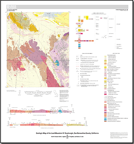
Howard, K.A., Jagiello, K.J., Fitzgibbon, T.T., and John, B.E., 2013, Geologic map of the Lead Mountain 15’ quadrangle, San Bernardino County, California: U.S. Geological Survey Geologic Quadrangle Map GQ–1766, scale 1:62,500, https://pubs.usgs.gov/gq/1766/.


Accessibility FOIA Privacy Policies and Notices

Take Pride in America logo USA.gov logo U.S. Department of the Interior | U.S. Geological Survey
URL: http://pubsdata.usgs.gov/pubs/gq/1766/index.html
Page Contact Information: GS Pubs Web Contact
Page Last Modified: Wednesday, 30-Nov-2016 14:57:47 EST