GROUND WATER ATLAS of the UNITED STATES
Arizona, Colorado, New Mexico, Utah
HA 730-C
Rio Grande aquifer system
There are two different files for each illustration
- A 90 ppi JPEG file, suitable for screen viewing is accessed
through the thumbnail image.
- A tiff file is accessed through the "tiff file"
link. All files are Adobe Photoshop. These files have been compressed
with GNU's gzip utility. If your web browser defaults to a screen
display of the file, turn on the "Load to local disk"
option before downloading. Download and process these tiff files
as ascii, not binary.
Introduction
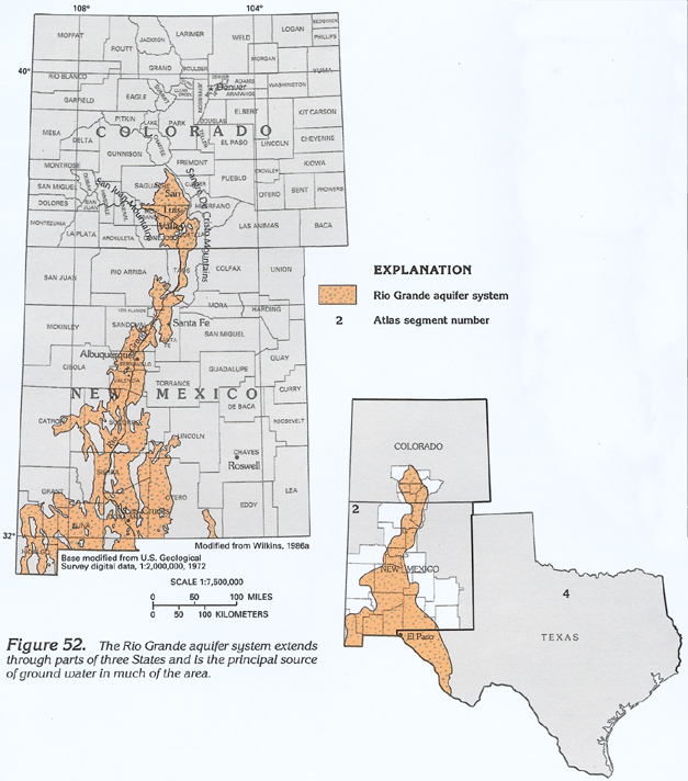
Figure 52 Map showing extent of the Rio Grande aquifer
system (332K)
 downloadable tiff file C052.tif.gz (2.7MB
compressed)
downloadable tiff file C052.tif.gz (2.7MB
compressed)
Figure 53 Graph showing average monthly
pan evaporation and average monthly precipitation at the San Luis
Valley in Colorado (84K)
 downloadable tiff file C053.tif.gz (602K
compressed)
downloadable tiff file C053.tif.gz (602K
compressed)
Figure 54 Photograph showing the Rio Grande
north of Santa Fe, New Mexico (176K)
 downloadable tiff file C054.tif.gz (1.4MB
compressed)
downloadable tiff file C054.tif.gz (1.4MB
compressed)
Figure 55 Map showing open and closed basins
along the Rio Grande (264K)
 downloadable tiff file C055.tif.gz (2.7MB
compressed)
downloadable tiff file C055.tif.gz (2.7MB
compressed)
 downloadable tiff file C052.tif.gz (2.7MB
compressed)
downloadable tiff file C052.tif.gz (2.7MB
compressed) 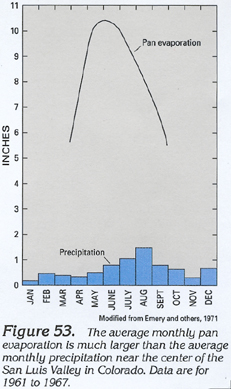 downloadable tiff file C053.tif.gz (602K
compressed)
downloadable tiff file C053.tif.gz (602K
compressed) 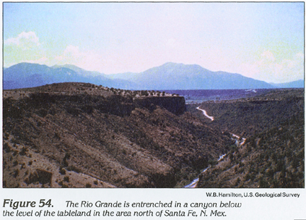 downloadable tiff file C054.tif.gz (1.4MB
compressed)
downloadable tiff file C054.tif.gz (1.4MB
compressed) 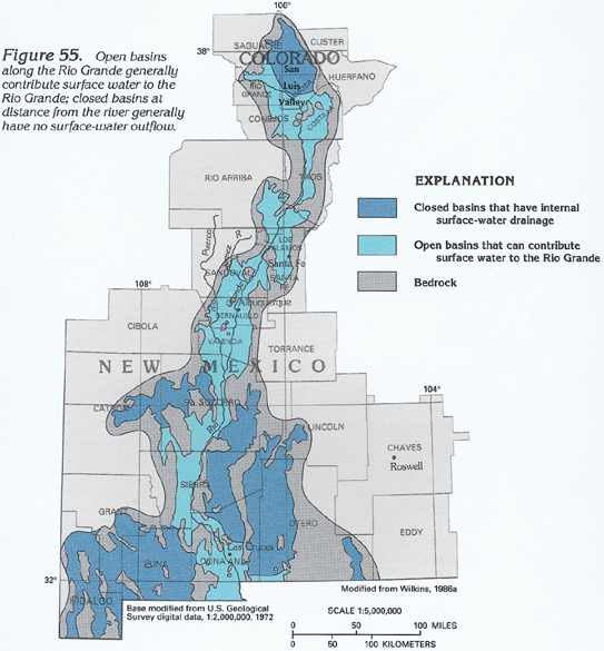 downloadable tiff file C055.tif.gz (2.7MB
compressed)
downloadable tiff file C055.tif.gz (2.7MB
compressed)