GROUND WATER ATLAS of the UNITED STATES
Kansas, Missouri, and Nebraska
HA 730-D
Great Plains aquifer system
There are two different files for each illustration
- A 72 ppi GIF file, suitable for screen viewing is accessed through
the thumbnail image
- An eps file, suitable for downloading to be printed or edited is accessed
through the "eps file" link. Most files are Adobe Illustrator
6.0, exceptions are noted. These files have been compressed with GNU's
gzip utility. If your web browser defaults to a screen display of the file,
turn on the "Load to local disk" option before downloading. Download
and process these eps files as ascii, not binary.
Hydrogeologic units
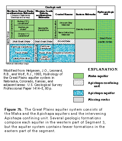
Figure 75 Correlation chart (33K)
 editable eps
file D075.eps.gz (66K compressed)
editable eps
file D075.eps.gz (66K compressed)
Figure 76 Map showing the Maha and Apishapa aquifer and the
Apishapa confining unit (33K)
 editable eps file D076.eps.gz
(149K compressed)
editable eps file D076.eps.gz
(149K compressed)
Figure 77 Geologic section (17K)
 editable eps file D077.eps.gz
(66K compressed)
editable eps file D077.eps.gz
(66K compressed)
Figure 78 Map showing where aquifer contains freshwater,
saline water, and oil and gas (33K)
 editable eps file D078.eps.gz
(149K compressed)
editable eps file D078.eps.gz
(149K compressed)
Figure 79 Map showing thickness of the Maha aquifer (50K)
 editable eps file D079.eps.gz
(149K compressed)
editable eps file D079.eps.gz
(149K compressed)
Figure 80 Map showing thickness of the Apishapa aquifer (50K)
 editable eps file D080.eps.gz
(231K compressed)
editable eps file D080.eps.gz
(231K compressed)
 editable eps
file D075.eps.gz (66K compressed)
editable eps
file D075.eps.gz (66K compressed) 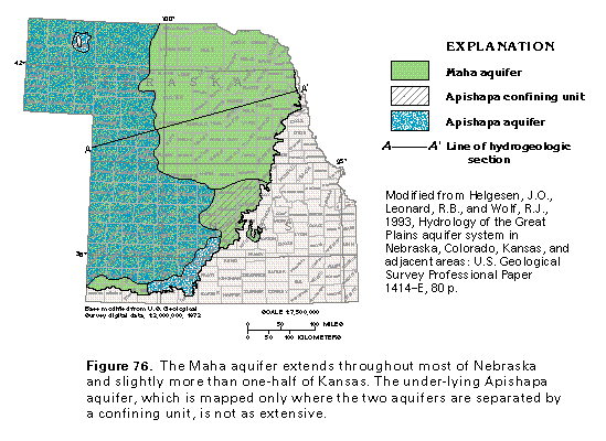 editable eps file D076.eps.gz
(149K compressed)
editable eps file D076.eps.gz
(149K compressed) 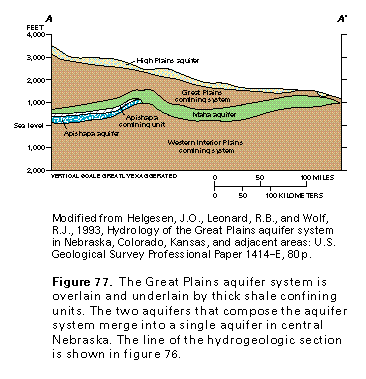 editable eps file D077.eps.gz
(66K compressed)
editable eps file D077.eps.gz
(66K compressed) 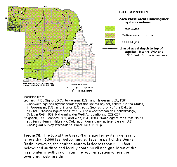 editable eps file D078.eps.gz
(149K compressed)
editable eps file D078.eps.gz
(149K compressed) 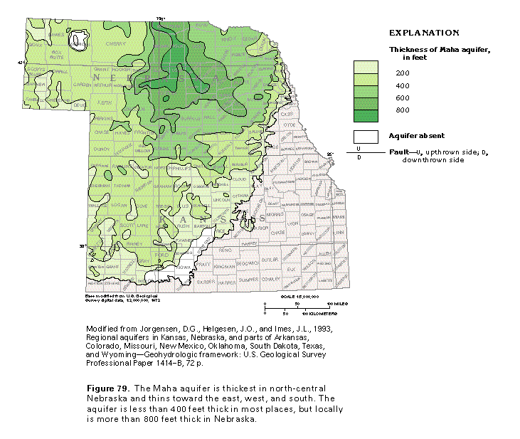 editable eps file D079.eps.gz
(149K compressed)
editable eps file D079.eps.gz
(149K compressed) 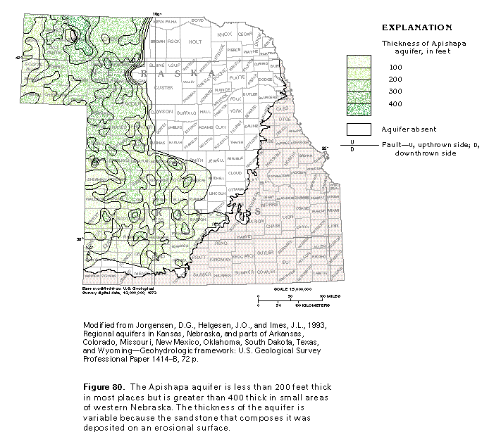 editable eps file D080.eps.gz
(231K compressed)
editable eps file D080.eps.gz
(231K compressed)