GROUND WATER ATLAS of the UNITED STATES
Kansas, Missouri, and Nebraska
HA 730-D
Ozark Plateaus aquifer system
There are two different files for each illustration
- A 72 ppi GIF file, suitable for screen viewing is accessed through
the thumbnail image
- An eps file, suitable for downloading to be printed or edited is accessed
through the "eps file" link. Most files are Adobe Illustrator
6.0, exceptions are noted. These files have been compressed with GNU's
gzip utility. If your web browser defaults to a screen display of the file,
turn on the "Load to local disk" option before downloading. Download
and process these eps files as ascii, not binary.
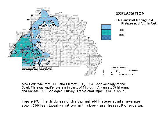
Springfield Plateau aquifer
Figure 97 Map showing thickness of the Springfield Plateau aquifer
(33K)
 editable eps
file D097.eps.gz (99K compressed)
editable eps
file D097.eps.gz (99K compressed)
Figure 98 Map showing potentiometric contours (33K)
 editable eps file D098.eps.gz
(132K compressed)
editable eps file D098.eps.gz
(132K compressed)
Figure 99 Map showing dissolved-solids concentration (33K)
 editable eps file D099.eps.gz
(99K compressed)
editable eps file D099.eps.gz
(99K compressed)
 editable eps
file D097.eps.gz (99K compressed)
editable eps
file D097.eps.gz (99K compressed) 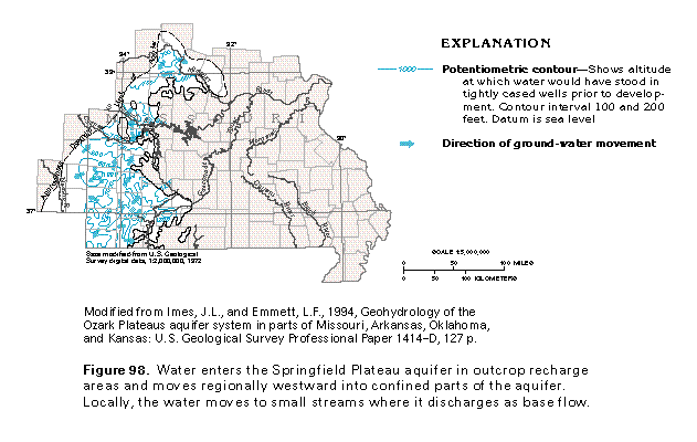 editable eps file D098.eps.gz
(132K compressed)
editable eps file D098.eps.gz
(132K compressed) 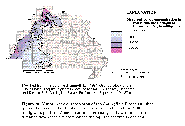 editable eps file D099.eps.gz
(99K compressed)
editable eps file D099.eps.gz
(99K compressed)