GROUND WATER ATLAS of the UNITED STATES
Kansas, Missouri, and Nebraska
HA 730-D
Ozark Plateaus aquifer system
There are two different files for each illustration
- A 72 ppi GIF file, suitable for screen viewing is accessed through
the thumbnail image
- An eps file, suitable for downloading to be printed or edited is accessed
through the "eps file" link. Most files are Adobe Illustrator
6.0, exceptions are noted. These files have been compressed with GNU's
gzip utility. If your web browser defaults to a screen display of the file,
turn on the "Load to local disk" option before downloading. Download
and process these eps files as ascii, not binary.
Ozark aquifer
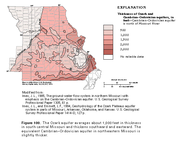
Figure 100 Map showing thickness of the Ozark and Cambrian-Ordovician
aquifers (33K)
 editable eps
file D100.eps.gz (99K compressed)
editable eps
file D100.eps.gz (99K compressed)
Figure 101 Map showing potentiometric contours (33K)
 editable eps file D101.eps.gz
(165K compressed)
editable eps file D101.eps.gz
(165K compressed)
Figure 102 Graph showing change in depth of water
(17K)
 editable eps
file D102.eps.gz (33K compressed)
editable eps
file D102.eps.gz (33K compressed)
Figure 103 Photo of sinkhole (50K)
 This illustration contains a placed image. Download the Adobe Illustrator
6 eps file D103.eps.gz (5.6M compressed)
which contains an imbedded Adobe Photoshop 3 (eps) file. You may also want
to download the editable Photoshop
file D103psh.eps.gz (5.6M compressed)
This illustration contains a placed image. Download the Adobe Illustrator
6 eps file D103.eps.gz (5.6M compressed)
which contains an imbedded Adobe Photoshop 3 (eps) file. You may also want
to download the editable Photoshop
file D103psh.eps.gz (5.6M compressed)
Figure 104 Map showing dissolved-solids concentration
(33K)
 editable eps
file D104.eps.gz (83K compressed)
editable eps
file D104.eps.gz (83K compressed)
 editable eps
file D100.eps.gz (99K compressed)
editable eps
file D100.eps.gz (99K compressed) 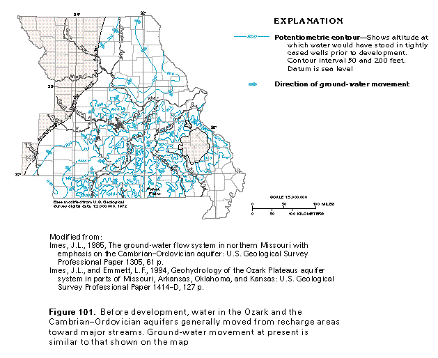 editable eps file D101.eps.gz
(165K compressed)
editable eps file D101.eps.gz
(165K compressed) 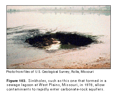 This illustration contains a placed image. Download the Adobe Illustrator
6 eps file D103.eps.gz (5.6M compressed)
which contains an imbedded Adobe Photoshop 3 (eps) file. You may also want
to download the editable Photoshop
file D103psh.eps.gz (5.6M compressed)
This illustration contains a placed image. Download the Adobe Illustrator
6 eps file D103.eps.gz (5.6M compressed)
which contains an imbedded Adobe Photoshop 3 (eps) file. You may also want
to download the editable Photoshop
file D103psh.eps.gz (5.6M compressed) 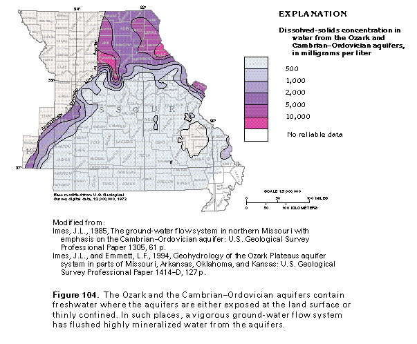 editable eps
file D104.eps.gz (83K compressed)
editable eps
file D104.eps.gz (83K compressed)