GROUND WATER ATLAS of the UNITED STATES
Kansas, Missouri, and Nebraska
HA 730-D
Surficial aquifer system
There are two different files for each illustration
- A 72 ppi GIF file, suitable for screen viewing is accessed through
the thumbnail image
- An eps file, suitable for downloading to be printed or edited is accessed
through the "eps file" link. Most files are Adobe Illustrator
6.0, exceptions are noted. These files have been compressed with GNU's
gzip utility. If your web browser defaults to a screen display of the file,
turn on the "Load to local disk" option before downloading. Download
and process these eps files as ascii, not binary.
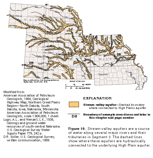
Stream-valley aquifers
Figure 19 Map of stream valley aquifers (33K)
 editable eps
file D019.eps.gz (330K compressed)
editable eps
file D019.eps.gz (330K compressed)
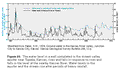
Figure 20 Graph showing well water levels from1950 to 1970
(17K)
 editable eps file D020.eps.gz
(17K compressed)
editable eps file D020.eps.gz
(17K compressed)
Figure 21 Diagramatic section of the stream-valley aquifer
along the Arkansas River (33K)
 This illustration contains a placed image. Download the Adobe Illustrator
6 eps file D021.eps.gz (297K compressed)
which contains an imbedded Adobe Photoshop 3 (eps) file. You may also want
to download the editable Photoshop
file D021psh.eps.gz (248K compressed)
This illustration contains a placed image. Download the Adobe Illustrator
6 eps file D021.eps.gz (297K compressed)
which contains an imbedded Adobe Photoshop 3 (eps) file. You may also want
to download the editable Photoshop
file D021psh.eps.gz (248K compressed)
 editable eps
file D019.eps.gz (330K compressed)
editable eps
file D019.eps.gz (330K compressed) 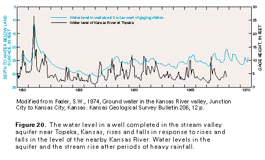 editable eps file D020.eps.gz
(17K compressed)
editable eps file D020.eps.gz
(17K compressed) 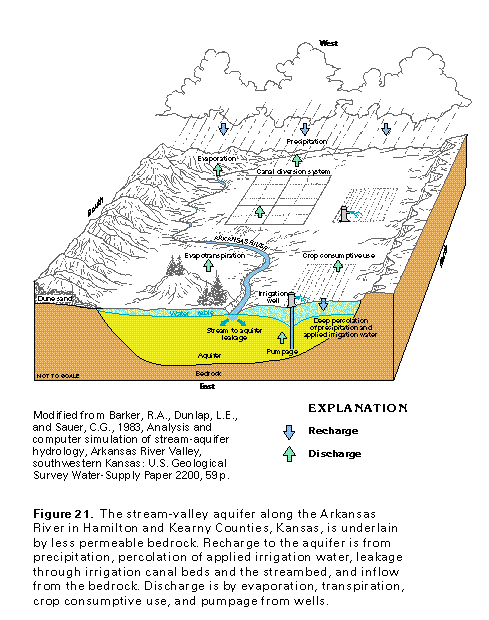 This illustration contains a placed image. Download the Adobe Illustrator
6 eps file D021.eps.gz (297K compressed)
which contains an imbedded Adobe Photoshop 3 (eps) file. You may also want
to download the editable Photoshop
file D021psh.eps.gz (248K compressed)
This illustration contains a placed image. Download the Adobe Illustrator
6 eps file D021.eps.gz (297K compressed)
which contains an imbedded Adobe Photoshop 3 (eps) file. You may also want
to download the editable Photoshop
file D021psh.eps.gz (248K compressed)