GROUND WATER ATLAS of the UNITED STATES
Kansas, Missouri, and Nebraska
HA 730-D
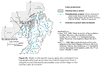
Surficial aquifer system
There are two different files for each illustration
- A 72 ppi GIF file, suitable for screen viewing is accessed through
the thumbnail image
- An eps file, suitable for downloading to be printed or edited is accessed
through the "eps file" link. Most files are Adobe Illustrator
6.0, exceptions are noted. These files have been compressed with GNU's
gzip utility. If your web browser defaults to a screen display of the file,
turn on the "Load to local disk" option before downloading. Download
and process these eps files as ascii, not binary.
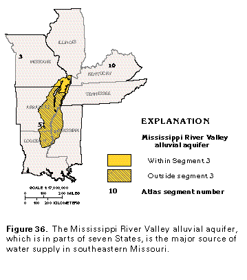
Mississippi River Valley alluvial aquifer
Figure 36 Map showing the Mississippi River Valley alluvial aquifer
(17K)
 editable eps
file D036.eps.gz (116K compressed)
editable eps
file D036.eps.gz (116K compressed)
Figure 37 Map showing the thickness of alluvium (33K)
 editable eps file D037.eps.gz
(99K compressed)
editable eps file D037.eps.gz
(99K compressed)
Figure 38 Geologic section (33K)
 editable eps file D038.eps.gz
(33K compressed)
editable eps file D038.eps.gz
(33K compressed)
Figure 39 Map showing potentiometric contours (33K)
 editable eps
file D039.eps.gz (66K compressed)
editable eps
file D039.eps.gz (66K compressed)
Figure 40 Map showing drainage ditchs (33K)
 editable eps file D040.eps.gz
(99K compressed)
editable eps file D040.eps.gz
(99K compressed)
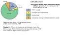
Figure 41 Chart showing the use of fresh gound-water withdrawals
during 1990 (17K)
 editable eps file D041.eps.gz
(17K compressed)
editable eps file D041.eps.gz
(17K compressed)
 editable eps
file D036.eps.gz (116K compressed)
editable eps
file D036.eps.gz (116K compressed)  editable eps file D037.eps.gz
(99K compressed)
editable eps file D037.eps.gz
(99K compressed) 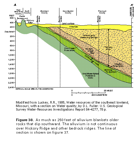 editable eps file D038.eps.gz
(33K compressed)
editable eps file D038.eps.gz
(33K compressed) 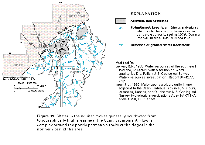 editable eps
file D039.eps.gz (66K compressed)
editable eps
file D039.eps.gz (66K compressed) 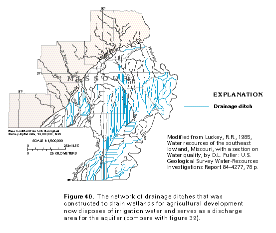 editable eps file D040.eps.gz
(99K compressed)
editable eps file D040.eps.gz
(99K compressed) 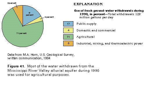 editable eps file D041.eps.gz
(17K compressed)
editable eps file D041.eps.gz
(17K compressed)