WESTERN INTERIOR PLAINS AQUIFER SYSTEM
WESTERN INTERIOR PLAINS AQUIFER SYSTEM
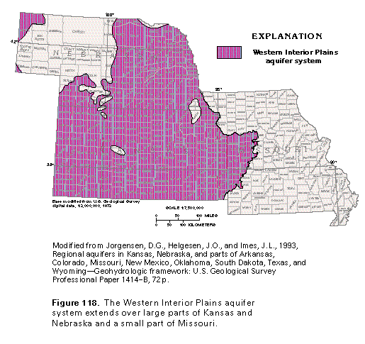
The Western Interior Plains aquifer system underlies most of Kansas, the eastern and southern parts of Nebraska, and a small area in west-central Missouri (fig. 118). The aquifer system consists of water-yielding dolomite, limestone, and sandstone that are stratigraphically equivalent to aquifers of the Ozark Plateaus aquifer system. However, in contrast to the Ozark Plateaus system, the Western Interior Plains aquifer system contains no freshwater.
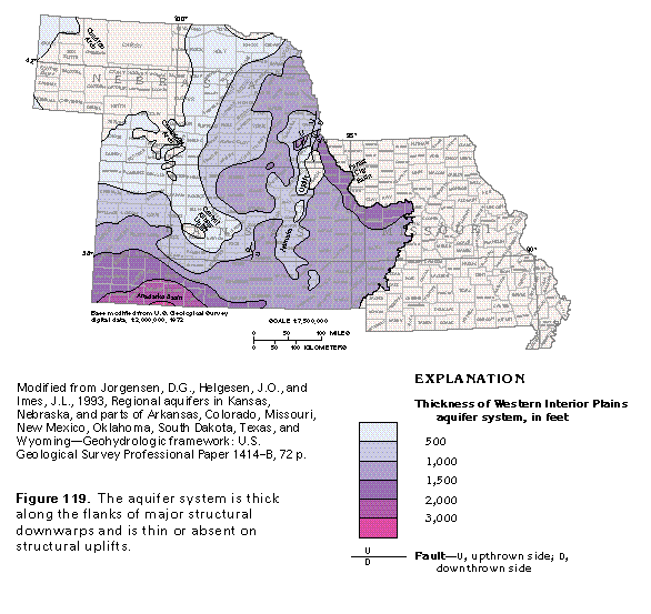
The Western Interior Plains aquifer system consists of lower aquifer units in rocks of Ordovician and Cambrian age, a shale confining unit of Mississippian and Devonian age, and an upper aquifer unit of Mississippian limestone. The thickness of the aquifer system (including the confining unit) ranges from less than 500 feet to more than 3,000 feet in Segment 3 (fig. 119). The aquifer system is thin or absent on structural uplifts and is thickest in downwarps. For example, the thick area in southwestern Kansas is on the northern flank of the Anadarko Basin, and the thick area along the Missouri River is on the southern flank of the Forest City Basin. The aquifer system is thin or missing in western Nebraska and central Kansas atop the Chadron and the Cambridge Arches and the central Kansas Uplift and is locally thin or absent in eastern Kansas on the Nemaha Uplift.
Regional ground-water movement in the aquifer system is southeastward to eastward. Much of the water discharges from the aquifer system in the transition zone between the Western Interior Plains and the Ozark Plateaus aquifer systems. The location of this transition zone and the merging of ground-water flow in these two aquifer systems are discussed in the section of this report that describes the relation of the Ozark Plateaus aquifer system to adjacent aquifers. Saline ground water from the Western Interior Plains aquifer system discharges to springs and streams in Henry and Saline Counties, Missouri. Water is thought to move very slowly through the aquifer system.
Dissolved-solids concentrations of water in the Western Interior Plains aquifer system are greater than 1,000 milligrams per liter everywhere. In thick, deeply buried parts of the aquifer system, dissolved-solids concentrations of more than 200,000 milligrams per liter have been reported. The large concentrations are due, in part, to the slow movement of ground water in the aquifer system. The slower the water moves, the longer it is in contact with aquifer minerals and the more mineral material it is able to dissolve.
Little water is withdrawn from the Western Interior Plains aquifer system because the aquifer system is deeply buried and contains highly mineralized water. Locally, deeply buried parts of the aquifer system contain oil and gas, and some brine that is a by-product of hydrocarbon production is injected into disposal wells, which are completed in permeable parts of the system.